General Information
Nahiya (Subdistrict)
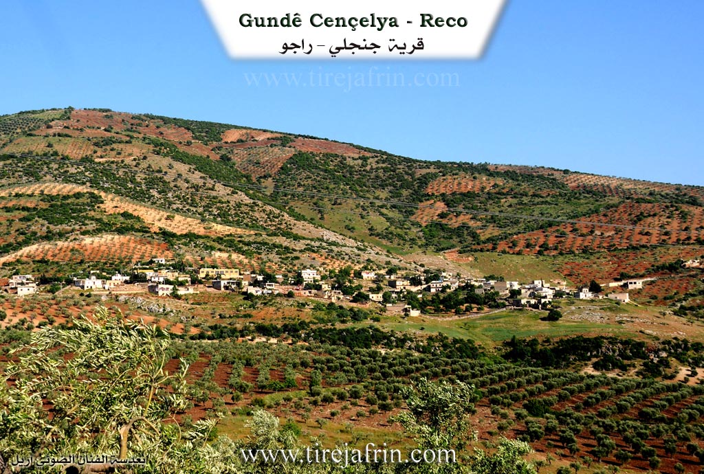
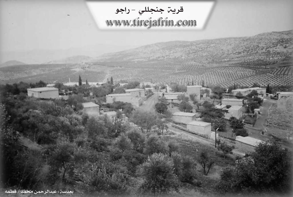
Reco
Also Known As
Janjalah, Çençeliya, Çençelî, Çençêlê, جنجلة, جنجلي, چنچلي, جنجليا
Families, Clans, etc.
Qember

Photos
Basic Information about Çençeliya
Source: Tirej Afrin
Etymology: The author suggests the name is from çençel meaning "the ladle or the worn-out vessel".
Foundation Date/Period: approximately 400 years
Hills: Bilal Heracî, Bilal Hebeş
Summaries
I. Summary from TirejAfrin Site (English) of Çençeliya
Source: https://www.tirejafrin.com/site/kura%20afrin%20%20%20Reco%20-%20jencliya.htm
Stated in the book Çiyayê Kurmênc Efrîn Geographical Study: Çençelî, Cencile / 1347 people, 69 houses / 8km from the center, 800m altitude.
Çençelî: I see that the name is from çençel "the ladle or the worn-out vessel". It is said that the oldest family in this village is of Armenian origin. The Arabized name is a verbal corruption of the old name. It is a medium village located on the northwestern slope of Mount Bilal Heracî.
Stated in the book Efrîn... Her River and Her Green Hills: Cencelî: A village in Çiyayê Kurmênc following the township of Reco, region of Efrîn, governorate of Heleb. It is a large village, located in the middle section of the mentioned mountain, on the northern slope of a limestone height. It overlooks agricultural lands with red and white soil to the west. As for in front of the village, there are two watercourses heading towards the west and the south.
It is bordered on the north by a plain planted with olive trees, the village of Çeqmeqa Mezin, and the Riya Bilbil-Reco (Bilbil-Reco road). On the south, by a high mountain range called Mount Bilal Hebeş and the village of Çobana located at the bottom of the mountain to the south. On the east, by a high mountain range and the village of Çeqmeqa Piçûk. On the west, by a watercourse, a plain, and the village of Holîlo.
The number of its houses reaches 80 houses, and its age is approximately 400 years, and it is among the old villages. Its old residences are stone and mud with flat wooden roofs, while the modern ones are cement, spread towards the west and the east. An electricity network, a modern primary school, and a mosque are available in it. It belongs to the municipality of Çeqmeqa Mezin. It connects with the public road Riya Bilbil-Reco (Bilbil-Reco road) via a leveled dirt road that is not paved.
The residents work in rain-fed agriculture on an area of 90 hectares (olives, vines, and other fruit trees) alongside raising sheep and goats. The village drinks from cisterns dug next to the houses in which rainwater is collected in winter, and currently, some artesian wells have been dug in the courtyards of the houses.
Village Mokhtar: Bilal Mihemed Qember
Sources of Information:
- Book: جبل الكرد (عفرين) دراسة جغرافية Çiyayê Kurmênc (Efrîn): A Geographical Study by د. محمد عبدو علي Dr. Mihemed Ebdo Elî.
- Book: عفرين .... نهرها وروابيها الخضراء Efrîn... Her River and Her Green Hills by عبدالرحمن محمد Ebdulrehman Mihemed from the village of Qetme.
- Studies of Navenda Tirej Soft / Ebdulrehman Hacî Osman.
- Some residents of the villages.
Preparation and execution: Director of the Tirej Efrîn site: Ebdulrehman Hacî Osman 20/12/2013
Foundation/Origin Information of Çençeliya
It is said that the oldest family in the village is of Armenian origin.
Source: TirejAfrin Site
Possible Village Name Meaning of Çençeliya
The name may come from "Çençûl," meaning "the rake or the broken pot."
Source: TirejAfrin Site