General Information
Nahiya (Subdistrict)
Reco
Also Known As
Al-Masnah, Çerxûta, المسنة, جرختلي, چرختلي, جرخيتو
Families, Clans, etc.
Berazî

Photos
Basic Information about Çerxûta
Source: Tirej Afrin
Etymology: The name Çerxut means worn out or shabby (çerxût) in Kurdish, which was a nickname for one of its early inhabitants. The Arabized name El-Musena was derived because the official believed the root was the Kurdish word for wheel (çerx), meaning a grinding stone (al-masanah).
Foundation Date/Period: about 300 years
Hills: Çiyayê Bilêl, Çiyayê Bilêl Hebeş
Summaries
I. Summary from TirejAfrin Site (English) of Çerxûta
Source: https://www.tirejafrin.com/site/kura%20afrin%20%20%20Reco%20-%20jarxtle.htm
It is stated in the book Çiyayê Kurmênc (Efrîn) Geographical Study: Çerxeta, Çerxetlî, El-Musena. 364 inhabitants, 61 hectares.
6 km, 700 m.
Çerxut: This means worn out or shabby (çerxût) in Kurdish, and it was a nickname for one of its early inhabitants.
The Arabizer believed that its source was from (çerx), meaning "the grinding machine" (al-masanah), so he translated it as such (El-Musena).
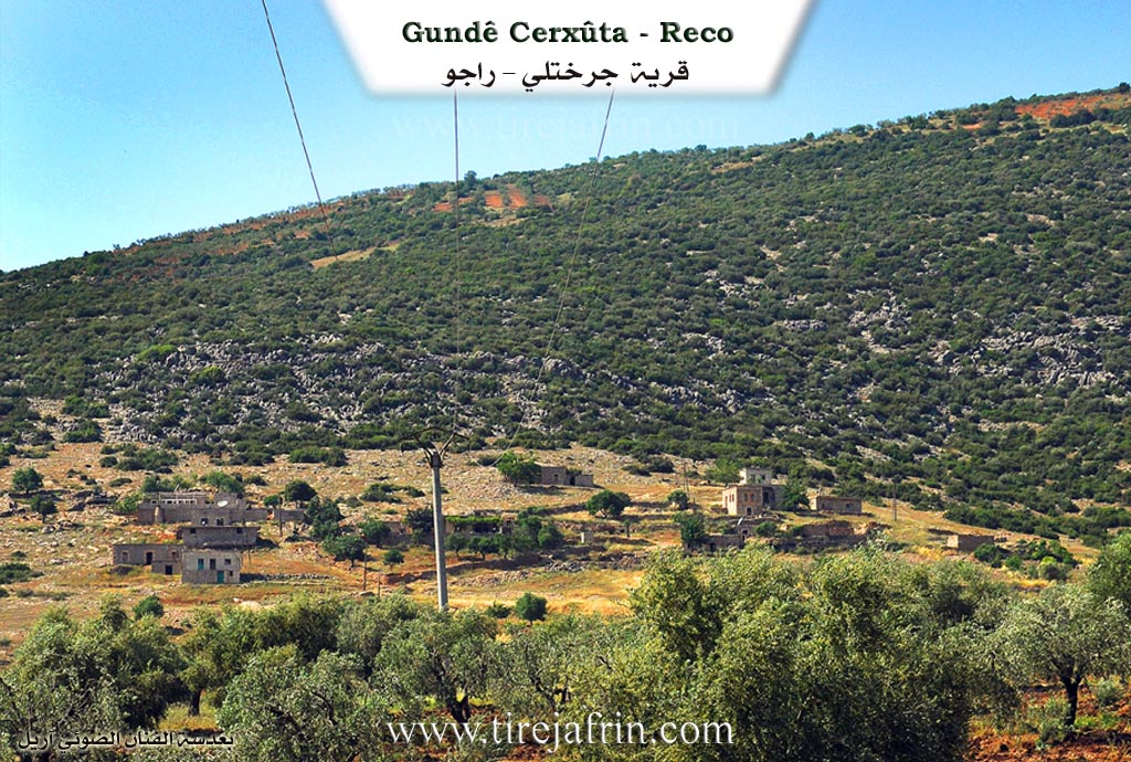
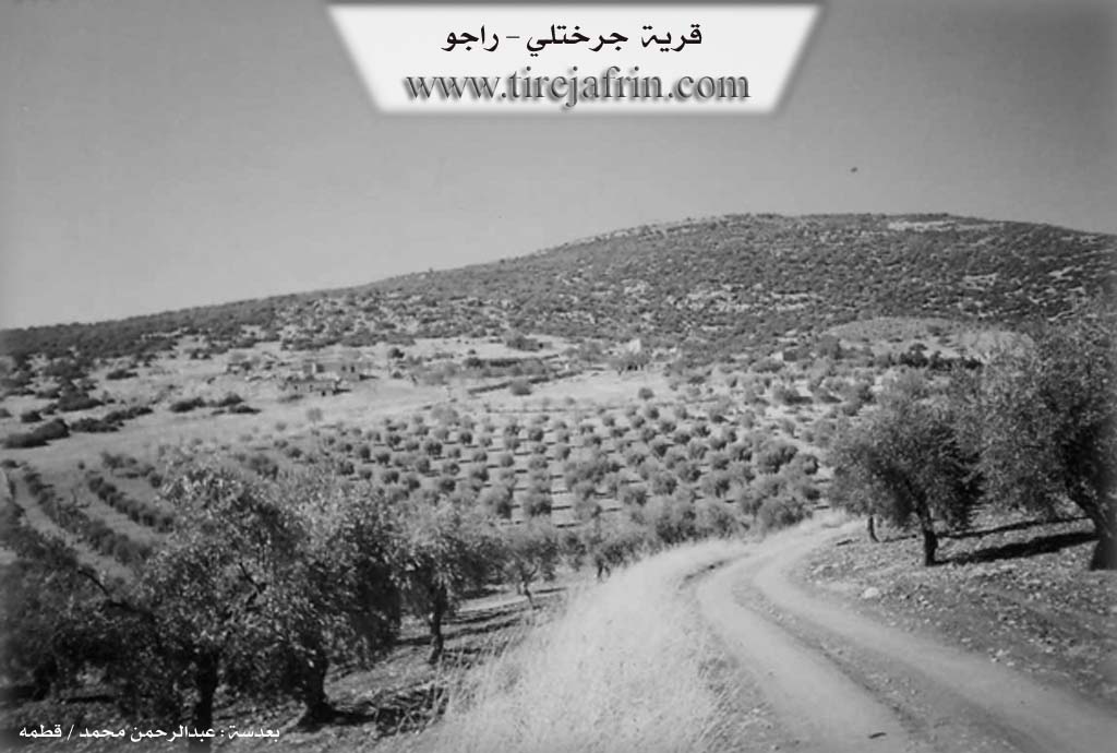
It is a small village located on the southern slope of Çiyayê Bilêl.
It is stated in the book Efrîn... Her River and Her Green Hills:
Çerxetlî: A village in Çiyayê Kurmênc belonging to the Reco district, Efrîn region, Heleb governorate. It is a small village located at the end of the southeastern slope of a limestone height covered in scattered thickets of oak trees. It overlooks clay agricultural lands to the south and east that incline towards the south. It is 6 km away from the town of Reco heading northeast.
It is bordered to the north by a high, rugged mountain chain and the village of Cencelî, and this mountain is called Çiyayê Bilêl Hebeş. To the south, it is bordered by a fertile plain planted with olive trees and grapevines, and the village of Şêx Bilal and Celqemê. To the east, it is bordered by a rugged mountain chain and the village of Çobanlî. To the west, it is bordered by a rugged mountain chain, a valley, and the village of Kuranlî.
The number of its houses reaches about 5 houses only, and its age is about 300 years. It is inhabited by one family from the Berazî family. Its houses are stone with wooden roofs, and the modern ones are cement. There are no public facilities or services in the village. A dirt road connects it to the Riya Kûtanlî-Reco (Kûtanlî-Reco road).
The residents work in rain fed agriculture (olives, legumes, vines) on an area of 61 hectares. They raise sheep and goats, and a section of them works in the industry of making charcoal from oak wood. The village drinks from cisterns dug next to the houses, in which water collects during the winter season.
Sources of Information:
- Book: جبل الكرد (عفرين) دراسة جغرافية Çiyayê Kurmênc (Efrîn): A Geographical Study by د. محمد عبدو علي Dr. Mihemed Ebdo Elî.
- Book: عفرين .... نهرها وروابيها الخضراء Efrîn... Her River and Her Green Hills by عبدالرحمن محمد Ebdulrehman Mihemed from the village of Qetme.
- Studies of Navenda Tirej Soft / Ebdulrehman Hacî Osman.
- Some residents of the villages.
Preparation and Execution: Manager of the website
Tirej Efrîn: Ebdulrehman Hacî Osman 20/12/2013
Possible Village Name Meaning of Çerxûta
"Çerxût" means "the spinning wheel" or "the inheritance" in Kurdish and was a nickname for one of its first inhabitants. The Arabized form may come from "Çerx," meaning "grinding machine."
Source: TirejAfrin Site