General Information
Nahiya (Subdistrict)
Reco
Photos
Basic Information about Çobana - Reco
Source: Tirej Afrin
Etymology: Çoban: The name means the shepherd in Kurdish and Turkish
Foundation Date/Period: Approximately 300 years ago
Hills: Bilal, Bilalîko
Summaries
I. Summary from TirejAfrin Site (English) of Çobana - Reco
Source: https://www.tirejafrin.com/site/kura%20afrin%20%20%20Reco%20-%20jobanle.htm
It is stated in the book جبل الكرد (عفرين) دراسة جغرافية Çiyayê Kurmênc (Efrîn): A Geographical Study: Obana, Çobanlî, Al-Ra'i /564 inhabitants - 765m/:
Çoban: The name means the shepherd in Kurdish and Turkish.
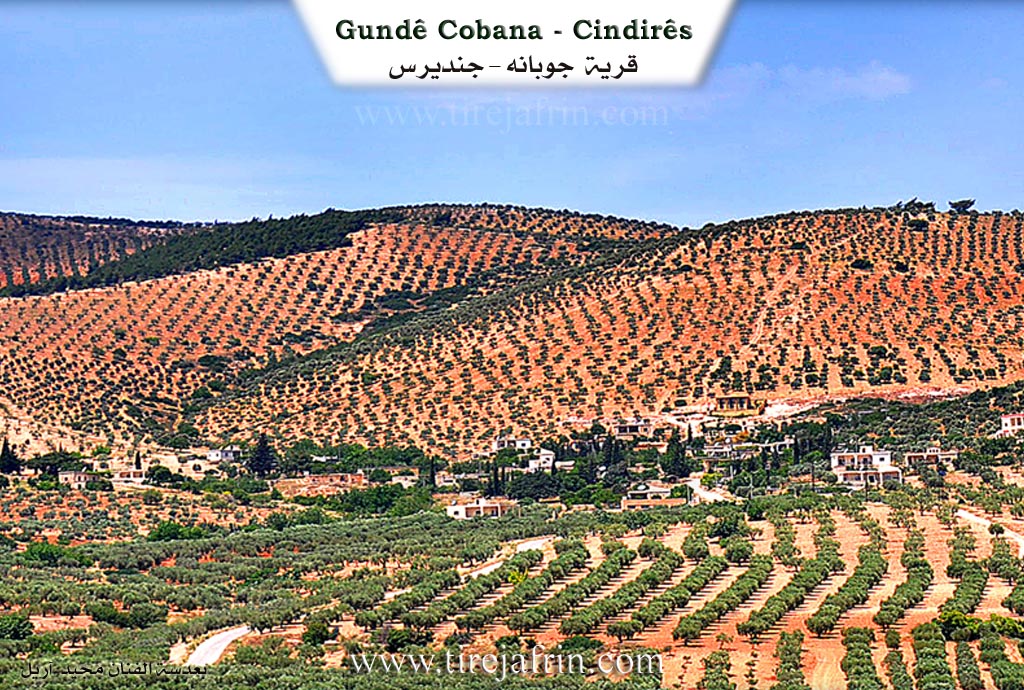
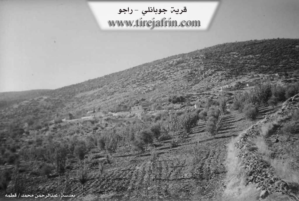
It is a small village located on the southern slope of Bilal mountain. Near it is an old water well with an old "gharrafa" (water lifter) for drawing water, which used to be operated by animals.
It is stated in the book عفرين .... نهرها وروابيها الخضراء Efrîn... Her River and Her Green Hills: Çobanlî: A village in Çiyayê Kurmênc, administratively belonging to the Reco sub-district, Efrîn region, Aleppo governorate. It is a small village located in the central part of the mentioned mountain on the eastern slope of a limestone height. It is 13 km away from the town of Reco towards the northeast. It overlooks agricultural lands towards the southeast, and oak forests are spread over the mountain slopes. Its soil is colluvial.
It is bordered to the north by a high mountain range called Bilalîko mountain and the village of Çeqmaqê Piçûk; to the south by a slope, a plain, and the village of Çetel Quyu; to the east by a mountain range and the village of Zerkanlî which is close by at a distance of 500 m; and to the west by a mountain range, a valley, and the village of Çerxetlî.
The number of its houses is about 30, and its age is about 300 years according to the account of one of the elderly people in the village. Its old houses are made of stone and mud with wooden roofs, while the modern ones are cement and have extended east and west. An electricity network is available, as well as a primary school shared between Zerkanlî and Çobanlî. It connects to the general road via an unpaved dirt road reaching the sub-district center and neighboring villages.
The residents work in rain-fed agriculture (olives, grains, vines, almonds, figs) on an area of 125 hectares. A section of the residents works in the industry of making charcoal from oak trees, in addition to raising sheep and goats. The village drinks from rainwater collected in cisterns dug in front of the homes and from an old Roman well at the bottom of the village on the eastern side.
Village Mukhtar: Ebdo Me'mo Ebdo.
Sources of Information:
- Book: جبل الكرد (عفرين) دراسة جغرافية Çiyayê Kurmênc (Efrîn): A Geographical Study by د. محمد عبدو علي Dr. Mihemed Ebdo Elî.
- Book: عفرين .... نهرها وروابيها الخضراء Efrîn... Her River and Her Green Hills by عبدالرحمن محمد Ebdulrehman Mihemed from the village of Qetme.
- Studies of Navenda Tirej Soft / Ebdulrehman Hacî Osman.
- Some residents of the villages.
Preparation and Execution: Manager of the website Tirej Efrîn: Ebdulrehman Hacî Osman 20/12/2013