General Information
Nahiya (Subdistrict)
Bilbilê
Map and Location
Coordinates: 36.736403, 36.77559
Photos
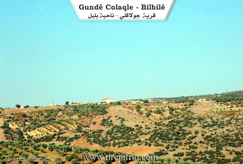
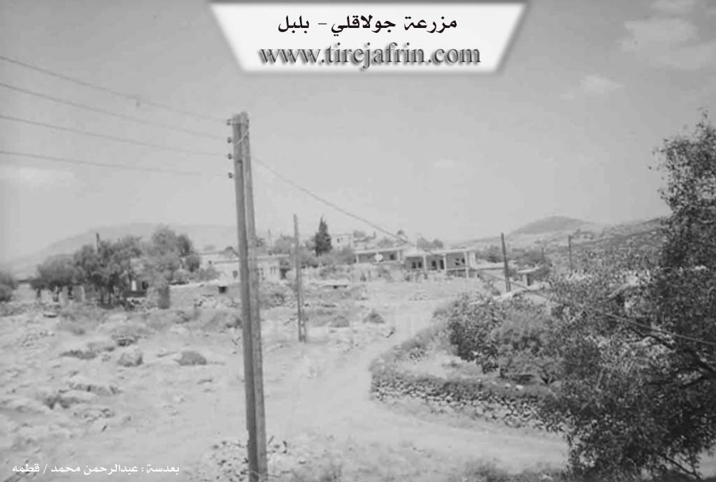
Basic Information about Çolaqa - Bilbilê
Source: Tirej Afrin
Etymology: Çolaq: meaning the one-armed person in Kurdish. The Arabized name is a translation of the old name
Foundation Date/Period: approximately 200 years ago
Hills: Çiyayê Semaq
Other Landmarks: Wadî El-Ehmer
Summaries
I. Summary from TirejAfrin Site (English) of Çolaqa - Bilbilê
It is stated in the book جبل الكرد (عفرين) دراسة جغرافية Çiyayê Kurmênc (Efrîn): A Geographical Study: Olaqa, Çolaqlî, El-Ekte' / 133 inhabitants, 860m /:
Çolaq: Meaning the "one armed" (al-akta') in Kurdish. The Arabized name is a translation of the old name.
It is a small village in a fortified location on the northeastern edge of Çiyayê Semaq.
It is stated in the book عفرين .... نهرها وروابيها الخضراء Efrîn... Her River and Her Green Hills: Çolaqlî: A farm in Çiyayê Kurmênc belonging to the Bilbil district, Efrîn region, Heleb governorate. It is a small farm built atop a fortified site on the northeastern edge of a rolling surface of a limestone plateau in Çiyayê Semaq. Its slopes have a moderate incline, and its soil is clay. It is located 2km southwest of the village of Xiziryanlî and about 13km southwest of the town of Bilbil.
It is bordered to the north by a torrential valley planted with olive trees and the villages of Baqçe Qanq and Elî Bek; to the south by Wadî El-Ehmer (which is known by this name by the people of the village), a high mountain range, and the village of Berkeşlî; to the west by a mountain slope, a torrential valley, and the village of Kurzêl Bilbil; and to the east by a rugged mountain range and the villages of Hacîro and Xiziryanlî.
The number of its houses is about 35 houses, and its age is about 200 years. Its dwellings are stone and mud with wooden roofs, and modern cement building has expanded on its outskirts. An electricity network and a primary school are available. The village drinks from cisterns where rainwater is collected in winter. The residents work in the rainfed cultivation of olives and grains and in raising sheep and goats. Its lands are mountainous and rugged, with abundant pastures. The locals currently drink from artesian wells dug next to the houses. The road to the village of Xiziryanlî up to the general intersection is mountainous, earthen, and unpaved.
Sources of Information:
- Book: جبل الكرد (عفرين) دراسة جغرافية Çiyayê Kurmênc (Efrîn): A Geographical Study by د. محمد عبدو علي Dr. Mihemed Ebdo Elî.
- Book: عفرين .... نهرها وروابيها الخضراء Efrîn... Her River and Her Green Hills by عبدالرحمن محمد Ebdulrehman Mihemed from the village of Qetme.
- Studies of Navenda Tirej Soft / Ebdulrehman Hacî Osman.
- Some residents of the villages.
Preparation and execution: Manager of the website Tirej Efrîn: Ebdulrehman Hacî Osman 20/12/2013