General Information
Nahiya (Subdistrict)
Bilbilê
Also Known As
Hadir, Hadru, حاضر, حاضرو, Ḧazira, حازرو
Photos
Basic Information about Ĥazira
Source: Tirej Afrin
Etymology: From the Kurdish word meaning the ready ones (hazir), believed to be a nickname for one of its early inhabitants
Foundation Date/Period: Approximately 150 years ago
Hills: Çiyayê Semaq
Other Landmarks: Qestel Xizir
Summaries
I. Summary from TirejAfrin Site (English) of Ĥazira
Source: https://www.tirejafrin.com/site/kura%20afrin%20%20%20bilbile%20-%20hazaro.htm
It is stated in the book جبل الكرد (عفرين) دراسة جغرافية Çiyayê Kurmênc (Efrîn): A Geographical Study: Ĥazira, Haziro, Hazir / 111 inhabitants 775m /:
Ĥazira: From the Kurdish meaning "the ready ones" (hazir), and it is believed that it is a nickname for one of its early inhabitants. The Arabization is a translation of the popular name.
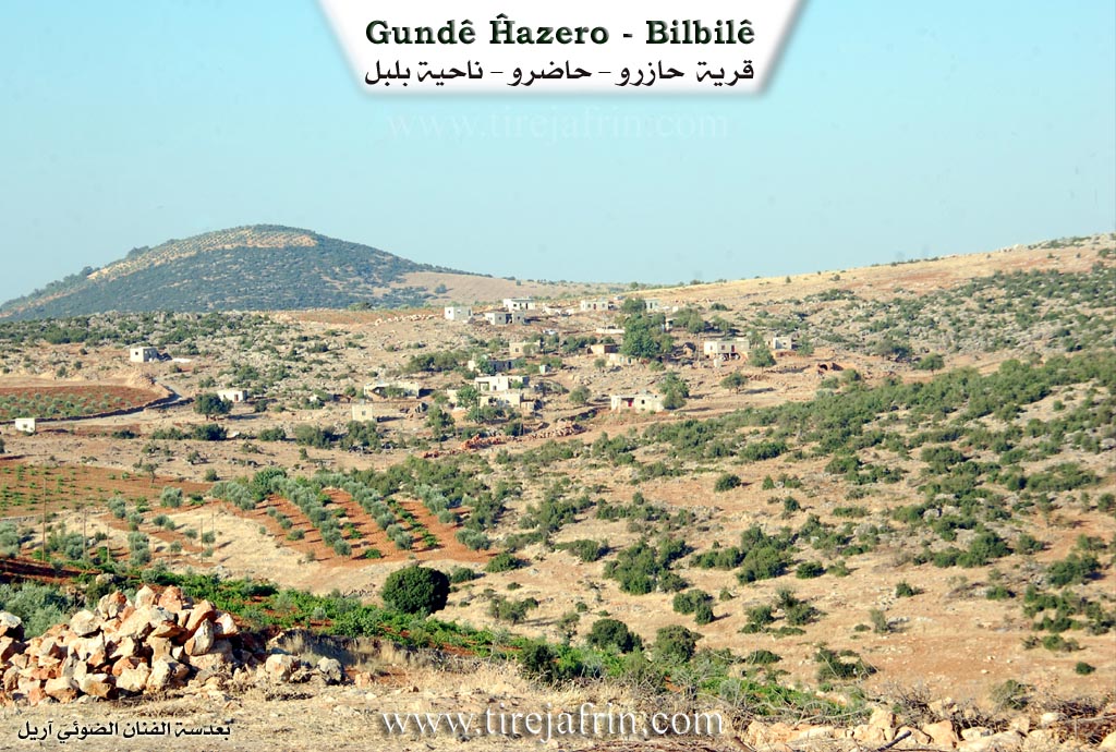
It is a small village located on a rocky slope, at the end of the central northern slope of Çiyayê Semaq. It is located 1km to the southwest of the village of Xiziriyanlî.
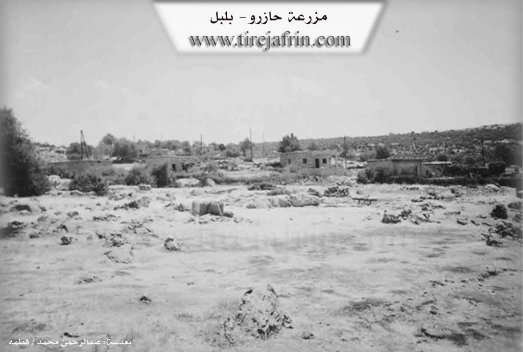
It is stated in the book عفرين .... نهرها وروابيها الخضراء Efrîn... Her River and Her Green Hills: Ĥazira: A farmstead in Çiyayê Kurmênc following the Bilbil subdistrict, Efrîn region, Heleb governorate. It is a small farmstead situated on a rolling rocky surface at the end of the calcareous central northern slope of Çiyayê Semaq. It is located to the southwest of the village of Xiziriyanlî and is 1km away from it. Its soil is fertile clay.
It is bordered to the north by a slope, a torrential valley, a plain planted with olive trees, and the village of Baxçe Qonax; to the south by a rugged mountain range and the village of Dûbîra; to the west by a plain, a torrential valley, and the village of Çolaqlî on a mountain elevation; and to the east by a mountain slope, a torrential valley, and the village of Xiziriyanlî.
The number of its houses reaches 10 houses, and its age is approximately 150 years. Its old dwellings are stone and mud with flat wooden roofs, while modern cement and stone houses have begun to spread around it. A modern electricity network is available. Most of its inhabitants work in rain fed agriculture (olives and vines) alongside raising sheep and goats. They drink from cisterns in which rainwater is collected in winter.
A dirt mountain road connects it to the village of Xiziriyanlî up to the junction of Qestel Xizir. The origin of this village is from the village of Xiziriyanlî.
Sources of Information:
- Book: جبل الكرد (عفرين) دراسة جغرافية Çiyayê Kurmênc (Efrîn): A Geographical Study by د. محمد عبدو علي Dr. Mihemed Ebdo Elî.
- Book: عفرين .... نهرها وروابيها الخضراء Efrîn... Her River and Her Green Hills by عبدالرحمن محمد Ebdulrehman Mihemed from the village of Qetme.
- Studies of Navenda Tirej Soft / Ebdulrehman Hacî Osman.
- Some residents of the villages.
Preparation and execution: Manager of the site Tirej Efrîn: Ebdulrehman Hacî Osman 20/12/2013
Foundation/Origin Information of Ĥazira
The village name is believed to be a nickname for one of its first inhabitants.
Source: TirejAfrin Site
Possible Village Name Meaning of Ĥazira
From Kurdish meaning "the ready ones," and it is believed to be a nickname for one of its first inhabitants. The Arabic name is a translation of the popular name.
Source: TirejAfrin Site