General Information
Nahiya (Subdistrict)
Cindires
Also Known As
حاج اسكندر, Ḧaj Iskender
Families, Clans, etc.
Cilf, Ebas, El Ebîd, Heneş, Hûşan, Mame Ale, Muhacir, Oseb, Rehawî, Rifet, Salih

Photos
Basic Information about Ĥec Îskenderê
Source: Tirej Afrin
Etymology: Îskender is a local proper name
Foundation Date/Period: Approximately 150 years ago
Other Landmarks: Hesîrkê
Summaries
I. Summary from TirejAfrin Site (English) of Ĥec Îskenderê
Source: https://www.tirejafrin.com/site/kura%20afrin%20Cindires%20-%20hec%20iskendere.htm
The following is stated in the book جبل الكرد (عفرين) دراسة جغرافية Çiyayê Kurmênc (Efrîn): A Geographical Study by د. محمد عبدو علي Dr. Mihemed Ebdo Elî:
Hecî Îskender / 1156 inhabitants, 725 hectares, 5km distance, 205m altitude.
Îskender: A local proper name.
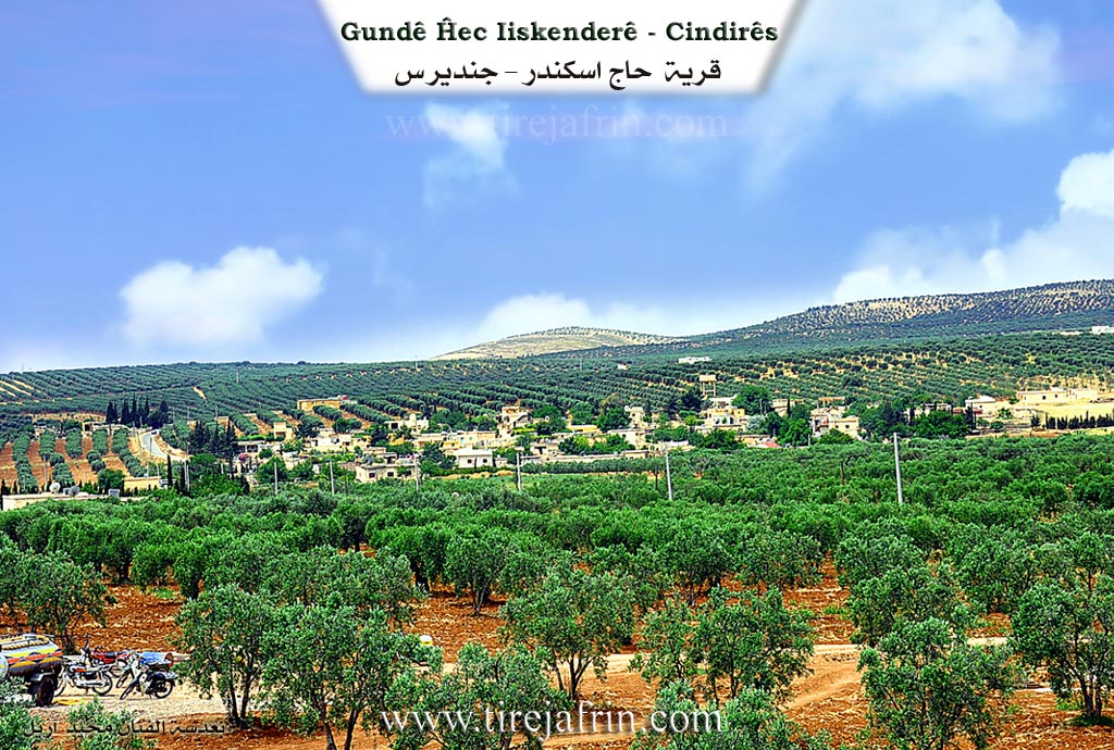
It is a small village located beside the valley of Hesîrkê.
The following is stated in the book عفرين .... نهرها وروابيها الخضراء Efrîn... Her River and Her Green Hills by the writer عبدالرحمن محمد Ebdulrehman Mihemed from the village of Qetme:
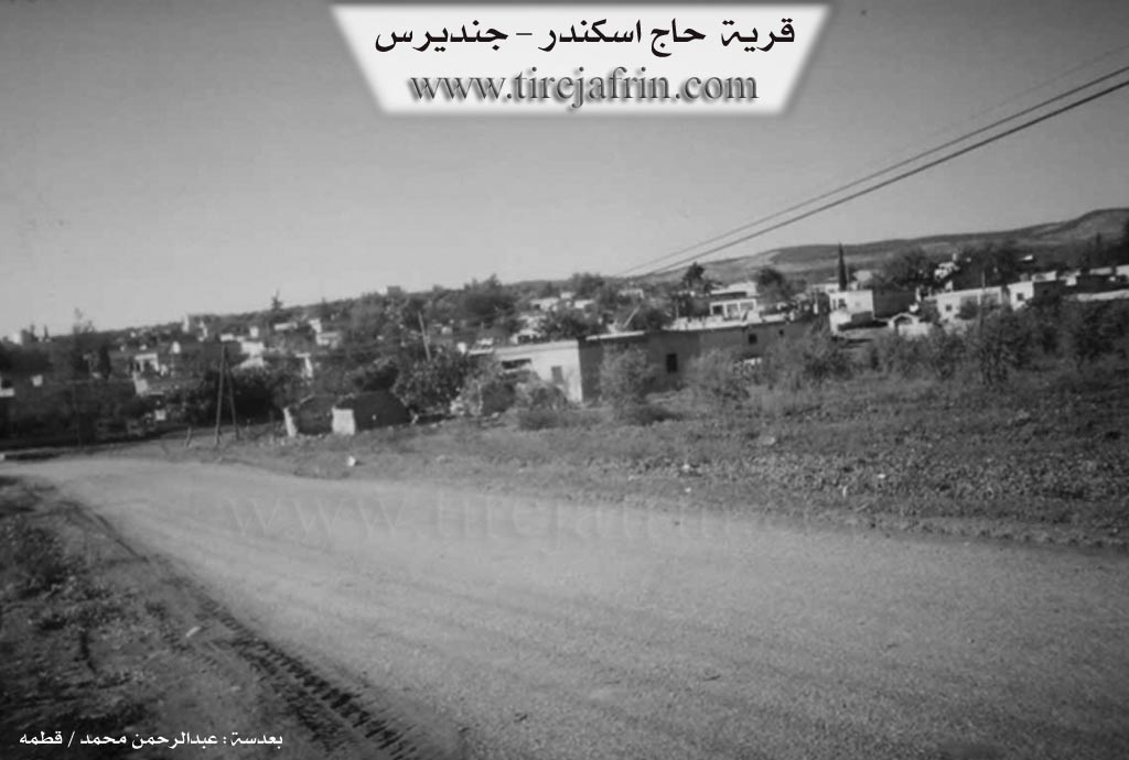
Hecî Îskender: A village in Çiyayê Kurmênc, administratively belonging to the Cindirês subdistrict, Efrîn region, Heleb governorate. It is a small village situated on flat land at the southwestern edge of the mentioned mountain, west of a watercourse that descends southward to Çemê Efrînê.
It is bordered to the north by a fertile plain and mountain highlands planted with olive trees and the village of Eşkan Xerbî. To the south, it is bordered by a plain and a valley planted with olive trees, the Riya Cindirês-Hemam road, the village of Nisriye, and Çemê Efrînê. To the west, it is bordered by mountain highlands planted with olive and forest trees and the village of Hemam. To the east, it is bordered by a valley and an agriculturally fertile plain planted with olive trees, the Riya Cindirês-Hemam road, and the village of Axcelê.
The number of houses is approximately 40, and its age is about 150 years according to the statements of the village residents. It used to consist of zinc barracks for the English army after the departure of the Ottomans from Syria. Its old houses are made of mud and wood, while the modern ones are of cement and stone. The village has an electricity network, a primary school, a telephone center taken from the town of Cindirês, and a small mosque near the main road.
The residents work in the rainfed cultivation of grains and legumes. The plain of Hecî Îskender is considered part of the Cindirês plain, which possesses fertile red soil and abundant groundwater. Its most important products are olives, which constitute 60% of the village area, while the rest is planted with grains, legumes, and cotton irrigated from artesian wells. Pomegranate trees and summer vegetables are also cultivated. The residents raise sheep and goats. The village gets its drinking water from the village's artesian wells and cisterns that collect rainwater. An asphalt road connects it to the town of Cindirês, passing through its center to the village of Hemam and the Turkish border.
The village is surrounded on all sides by olive trees and other fruit trees. At the entrance of the village, there is an old archaeological bridge about three meters high, dating back to the time of the French Mandate. On the eastern side of the village, there is a football field where league matches for popular neighborhoods are held between the villages of the region.
Among the families present in the village are: Mame Ale family, Heneş family, Rifet family, Muhacir family, Oseb family, Cilf family, Rehawî family, Ebas family, Hûşan family, Salih family, and El Ebîd family.
The mukhtar of the village is Mr. Şukrî Mistefa Muhacir.
There are many university degree holders in the village. Among the social figures in the village is: Hecî Mistefa Muhacir.
Preparation and Execution:
Director of Navenda Tirej Efrîn: Ebdulrehman Hacî Osman
20/12/2013
Sources
Book: جبل الكرد (عفرين) دراسة جغرافية Çiyayê Kurmênc (Efrîn): A Geographical Study by د. محمد عبدو علي Dr. Mihemed Ebdo Elî.
Book: عفرين .... نهرها وروابيها الخضراء Efrîn... Her River and Her Green Hills by عبدالرحمن محمد Ebdulrehman Mihemed.
Preparation and execution by Ebdulrehman Hacî Osman, director of Navenda Tirej Efrîn.
Some residents of the village.
Foundation/Origin Information of Ĥec Îskenderê
It was originally barracks for the British Army after the departure of the Ottomans from Syria.
Source: TirejAfrin Site
Possible Village Name Meaning of Ĥec Îskenderê
Iskender is a local proper name.
Source: TirejAfrin Site