General Information
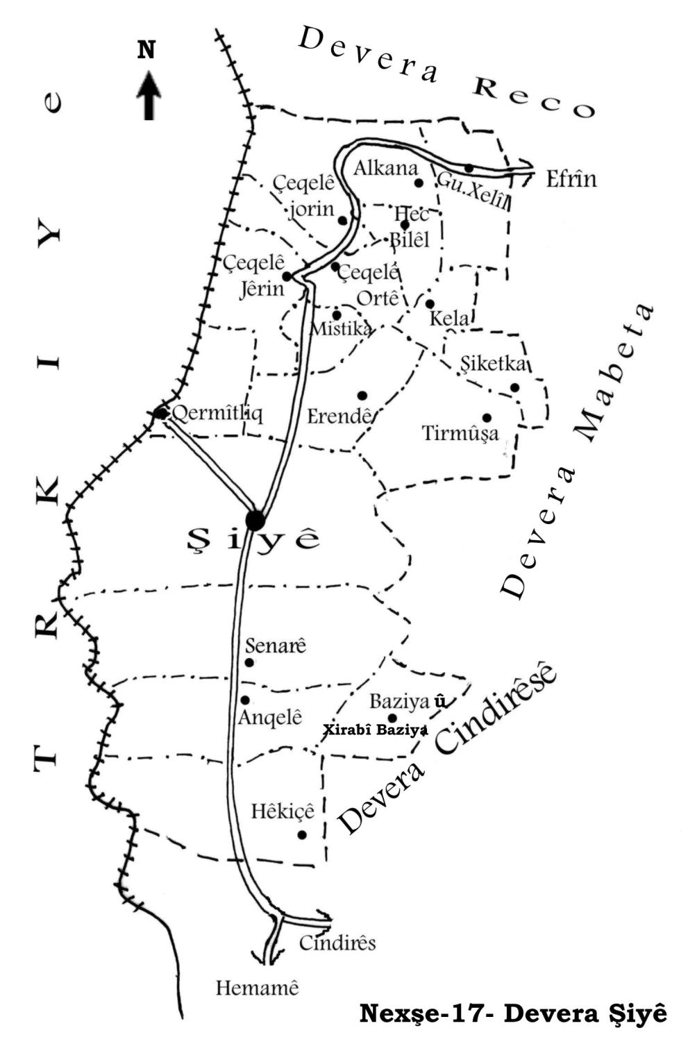
Nahiya (Subdistrict)
Şiyê
Also Known As
Hecbilê, Ĥec Bilêl, حاج بلال, Ḥaj Bilal
Photos
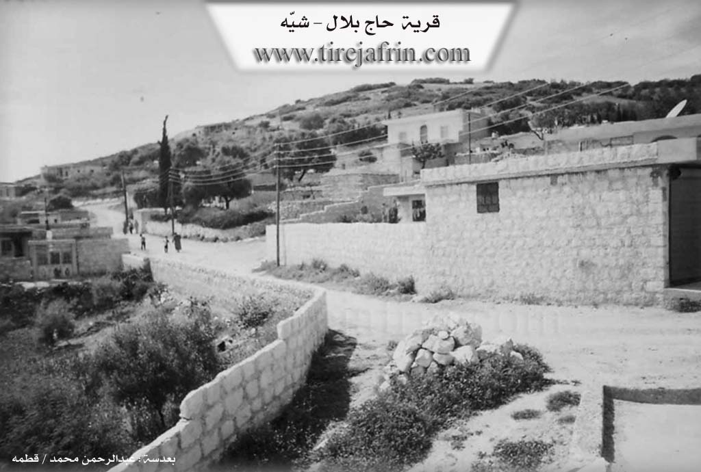
Basic Information about Ĥec Bilal
Source: Tirej Afrin
Etymology: A local proper noun derived from the name "Bîlal" and his religious title "Hec".
Foundation Date/Period: Approximately 200 years ago
Other Landmarks: TV broadcast station
Summaries
I. Summary from TirejAfrin Site (English) of Ĥec Bilal
Source: https://www.tirejafrin.com/site/kura%20afrin%20%20%20shiye%20-%20hec%20bilal.htm
Hecî Bîl / 556 inhabitants 720m
It is stated in the book جبل الكرد (عفرين) دراسة جغرافية Çiyayê Kurmênc (Efrîn): A Geographical Study by د. محمد عبدو علي Dr. Mihemed Ebdo Elî:
Hecî Bîl: A local proper noun derived from "Bîlal" and his religious title "Hec". It is a small village situated on a limestone height furrowed by valleys, and it is located 1 km away from the village of Alkana toward the southwest.
It is stated in the book عفرين .... نهرها وروابيها الخضراء Efrîn... Her River and Her Green Hills by the writer عبدالرحمن محمد Ebdulrehman Mihemed from the village of Qetme:
Hecî Bîl: A village in Çiyayê Kurmênc, administratively belonging to the Şiyê subdistrict, Efrîn region, Aleppo governorate. It is a small village situated in the western section of the central part of the mentioned mountain block. It was built in a defensive location at the top of the southeastern slope of a limestone height furrowed by valleys, and at the beginning of a watercourse descending toward the southeast. It is 1 km away from the village of Satiya toward the southwest and 11 km from the town of Şiyê in the northwestern direction.
It is bordered to the north by a high mountain range planted with forest trees, the village of Satî Uşaxî, and a TV broadcast station. To the south, it is bordered by a valley, a harsh slope, and the villages of Kêla and Erende. To the west, there is a deep valley, a mountain range planted with forest trees, and the villages of Şêx Çeqelî and Seûlcik. To the east, there is a deep valley, a mountain range planted with forest trees, and the villages of Xaziya Jêrîn and Xaziya Jorîn.
The number of its houses is about 15 houses, and its age is approximately 200 years. Its dwellings are made of stone and mud with flat wooden roofs, while the modern ones are made of stone and cement, spread toward the northwest, representing 80 percent of the construction. An electricity network is available, and they drink water from the state affiliated company or from rainwater collection. Its residents work in the cultivation of olives, vines, and figs, alongside raising sheep and goats. The village is connected to the town of Şiyê and neighboring villages by a paved dirt road. It contains a temporary school consisting of a single primitive room.
Village Mukhtar: Neşet Îbrahîm Ezîz
Preparation and execution:
Manager of Tirej Efrîn site: Ebdulrehman Hacî Osman
20/12/2013
Sources
Book: جبل الكرد (عفرين) دراسة جغرافية Çiyayê Kurmênc (Efrîn): A Geographical Study by د. محمد عبدو علي Dr. Mihemed Ebdo Elî.
Book: عفرين .... نهرها وروابيها الخضراء Efrîn... Her River and Her Green Hills by عبدالرحمن محمد Ebdulrehman Mihemed from the village of Qetme.
Tirej Efrîn / Ebdulrehman Hacî Osman.
Possible Village Name Meaning of Ĥec Bilal
A local proper name from "Bilal" and his religious title "Haj".
Source: TirejAfrin Site