General Information
Nahiya (Subdistrict)
Cindires
Also Known As
Al-Hajjaj, Hajiler, الحجاج, حاجيلار, حاجيلر, Ḧecilerê
Families, Clans, etc.
Hoto, Mistefa Betal Axa

Photos
Basic Information about Ĥecîler
Source: Tirej Afrin
Etymology: The name means the plural of 'Pilgrims' (Hacî + ler) in Turkish
Foundation Date/Period: Approximately 75 years (as of 2013)
Other Landmarks: Hesîrkê, Sîlê
Summaries
I. Summary from TirejAfrin Site (English) of Ĥecîler
Source: https://www.tirejafrin.com/site/kura%20afrin%20Cindires%20-%20hecilere.htm
The following is stated in the book جبل الكرد (عفرين) دراسة جغرافية Çiyayê Kurmênc (Efrîn): A Geographical Study by د. محمد عبدو علي Dr. Mihemed Ebdo Elî:
Hacîler, Al-Hajjaj / 1409 inhabitants, 7km, 195m.
The name means the plural of "The Pilgrims" (Hacî + ler) in Turkish.
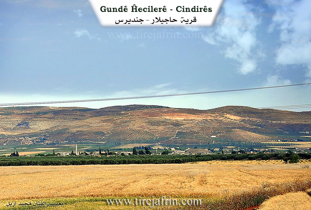
It is a small village. The valley of Hesîrkê passes to the east of it, descending southward toward the river Efrîn.
The following is stated in the book عفرين .... نهرها وروابيها الخضراء Efrîn... Her River and Her Green Hills by the writer عبدالرحمن محمد Ebdulrehman Mihemed from the village of Qetme:
Hacîler is a village in Çiyayê Kurmênc that follows the district of Cindirês, area of Efrîn, governorate of Heleb. It is a small village located on the edges of the plain of Cindirês and the Cûm. It is 4km away from the town of Cindirês. Its soil is fertile alluvial soil.
It is bordered to the north by a fertile plain, a stream, and the village of Hemîlk. It is bordered to the south by a fertile plain, the course of the Efrîn river valley, and the village of Til Silor. It is bordered to the west by an agricultural plain fertile with olive trees and the town of Cindirês directly. It is bordered to the east by a fertile plain planted with olive trees and grains, and the village of Ebû Kaêb Xerbî.
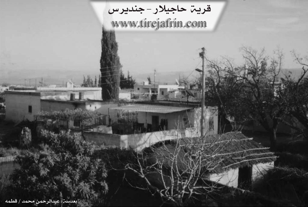
The valley of Sîlê passes through the middle of the village heading south toward the Efrîn river valley. The number of its houses covers approximately 75 houses, and its age is approximately 75 years. It was previously a farm (mezra) for the village of Celemê, and now it has become independent. Its old houses are made of stone and mud with wooden ceilings and two sloped zinc sheets, while modern concrete houses have spread around the old site.
An electricity network, telephone, and drinking water are available from a well belonging to the state or from artesian wells dug next to the homes. It contains a mosque, a primary school, and a paved road to the town of Cindirês. It belongs to the municipality of Celemê. Formerly, it consisted of houses for the family of Mistefa Betal Axa and farmers from the village of Celemê.
The residents work in rain fed agriculture (olives, grains) and irrigated agriculture from artesian wells or by pumping from the river Efrîn for summer vegetables and sugar beets, alongside raising sheep and cows.
Mukhtar of the village: Ednan Hoto
Preparation and execution:
Manager of the site Tîrêj Efrîn: Ebdulrehman Hacî Osman
20/12/2013
Sources
Book: جبل الكرد (عفرين) دراسة جغرافية Çiyayê Kurmênc (Efrîn): A Geographical Study by د. محمد عبدو علي Dr. Mihemed Ebdo Elî.
Book: عفرين .... نهرها وروابيها الخضراء Efrîn... Her River and Her Green Hills by عبدالرحمن محمد Ebdulrehman Mihemed from the village of Qetme.
Foundation/Origin Information of Ĥecîler
It was previously a farm belonging to Jalma village and has now become independent. It was formerly housing for the Mustafa Batal Agha family and farmers from Jalma village.
Source: TirejAfrin Site
Possible Village Name Meaning of Ĥecîler
The name means the plural of "pilgrims" in Turkish.
Source: TirejAfrin Site