General Information
Nahiya (Subdistrict)
Reco
Also Known As
Sheikh Bilal, Şêx Bila, شيخ بلال

Photos
Basic Information about Şêx Bila
Source: Tirej Afrin
Etymology: Named after its first inhabitant, Şêx Bila
Foundation Date/Period: Approximately 200 years ago
Hills: Çiyayê Hawar
Summaries
I. Summary from TirejAfrin Site (English) of Şêx Bila
Source: https://www.tirejafrin.com/site/kura%20afrin%20%20%20Reco%20-%20shx%20balal.htm
It is stated in the book جبل الكرد (عفرين) دراسة جغرافية Çiyayê Kurmênc (Efrîn): A Geographical Study: Şêx Bila, /439 inhabitants - 690m altitude - 5km distance/:
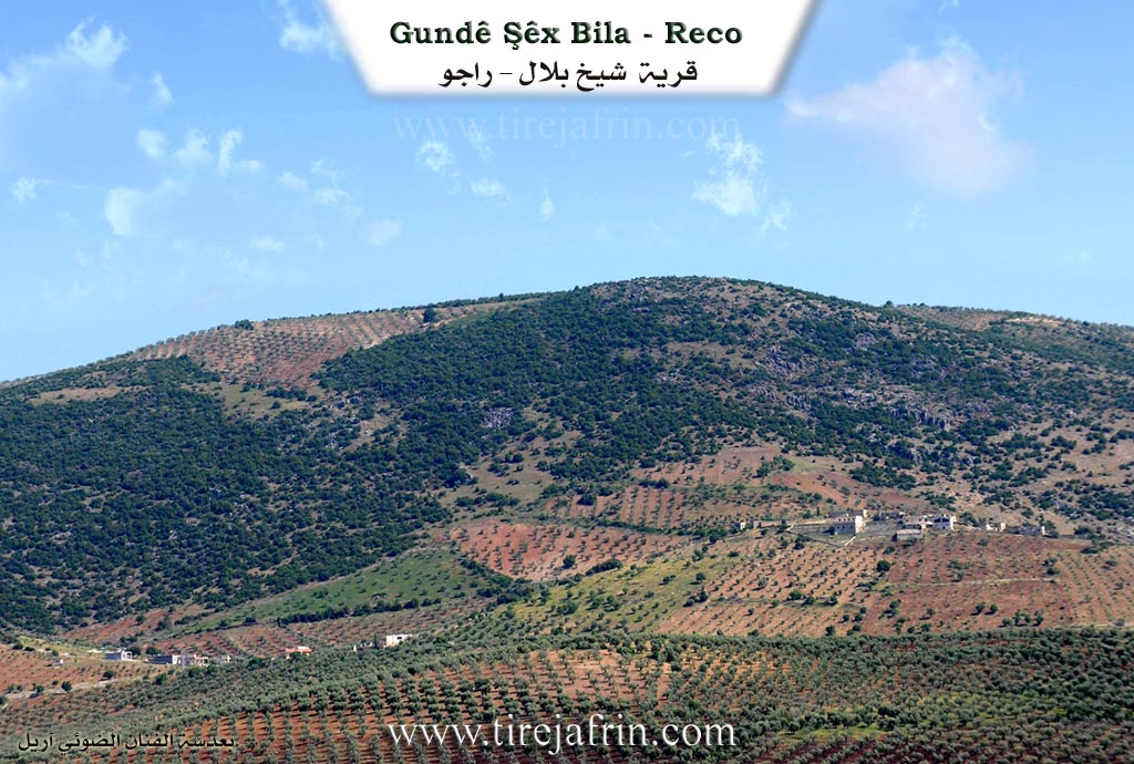
Şêx Bila is the name of its first inhabitant. It is a small village situated on the northwestern slope of Çiyayê Hawar.
It is stated in the book عفرين .... نهرها وروابيها الخضراء Efrîn... Her River and Her Green Hills: Şêx Bila is a village in Çiyayê Kurmênc following the Reco district, Efrîn region, Heleb governorate. It is a small farmstead situated on a rocky flat, on the northwestern slope of a limestone height where pastures and oak woodlands are spread. It overlooks agricultural lands with alluvial soil to the north.
It is bordered to the north by a slope, a valley, a plain, and the village of Kûran; to the south by a high mountain range planted with forest trees and oak, and the village of Koliyan Jorîn; to the east by a slope, a plain planted with olive trees, and the village of Çeqmeq; and to the west by a slope, a valley, the Xeta Trêna Heleb-Reco (Heleb-Reco railway line), and the village of Mûsêk.
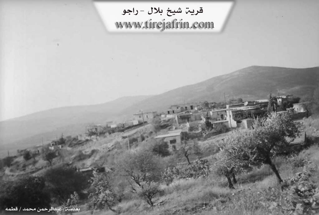
The number of its houses reaches about 30 houses, and its age is 200 years. Its dwellings are of stone and mud with wooden roofs, while modern cement buildings have spread to the east and west. An electricity network is available, as is a modern primary school (the school building is made of white hewn stone).
The village connects to the main road and the village of Çeqmeq via a leveled dirt road that is not paved. The village drinks from cisterns dug next to the houses, in which rainwater is collected during the winter season. The residents work in rain fed agriculture (olives, vines, and legumes) and raise sheep and goats. The village connects with the village of Çeqmeq and the main Riya Reco-Efrîn (Reco-Efrîn road) via a road newly paved in 2007.
Village Mukhtar: Izzet Bilal Mihemed (Ebû Mizgîn).
Sources of Information:
- Book: جبل الكرد (عفرين) دراسة جغرافية Çiyayê Kurmênc (Efrîn): A Geographical Study by د. محمد عبدو علي Dr. Mihemed Ebdo Elî.
- Book: عفرين .... نهرها وروابيها الخضراء Efrîn... Her River and Her Green Hills by عبدالرحمن محمد Ebdulrehman Mihemed from the village of Qetme.
- Studies of Navenda Tirej Soft / Ebdulrehman Hacî Osman.
- Some residents of the villages.
Preparation and execution: Manager of the Tirej Efrîn site: Ebdulrehman Hacî Osman 20/12/2013
Possible Village Name Meaning of Şêx Bila
Sheikh Bilal, the name of its first inhabitant.
Source: TirejAfrin Site