General Information
Nahiya (Subdistrict)
Mabeta
Also Known As
Şêx Kêlê, الشيخ الأقرع, مزرعة شيخ كيلو, شيخ كيل
Families, Clans, etc.
Mihyedîn Şêx Kîlo

Photos
Basic Information about Şêx Kêlê
Source: Tirej Afrin
Etymology: Named Şêx Kîlî meaning "The Bald Sheikh" (Şêx + Kîl), which was the title of one of the early residents. The Arabized name is a translation of the Kurdish name.
Foundation Date/Period: Approximately 300 years ago
Hills: Çiyayê Hawarî
Wells: Artesian well near Gulîbo
Other Landmarks: Geliyê Zerafkê, Riya Efrîn-Reco, Xeta Trêna Heleb-Meydan Ekbez
Summaries
I. Summary from TirejAfrin Site (English) of Şêx Kêlê
Source: https://www.tirejafrin.com/site/kura%20afrin%20%20%20mebetli%20-%20shx%20kele.htm
Based on the book جبل الكرد (عفرين) دراسة جغرافية Çiyayê Kurmênc (Efrîn): A Geographical Study by د. محمد عبدو علي Dr. Mihemed Ebdo Elî:
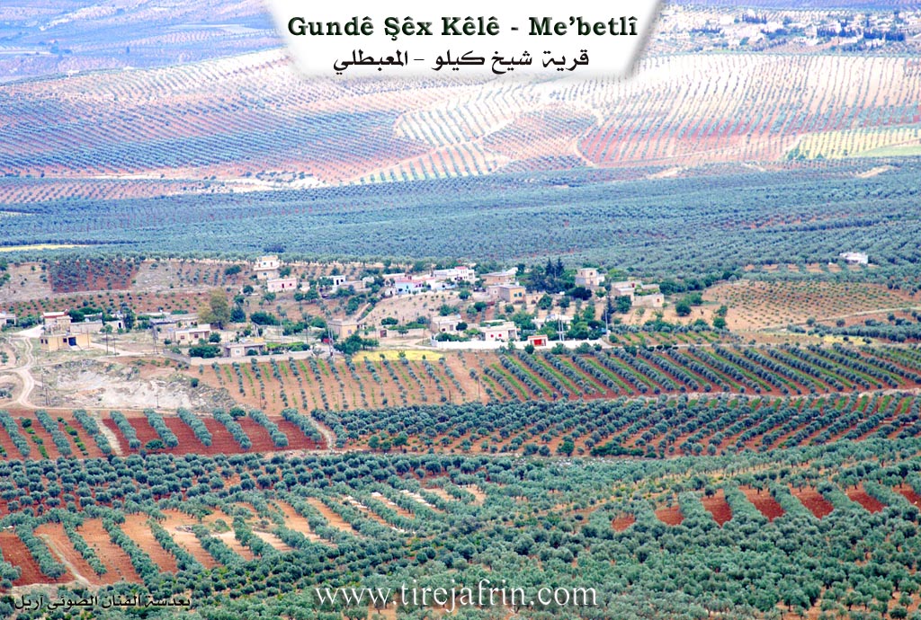
Şêx Kîlo, or Şêx Kîlî, also known as "The Bald Sheikh" (al-Sheikh al-Aqra'), has 739 inhabitants and an elevation of 480 meters. Şêx Kîlî means "The Bald Sheikh" (şêx + kîl). This was the title of one of the village's first residents. The Arabized name provided is a translation of the Kurdish name. It is a small village located south of Ebrez.
Based on the book عفرين .... نهرها وروابيها الخضراء Efrîn... Her River and Her Green Hills by عبدالرحمن محمد Ebdulrehman Mihemed from the village of Qetme:
Şêx Kîlo is a village in Çiyayê Kurmênc that belongs to the Mabeta sub district within the Efrîn region of the Heleb governorate. It is a small village situated in the central part of the mentioned mountain range on the undulating southern slopes of the limestone Çiyayê Hawarê. It overlooks agricultural lands to the south and is located 11 kilometers northeast of the town of Mabeta.
The village is bordered to the north by the village of Kûbek at a distance of 500 meters along with the village of Ebrez and Çiyayê Hawarê. To the south lie a wide agricultural plain planted with olive trees the Riya Efrîn-Reco (Efrîn-Reco road) the Xeta Trêna Heleb-Meydan Ekbez (Heleb-Meydan Ekbez railway) and the village of Qetranlî. To the west there is a mountainous height and the villages of Heyat and Oksûzlî. To the east lie an agricultural plain planted with olive trees Geliyê Zerafkê and the village of Embarlî.
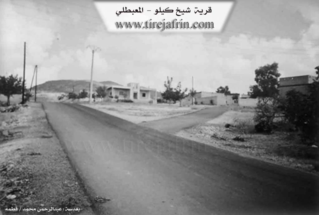
The number of houses in the village is approximately 15 and it is about 300 years old. Its old houses are made of stone and mud with flat wooden roofs while the modern ones are built of cement. A network of electricity and a primary school are available in the village. The village obtains drinking water from an artesian well adjacent to the village of Gulîbo or from artesian wells drilled next to the houses.
The inhabitants work in rain fed agriculture on an area of 1145 hectares growing grains legumes olive trees and grapevines. They also cultivate irrigated summer vegetables and other fruit trees using artesian wells alongside raising sheep and goats. The village was connected to the sub district center by a newly paved road in 2005. One of the most important families is the Mihyedîn Şêx Kîlo family who were the first to inhabit the village.
The village mukhtar is Mihemed Hesen.
Sources:
- Book: جبل الكرد (عفرين) دراسة جغرافية Çiyayê Kurmênc (Efrîn): A Geographical Study by د. محمد عبدو علي Dr. Mihemed Ebdo Elî.
- Book: عفرين .... نهرها وروابيها الخضراء Efrîn... Her River and Her Green Hills by عبدالرحمن محمد Ebdulrehman Mihemed from the village of Qetme.
Preparation and Execution:
- Manager of the Navenda Tirej Efrîn site: Ebdulrehman Hacî Osman
- 20/12/2013
Foundation/Origin Information of Şêx Kêlê
The Muhi al-Din Sheikh Kilo family were the first to settle in the village.
Source: TirejAfrin Site
Possible Village Name Meaning of Şêx Kêlê
Sheikh Kilo means "The Bald Sheikh", it is the nickname of one of the early inhabitants of the village.
Source: TirejAfrin Site