General Information
Nahiya (Subdistrict)
Mabeta
Also Known As
Al-Sheikhani, Sheikh Hitko, Şêxûtkê, Šêxûtka, الشيخاني, شيخ هتكو, شيخ هيتكو, شيخوتكا, شيخوتكو

Photos
Basic Information about Şêxûtka
Source: Tirej Afrin
Etymology: Attributed to the name Şêxo, one of the early inhabitants of the village who was known for religiosity and piety
Foundation Date/Period: 350 years
Other Landmarks: Newala Zerafkê, Newala Sîlê
Summaries
I. Summary from TirejAfrin Site (English) of Şêxûtka
Source: https://www.tirejafrin.com/site/kura%20afrin%20%20%20mebetli%20-%20shxhtko.htm
It is stated in the book Çiyayê Kurmênc (Efrîn): A Geographical Study by Dr. Mihemed Ebdo Elî: Şêxotka, Şêx Hetko, El-Şêxanî /992 inhabitants - 290 hectares - 12km - 440m/:
Şêxotka: Attributed to the name Şêxo, who was one of the early inhabitants of the village known for religiosity and piety.
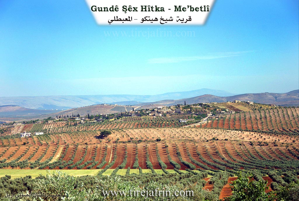
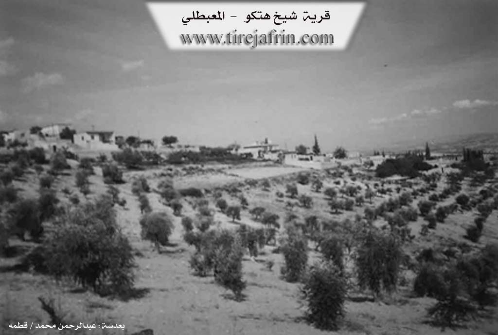
It is a medium-sized village located on a plateau in the southeastern part of Mount Hawar. Because of its location on the public road, some commercial shops have appeared in it.
It is stated in the book Efrîn... Her River and Her Green Hills by the writer Ebdulrehman Mihemed from the village of Qetme:
Şêx Hetko: A village in Çiyayê Kurmênc, belonging to the Mabeta sub-district, Efrîn region, Heleb governorate. It is a large village located in the central part of the mentioned mountain, on a wide and undulating surface of a limestone plateau covered by clay soil. It is 12km away from the town of Mabeta towards the northeast.
It is bordered to the north by mountain heights, a wide plain planted with olive trees, and the villages of Sîmalik and Rûta. To the south, it is bordered by a slope, a wide and agriculturally fertile plain, the valley of the Zerafkê river, and the village of Kaniya Gawir (Little and Big). To the west, it is bordered by the village of Amaran which is nearby at a distance of 700m. To the east, it is bordered by a slope, the Sîlê valley, mountain heights planted with olive trees, and the villages of Gemrûk and Ereb Şêxo.
The number of its houses reaches 115, and its age is 350 years. Its old residences are stone and mud with flat wooden roofs, while the modern ones are cement and stone, spreading east and west. It has an electricity network and a water network connected to the well of the village of Şorbe. It contains a primary school, a mosque, and a modern olive press.
The residents work in rain-fed agriculture (olives, grains, melons, legumes) on an area of 290 hectares, alongside raising sheep and goats. It is connected to the sub-district center by a paved road, which passes through its center up to the Riya Bilbil-Meydankê (Bulbul-Meydankê road).
Village Mukhtar: Ebdulmenan Şêx Reşîd.
Sources:
- Book: جبل الكرد (عفرين) دراسة جغرافية Çiyayê Kurmênc (Efrîn): A Geographical Study by د. محمد عبدو علي Dr. Mihemed Ebdo Elî.
- Book: عفرين .... نهرها وروابيها الخضراء Efrîn... Her River and Her Green Hills by عبدالرحمن محمد Ebdulrehman Mihemed from the village of Qetme.
Preparation and Execution:
- Manager of Navenda Tirej Efrîn: Ebdulrehman Hacî Osman
- 20/12/2013
Possible Village Name Meaning of Şêxûtka
Its name originates from one of its first inhabitants, a man named Şêxo, who was renowned for his piety and religiosity.
Source: Afrin 366 Transcript
V. Links
- Tirej Afrin:
https://www.tirejafrin.com/site/kura%20afrin%20%20%20mebetli%20-%20shxhtko.htm - Local FB pages:
https://www.facebook.com/profile.php?id=100089275868689 - Videos:
https://www.youtube.com/watch?v=VXUEy0X1HcY - Link:
https://www.youtube.com/watch?v=CpiQfEp8Gpw - Link:
https://www.youtube.com/watch?v=mApskdRQtLk - Link:
https://www.youtube.com/watch?v=22mcKfqWck0