General Information
Nahiya (Subdistrict)
Reco
Also Known As
Al-Shadyan, Shadyanli, Şediya, الشديان، شديا, شديانلي, شاديه
Tribes
Şadya
Families, Clans, etc.
Bilal Misto, Emîr Axa, Zade

Photos
Basic Information about Şediya
Source: Tirej Afrin
Etymology: Kurdish in form and pronunciation from "Şadya" (joy and happiness). It is the name of a Kurdish tribe inhabiting the Maden region in Northern Kurdistan.
Foundation Date/Period: 1700
Ruins: Gûmît
Other Landmarks: Geliyê Sarîsîn, Çemê Reş
Summaries
I. Summary from TirejAfrin Site (English) of Şediya
Source: https://www.tirejafrin.com/site/kura%20afrin%20%20%20Reco%20-%20shedyan.htm
Based on the book جبل الكرد (عفرين) دراسة جغرافية Çiyayê Kurmênc (Efrîn): A Geographical Study: Şediya, Şedyanlî, Şedyan / 440 inhabitants - 198 hectares - 8km - 420m /:
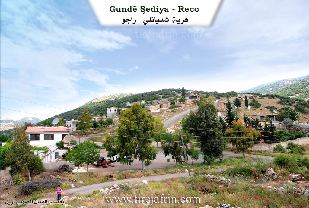
Şediya: A Kurdish name in form and pronunciation, derived from "Şadya" meaning joy and happiness. It is the name of a Kurdish tribe inhabiting the Maden region in northern Kurdistan, to which the famous Kurdish personality Nureddîn Zaza belongs. The Arabicized name "Şedyan" is a verbal manipulation of the old name.
It is a small village located on a forestry slope overlooking the lands of the Lîçe plain on the Turkish border. It is reached via the Geliyê Sarîsîn (Sarîsîn valley) by a paved road. Its lands and its warm location on the edges of the Amik plain are characterized by the production of early vegetables. The village consists of two parts: the Upper Village, which is the old one, and the Lower Village, which is the modern one. The village is distinguished by a beautiful geographical location, surrounded by dense oak forests.
Based on the book عفرين .... نهرها وروابيها الخضراء Efrîn... Her River and Her Green Hills: Şediya: A village in Çiyayê Kurmênc following the Reco district, Efrîn region, Heleb governorate.
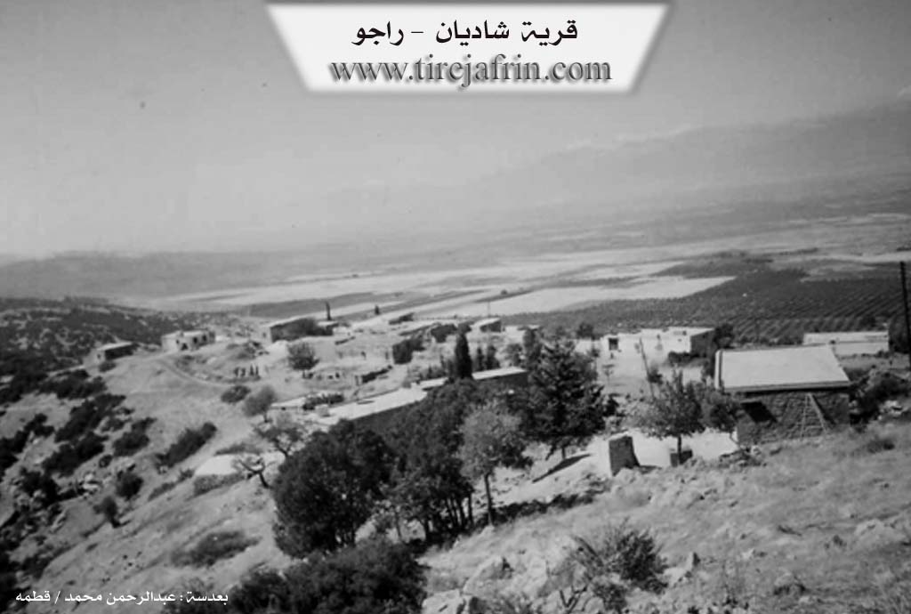
It is a small village located in the middle section of the mentioned mountain on the slope, overlooking the lands of the Amik plain near the current borders of the Sanjak of Alexandretta. It is 8 km away from the town of Reco towards the southwest. It is bordered to the north by a mountain range, the village of Girê, and the farm of Sorkê. To the south, it is bordered by a slope, a mountain range, the village of Sewlcik, the abandoned village of Gûmît, and a castle. To the east, it is bordered by a deep ravine, a very high mountain range planted with oak and terebinth trees, and the village of Gemruş. To the west, it is bordered by a harsh slope, the Amik plain, the Çemê Reş (Black River), and the Turkish border directly.
The number of its houses is about 30, and its age is about 400 years according to the account of the village Mukhtar, because there is a house with its construction date written as 1700 AD. It is one of the very old villages in the Efrîn region. Its dwellings are made of stone and mud with wooden roofs sloping on both sides covered with cane (tamat). As for the modern ones, they are cement and have extended in the southern and eastern directions.
A continuous electricity network and a modern primary school are available, as well as a paved dirt road (not asphalted). The village drinks from cisterns where rainwater is collected. The residents work in rain-fed agriculture (olives, grains, legumes) on an area of 198 hectares, and in irrigated agriculture from the waters of the Çemê Reş (vegetables) and fruit trees on small areas. They also raise sheep and goats in large numbers.
In the center of the village, there are three old archaeological architectural buildings, while the modern ones are in the northern side. There is also an archaeological castle southwest of the village, and the Çemê Reş passes near it on the western side of the village. Among its most important families are: Bilal Misto, Zade, and Emîr Axa, who were the first to inhabit the village.
Village Mukhtar: Hesen Emîr Rifet
Sources of Information:
- Book: جبل الكرد (عفرين) دراسة جغرافية Çiyayê Kurmênc (Efrîn): A Geographical Study by د. محمد عبدو علي Dr. Mihemed Ebdo Elî.
- Book: عفرين .... نهرها وروابيها الخضراء Efrîn... Her River and Her Green Hills by عبدالرحمن محمد Ebdulrehman Mihemed from the village of Qetme.
- Studies of Navenda Tirej Soft / Ebdulrehman Hacî Osman.
- Some residents of the villages.
Preparation and Execution: Manager of the Tirej Efrîn website: Ebdulrehman Hacî Osman 20/12/2013
Foundation/Origin Information of Şediya
Among its most important families are Bilal Mastaw, Zada, and Amir Agha, and they are the first to inhabit the village.
Source: TirejAfrin Site
Possible Village Name Meaning of Şediya
A Kurdish name from "Shadiya" meaning joy and happiness. It is also the name of a Kurdish tribe living in the Madan-Ma'dan region.
Source: TirejAfrin Site