General Information
Nahiya (Subdistrict)
Efrîn
Also Known As
Shwarkhe Arze, Shwargha al-Aruz, Shawarighat al-Arz, شوارغة الأرز
Families, Clans, etc.
Derwîş Şemo
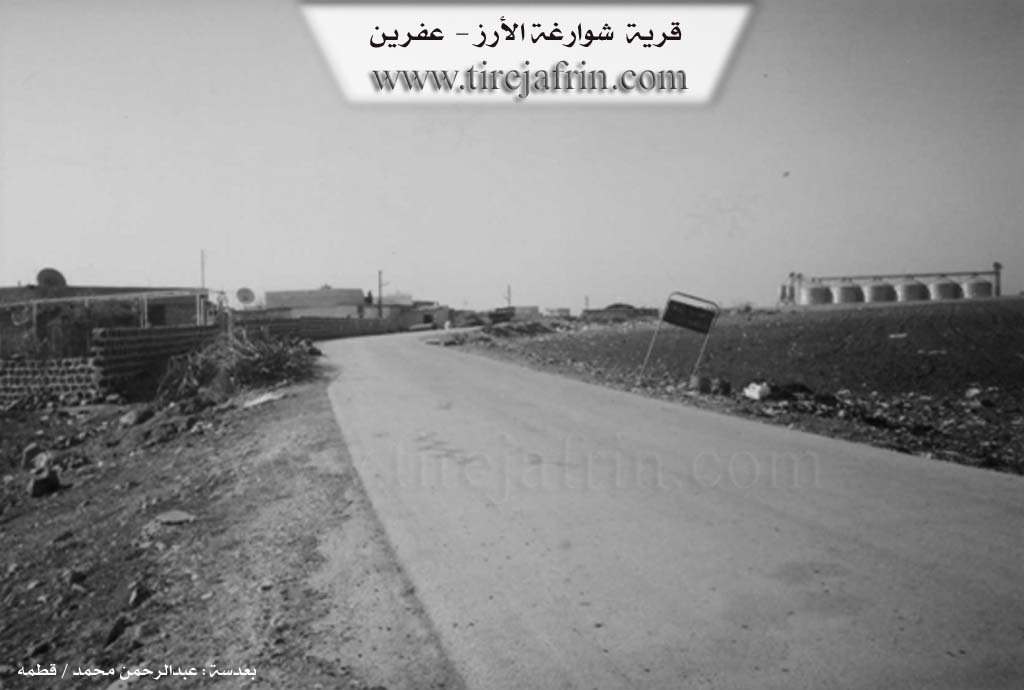
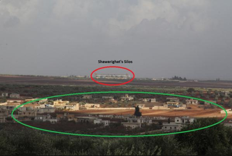
Photos
Basic Information about Şewarxa Arze
Source: Tirej Afrin
Etymology: The text states it is an Arabic name
Foundation Date/Period: Approximately 500 years
Hills: Girê Qîbar
Other Landmarks: Meqsef el-Nemir
Summaries
I. Summary from TirejAfrin Site (English) of Şewarxa Arze
Source: https://www.tirejafrin.com/site/kura%20afrin%20markaz-%20shwrxt%20alrz.htm
The following is stated in the book جبل الكرد (عفرين) دراسة جغرافية Çiyayê Kurmênc (Efrîn): A Geographical Study by د. محمد عبدو علي Dr. Mihemed Ebdo Elî:
Şewarxa, Şewarxet el-Erz /373 inhabitants, 25km, 552m/:
It is an Arabic name. It is a medium sized village located on the eastern administrative borders of the Efrîn region.
The following is stated in the book عفرين .... نهرها وروابيها الخضراء Efrîn... Her River and Her Green Hills by the writer عبدالرحمن محمد Ebdulrehman Mihemed from the village of Qetme:
Şewarxet el-Erz is a village in Çiyayê Kurmênc. It belongs to the sub district of the villages of the Efrîn region center, Heleb governorate. It is a large village located on the western slope of the western Çiyayê Lêlûn and Çiyayê Seman.
It is bordered to the north by a plain planted with olive trees, a mountain chain, and the villages of Kefermez and Qere Tepê. To the south, it is bordered by a wide plain, a mountainous plateau, and the villages of Turîndê and Qerzîhel. To the west, it is bordered by an agricultural plain, the archaeological Girê Qîbar, the Riya Heleb-Efrîn (Aleppo-Efrîn road), and the village of Cumkê. To the east, it is bordered by the northern Çiyayê Seman chain, the western Çiyayê Lêlûn chain, the villages of Meryemîn, Xaldiye, and Enab, and a very high mountain chain.
The number of houses reaches approximately 250 houses, and the age of the village is approximately 500 years. It is one of the very old villages in the region. Its old houses are made of stones, mud, and wooden ceilings, while the modern ones are made of stones and reinforced concrete. An electricity network is available, as well as drinking water taken from the source of Kefir Cenê. It has a primary school and a telephone, and it connects to the district center and neighboring villages via an asphalt road. A town council was established in the village in the year 2002.
The residents of the village work in the cultivation of grains, vegetables, olives, and fruit trees. Its lands are agriculturally fertile due to the passage of the stream of the Kefir Cenê spring and the presence of artesian wells. Girê Qîbar is archaeological, indicated by the presence of Roman and Byzantine ruins.
Among its most important families is the Derwîş Şemo family, who were the first to inhabit the village since its founding. There is the Meqsef el-Nemir tourist site west of the village next to the Riya Heleb-Efrîn (Aleppo-Efrîn road).
The village mukhtar is Mihemed Hermûş.
Preparation and Execution:
Manager of the Tirej Efrîn site: Ebdulrehman Hacî Osman
20/12/2013
Sources:
- Book: جبل الكرد (عفرين) دراسة جغرافية Çiyayê Kurmênc (Efrîn): A Geographical Study by د. محمد عبدو علي Dr. Mihemed Ebdo Elî.
- Book: عفرين .... نهرها وروابيها الخضراء Efrîn... Her River and Her Green Hills by عبدالرحمن محمد Ebdulrehman Mihemed from the village of Qetme.
- Navenda Tirej Soft / Ebdulrehman Hacî Osman.