General Information
Nahiya (Subdistrict)
Cindires
Also Known As
Ashkan West, Aşkê Xerbî, آشكان, اشكان غربي
Tribes
Aşkan

Photos
Basic Information about Aşkê Xerbî
Source: Tirej Afrin
Etymology: Named after the Aşkan tribe (mentioned as Aşkî by Şerefxan). Linked by Diakonoff to the ancient Eskît (Scythian) people derived from "Aşkîda" (meaning: the ancient archaeological one).
Foundation Date/Period: Approximately 500 years ago
Shrines: Şêx Bêreqdar
Other Landmarks: Çamli Bêl
Summaries
I. Summary from TirejAfrin Site (English) of Aşkê Xerbî
Source: https://www.tirejafrin.com/site/kura%20afrin%20Cindires%20-%20ashkan%20xerbi.htm
According to the book جبل الكرد (عفرين) دراسة جغرافية Çiyayê Kurmênc (Efrîn): A Geographical Study by د. محمد عبدو علي Dr. Mihemed Ebdo Elî:
Aşka, Aşkan:
Aşkan: The name of a Kurdish tribe mentioned by Şerefxan under the name Aşkî (Source:- Sharafnama, p. 75). The Soviet Orientalist Diakonoff (p. 229) mentions the name of the "Scythian" (Eskît) people as coming from the word "Aşkîda," which means "the ancient archaeological one." This people or tribe is among the peoples of the mountains of Kurdistan in the eighth century BC and is considered among the ancestors of the Kurds. I believe there is a great similarity between the name of this people and the name of the Aşkan tribe.
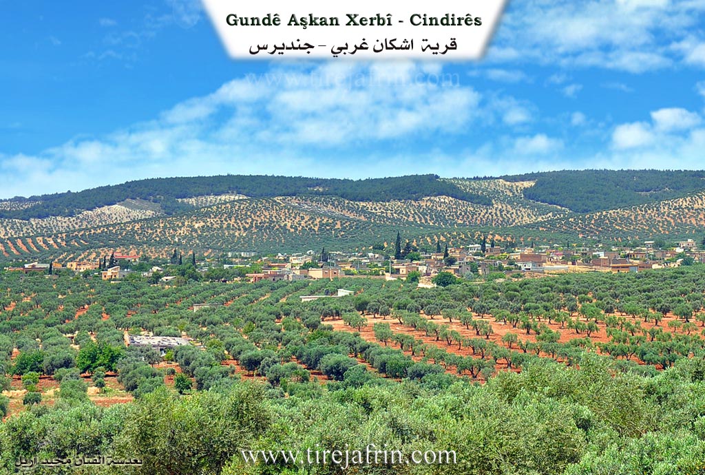
- Aşkan Xerbî /1138 inhabitants - 764 hectares - 7km - 310m altitude/:
- It is a medium-sized village. Its houses are spread on a rise amidst wide olive fields.
- According to the book عفرين .... نهرها وروابيها الخضراء Efrîn... Her River and Her Green Hills by the writer عبدالرحمن محمد Ebdulrehman Mihemed from the village of Qetme:
- Aşkan Xerbî:
- A village in Çiyayê Kurmênc, administratively belonging to the Cindirês district of the Efrîn region, Heleb governorate. It is a large village located at the bottom of the southeastern slope of Çiyayê Kurmênc, where the transitional lands between mountain pastures and agricultural plains are located, to the west of a watercourse.
- It is 7km west of the town of Cindirês. It is bordered to the north by mountain heights, the shrine of Şêx Bêreqdar on the highest mountain peak, and the village of Merwanê Jorîn. To the south, there is a slope and a wide, agriculturally fertile plain, the Riya Efrîn-Hemam (Efrîn-Hemam road), and the village of Hac Îskender. To the west, a fertile plain planted with olive trees, mountain and forest heights, and the village of Hemam. To the east, a valley passes through the village starting from the north and ending in the south in the Cindirês plain, along with the nearby village of Baflûr and Kefer Sefrê.
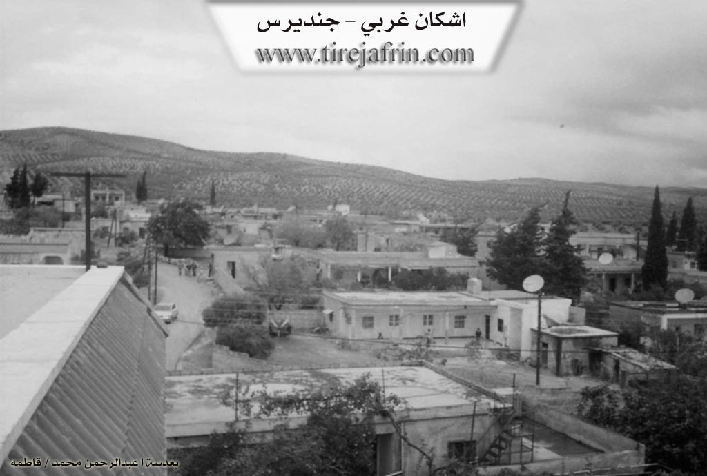
- Its residences were stone and mud; most have been demolished, and modern construction has been erected in their place, spreading towards the west and south, adjacent to the transportation road and on the slope of the neighboring mountain. Modern buildings have become predominant over the old ones. The number of its houses reaches 150, and its age is approximately 500 years, according to the statements of one of the elderly residents of the village. Previously, it consisted of caves inhabited by the people of the village.
- An electricity network, a primary school, and a mosque in the center of the village are available. The road connecting to the district center is paved. Most of its inhabitants work in olive cultivation, which constitutes 90% of the cultivated areas, followed by rain-fed grains and legumes, and the raising of sheep and goats. Drinking water is secured from the well located east of the village and from cisterns that collect rainwater. The farm of Çamli Bêl is attached to it.
- Village Mukhtar: Mihemed Hesen Hemdûş
- Sources:
- Book: جبل الكرد (عفرين) دراسة جغرافية Çiyayê Kurmênc (Efrîn): A Geographical Study by د. محمد عبدو علي Dr. Mihemed Ebdo Elî.
- Book: عفرين .... نهرها وروابيها الخضراء Efrîn... Her River and Her Green Hills by عبدالرحمن محمد Ebdulrehman Mihemed from the village of Qetme.
Preparation and execution:
- Director of the Tirej Efrîn website: Ebdulrehman Hacî Osman
- 20/12/2013
Foundation/Origin Information of Aşkê Xerbî
It was previously caves inhabited by the village people.
Source: TirejAfrin Site
Possible Village Name Meaning of Aşkê Xerbî
Ashkan: The name of a Kurdish tribe mentioned by Sharafkhan under the name Ashki. The Soviet orientalist Diakonov mentions the name of the people "Askit" from the word "Ashkida," which means "the ancient archaeological," and this tribe are from the peoples of the Kurdistan mountains in the eighth century BC, and are considered among the ancestors of the Kurds.
Source: TirejAfrin Site