General Information
Nahiya (Subdistrict)
Şera
Also Known As
Alciya, Aliji, آلجي, ٩اولجيه
Families, Clans, etc.
Şêx Ismaîl Zade

Photos
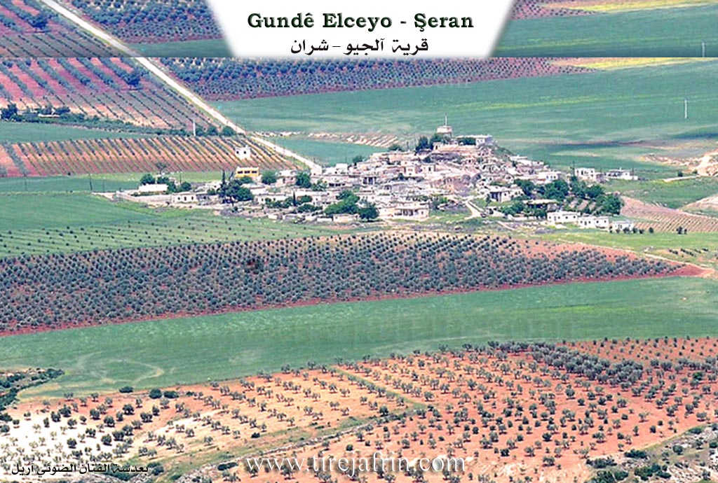
Top: "Village of Alyağa - Sharan" and "www.tirejafrin.com"
Basic Information about Alciya
Source: Tirej Afrin
Etymology: The name is derived from Kurdish components: (Al) meaning flag or banner, and the suffix (ci) meaning owner or possessor. The full meaning is owners of the banner.
Foundation Date/Period: approximately 350 years ago
Hills: Ancient archaeological hill
Other Landmarks: River Efrîn
Summaries
I. Summary from TirejAfrin Site (English) of Alciya
Source: https://www.tirejafrin.com/site/kura%20afrin%20%20sheran%20-%20alciya.htm
It is stated in the book جبل الكرد (عفرين) دراسة جغرافية Çiyayê Kurmênc (Efrîn): A Geographical Study: Alciya, /1259 inhabitants - 1015 hectares - 390m altitude - 20km distance/:
Al: means flag or banner in Kurdish. ChatGPT Deep Research: a linguistic suffix indicating the meaning of "owner". Thus, the full meaning becomes "owners of the banner".
It is a small village located atop a small hill. It is built upon an ancient archaeological hill.
It is stated in the book عفرين .... نهرها وروابيها الخضراء Efrîn... Her River and Her Green Hills: Alciya: A village in Çiyayê Kurmênc following the township of Şeran, district of Efrîn, governorate of Heleb, (1253 inhabitants). It is a small village located in the northern part of Çiyayê Kurmênc, atop a small hill on the right side of a valley that slopes towards the southeast, which feeds into the river Efrîn. Its soil is fertile reddish clay. It is 20 km away from Şeran towards the northwest.
It is bordered to the north by a wide plain of olive trees and the village of Dura Qilî, to the south by a slope, a plain, the valley of the river Efrîn, and the village of Qarqîn Kebîr and Elî Bazanlî, to the east by a valley, a plain, fertile agricultural lands, and the village of Bilûrsink, and to the west by a wide plain planted with olive trees and vegetables and the village of Qarqîn Sexîr.
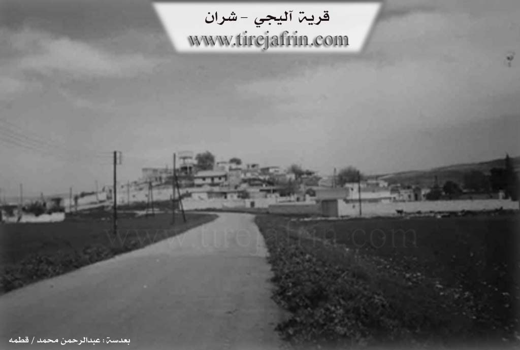
The number of its houses is about 50 houses and the age of the village is about 350 years. This village is one of the villages belonging to the family of Şêx Ismaîl Zade formerly.
Its old dwellings are of stone and mud with wooden roofs, and the modern ones are of stone and reinforced concrete. An electricity network and drinking water belonging to the state are available in it. It has a primary school and a paved road passes through its center to several neighboring villages. It contains a large and old press belonging to the family of Şêx Ismaîl Zade.
The residents of the village work in the cultivation of grains, olives, and vines on an area of 1000 hectares, and in the cultivation of irrigated summer vegetables, apricots, pomegranates, and walnuts from the river Efrîn on 15 hectares due to its proximity to the course of the river Efrîn, and in sheep rearing. Its lands are very fertile; part of its soil is white and part is red in color.
Village Mukhtar: Osman Osman
Sources of Information:
- Book: جبل الكرد (عفرين) دراسة جغرافية Çiyayê Kurmênc (Efrîn): A Geographical Study by د. محمد عبدو علي Dr. Mihemed Ebdo Elî.
- Book: عفرين .... نهرها وروابيها الخضراء Efrîn... Her River and Her Green Hills by عبدالرحمن محمد Ebdulrehman Mihemed from the village of Qetme.
- Studies of Navenda Tirej Soft / Ebdulrehman Hacî Osman.
- Some residents of the villages.
Preparation and Execution: Manager of the website Tirej Efrîn: Ebdulrehman Hacî Osman 20/12/2013
Foundation/Origin Information of Alciya
This village is one of the villages of the Sheikh Ismail Zadeh family previously. It is built on an ancient archaeological mound.
Source: TirejAfrin Site
Possible Village Name Meaning of Alciya
Al (آل): means flag or banner in Kurdish, Cî: a linguistic suffix meaning "owner," so the complete meaning becomes "owners of the banner."
Source: TirejAfrin Site