General Information
Nahiya (Subdistrict)
Bilbilê
Also Known As
Al-Tiflah, Bîbaka, Bîk Oshaghi, Gundê Bîkê, الطفلة, بيبوكو, بيك أوشاغي, بيك اوشاغي

Photos
Basic Information about Bîbaka
Source: Tirej Afrin
Etymology: Bîbaka is a folk name with unclear meaning. The Ottoman name Bêk Uşaxî means "Children of the Bey" (Bêk + Uşaxî), which is a Turkish and Kurdish designation.
Foundation Date/Period: about 400 years
Summaries
I. Summary from TirejAfrin Site (English) of Bîbaka
Source: https://www.tirejafrin.com/site/kura%20afrin%20%20%20bilbile%20-%20bibaka.htm
It is stated in the book جبل الكرد (عفرين) دراسة جغرافية Çiyayê Kurmênc (Efrîn): A Geographical Study: Bîbaka, Bêk Uşaxî, Al-Tifla / 1292 people 275 hectares 13 km 650 m /:
Bîbaka: A folk name with unclear meaning. The Ottoman name "Bêk Uşaxî" means "Children of the Bey" (Bêk + Uşaxî), and it is a Turkish and Kurdish designation. The Arabized name "Al-Tifla" has no connection to the old name in terms of pronunciation or meaning.
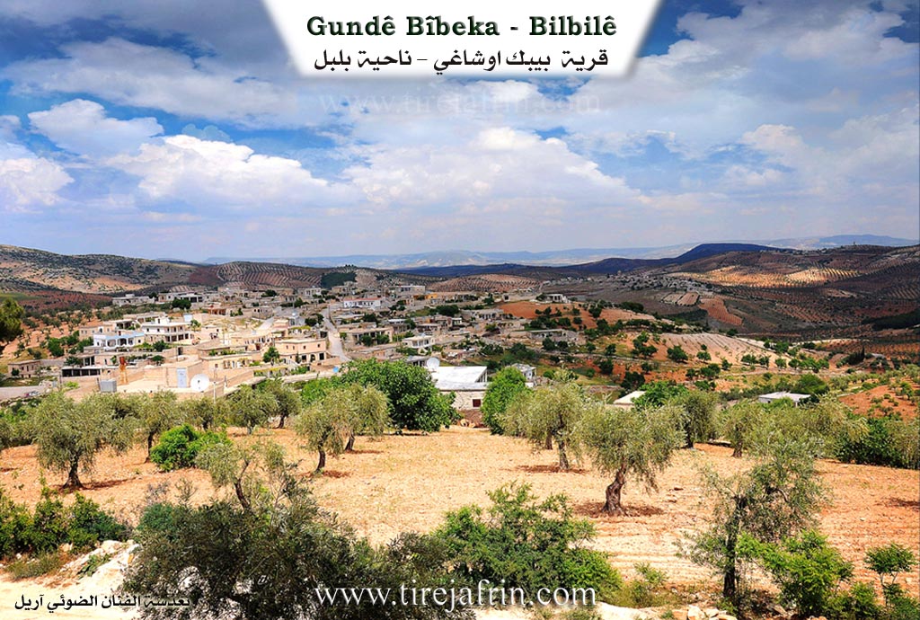
It is a small village located on a plateau, surrounded by valleys.
It is stated in the book عفرين .... نهرها وروابيها الخضراء Efrîn... Her River and Her Green Hills: Bêk Uşaxî: A village in Çiyayê Kurmênc following the Bilbil subdistrict, Efrîn region, Heleb governorate. It is a large village located on a limestone plateau with a flat surface and gentle slopes, surrounded by valleys from all sides, which made it isolated from flood dangers. To its west is a forest thicket with an area of /20/ hectares, and its soil is clay. It is 13 km away from the town of Bilbil towards the south.
It is bounded to the north by a slope and a torrential valley planted with olive trees and the village of Şerqiyanlî; to the south by a slope and a torrential valley planted with olive trees, the Riya Kotanlî-Reco (Kotanlî-Reco road), and the villages of Gurê Gol and Xelîlak Uşaxî; to the west by a deep torrential valley and the villages of Qotanlî and Berkeşlî; and to the east by a torrential valley planted with olive trees, a mountainous height, and the village of Qaş Uşaxî at the top of the height.
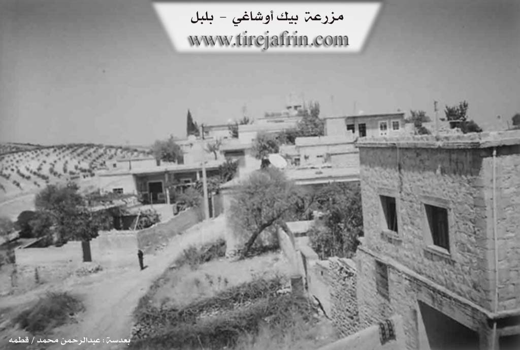
The number of its houses is about 125 houses and its age is about 400 years. Its old houses are stone and mud with flat wooden roofs, while the modern ones are stone and cement, which have extended east and south. An electricity network, a primary school, and two modern presses for pressing olives are available in it. The village drinks from a water network connected to a well west of the village or from artesian wells dug next to the homes. Most of its inhabitants work in rain fed agriculture on an area of /275/ hectares of olives, vines, and grains, alongside raising sheep and goats. A paved road with a length of /2/ km connects it to the town of Bilbil.
Village Mukhtar: Bekir Şeref Şeref
Sources of Information:
- Book: جبل الكرد (عفرين) دراسة جغرافية Çiyayê Kurmênc (Efrîn): A Geographical Study by د. محمد عبدو علي Dr. Mihemed Ebdo Elî.
- Book: عفرين .... نهرها وروابيها الخضراء Efrîn... Her River and Her Green Hills by عبدالرحمن محمد Ebdulrehman Mihemed from the village of Qetme.
- Studies of Navenda Tirej Soft / Ebdulrehman Hacî Osman.
- Some residents of the villages.
Preparation and execution: Manager of the website Tirej Efrîn: Ebdulrehman Hacî Osman 20/12/2013
Possible Village Name Meaning of Bîbaka
Bîbaka: A popular name of unclear meaning. The Ottoman designation "Bîk Oshaghi" means "children of the Bey," which is a Turkish and Kurdish designation. The Arabized name "Al-Tiflah" has no connection to the old name.
Source: TirejAfrin Site