General Information
Nahiya (Subdistrict)
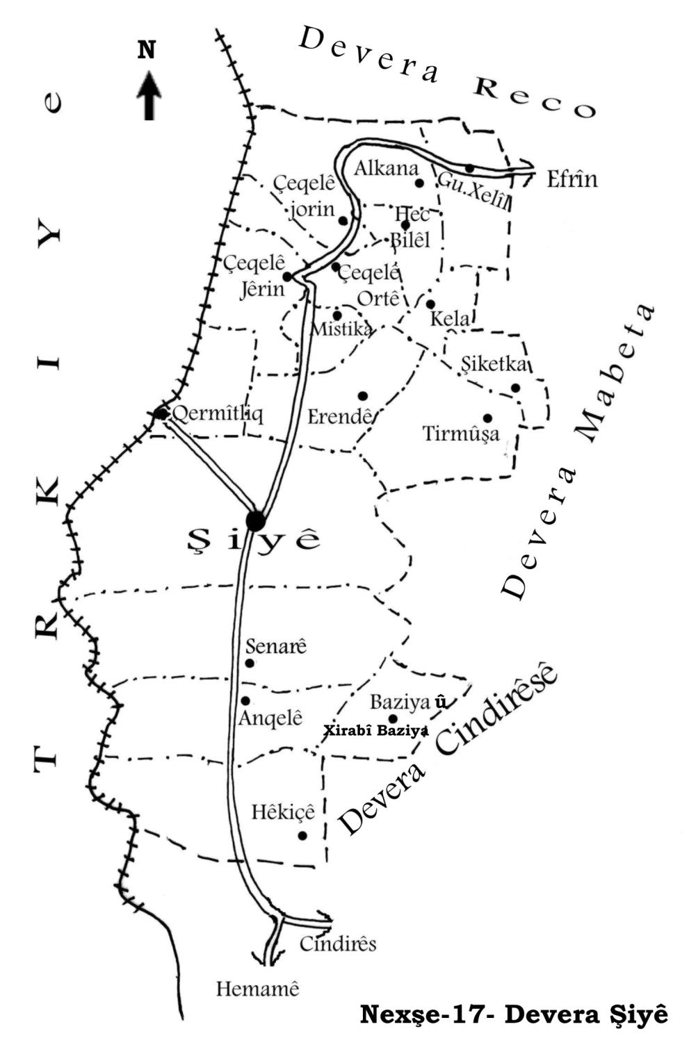
Şiyê
Also Known As
Al-Baziya, Bazayanli, Baziya, Xirabî Baziya, البازية, بازيانلي, خربة بازيانلي/ خربة البازية, بازيا
Tribes
Baziya
Photos
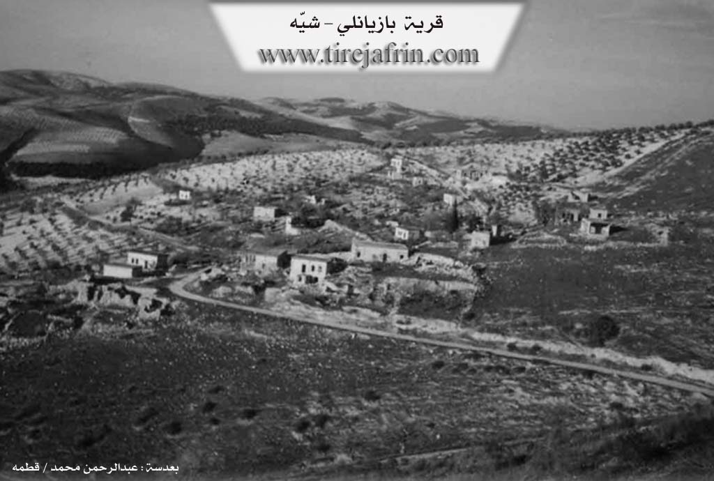
Basic Information about Baziya
Source: Tirej Afrin
Etymology: Baziya is the name of a region and a tribe in southern Kurdistan, and Baz is a Kurdish name for a type of bird of prey
Foundation Date/Period: Approximately 200 years ago (modern village); Roman era (ancient site)
Hills: Çiyayê Na'so
Shrines: Qazaqlî
Ruins: Roman ruins
Other Landmarks: Wadî Cerçem
Summaries
I. Summary from TirejAfrin Site (English) of Baziya
Source: https://www.tirejafrin.com/site/kura%20afrin%20%20%20shiye%20-%20baziya.htm
The following is stated in the book جبل الكرد (عفرين) دراسة جغرافية Çiyayê Kurmênc (Efrîn): A Geographical Study by د. محمد عبدو علي Dr. Mihemed Ebdo Elî: Baziya, Baziyanlî, or El-Baziya has 167 inhabitants, is located 6km away, and sits at an altitude of 460m.
Baziya is the name of a region and a tribe in southern Kurdistan, and Baz is a Kurdish name for a type of bird of prey. It is a small village containing hewn stones believed to be ruins of antiquities dating back to the Roman era, which were reused in modern construction. Due to the lack of services and the deterioration of economic conditions, most of its inhabitants have abandoned it in recent decades.
The following is stated in the book عفرين .... نهرها وروابيها الخضراء Efrîn... Her River and Her Green Hills by the writer عبدالرحمن محمد Ebdulrehman Mihemed from the village of Qetme regarding Baziyanlî: It is a village in Çiyayê Kurmênc, administratively belonging to the township of Şêx el-Hedîd, Efrîn region, Heleb governorate.
It is a small village located on the western slope of the aforementioned mountain, Çiyayê Na'so, near Wadî Cerçem, at a distance of 6km southeast of Şêx el-Hedîd. It is bordered to the north by a high mountain chain planted with forest trees and olives and the village of Hec Hesenlî; to the south by a deep valley, a high mountain chain planted with olive and forest trees, the village of Kefer Sefrê, and the shrine of Qazaqlî; to the west by three watercourses, Wadî Cerçem, and the villages of Sînara and Enqelê; and to the east by a high mountain chain planted with olives and forest trees and the village of Tataranlî.
The number of its houses reaches approximately 20 houses, and its age is about 200 years. Its old houses are made of limestone and mud with flat wooden roofs, while the modern ones are of cement and stone. Its habitation is ancient, dating back to the Roman era, indicated by stones reused in construction.
Services are completely unavailable in the village. The residents work in the cultivation of olives, vines, and grains. The village drinks from rainwater collected in cisterns dug into the houses. Currently, the residents have migrated to the nearby cities of Heleb, Efrîn, and Cindirês, and the reason is the lack of public facilities such as electricity and schools, and the ruggedness of the area where the village is located.
Village Mukhtar: Abidîn Umer
Preparation and execution:
Manager of Navenda Tirej Efrîn: Ebdulrehman Hacî Osman
20/12/2013
Sources
Book: جبل الكرد (عفرين) دراسة جغرافية Çiyayê Kurmênc (Efrîn): A Geographical Study by د. محمد عبدو علي Dr. Mihemed Ebdo Elî.
Book: عفرين .... نهرها وروابيها الخضراء Efrîn... Her River and Her Green Hills by عبدالرحمن محمد Ebdulrehman Mihemed from the village of Qetme.
Studies of Navenda Tirej Soft / Ebdulrehman Hacî Osman.
Foundation/Origin Information of Baziya
Due to lack of services and deteriorating economic conditions, most of its inhabitants emigrated in recent decades.
Source: TirejAfrin Site
Possible Village Name Meaning of Baziya
Baziya: Name of a region and tribe in southern Kurdistan. Baz: is a Kurdish name for a type of predatory bird.
Source: TirejAfrin Site