General Information
Nahiya (Subdistrict)
Efrîn
Also Known As
Cidêdê, Jadida, جديدة
Families, Clans, etc.
Ebdo Reşo

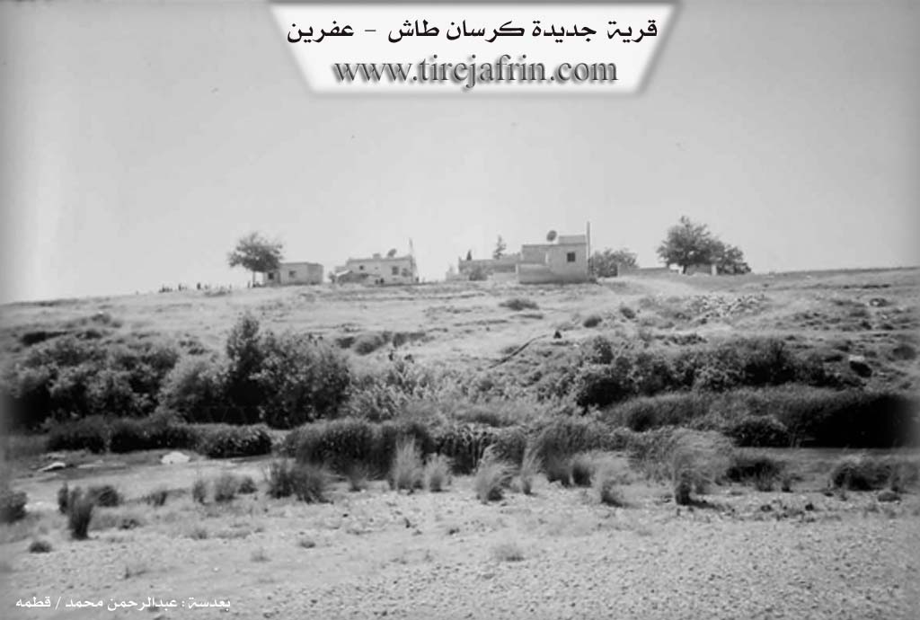
Photos
Basic Information about Cidêdê
Source: Tirej Afrin
Etymology: It is believed that the name is Syriac
Foundation Date/Period: Approximately 100 years ago
Ruins: Eyn Dara
Other Landmarks: Çemê Efrînê
Summaries
I. Summary from TirejAfrin Site (English) of Cidêdê
Source: https://www.tirejafrin.com/site/kura%20afrin%20markaz-%20cidede.htm
It is stated in the book جبل الكرد (عفرين) دراسة جغرافية Çiyayê Kurmênc (Efrîn): A Geographical Study by د. محمد عبدو علي Dr. Mihemed Ebdo Elî: Cidd, Cedîde / 118 people 3.5km 220m /:
It is believed that the name is Syriac.
It consists of several houses for habitation, located on the western bank of the Efrîn river. It was among the properties of the Ebdo Reşo family, one of the wealthy families of the region. It is surrounded by fertile agricultural lands irrigated by the waters of the Efrîn river.
And it is stated in the book: عفرين .... نهرها وروابيها الخضراء Efrîn... Her River and Her Green Hills by the writer عبدالرحمن محمد Ebdulrehman Mihemed from the village of Qetme:
Cedîde: A farm in Çiyayê Kurmênc, belonging to the villages of the Efrîn center, Heleb governorate. It is a small farm consisting of five old houses and was a dwelling for the peasants and agents of the Aghas.
It is bordered to the north by Kersan Taş and Efrîn. And to the south by the course of the Efrîn river, the village of Betîte, the archaeological site of Eyn Dara, the Efrîn river, the Riya Cindirês-Efrîn (Cindirês Efrîn road), and the village of Babîlît. And to the east by the Efrîn river and the village of Tûrendê.
The number of its houses is about 5 houses and its age is about 100 years. Its old dwellings are of stone and mud with wooden roofs, and the modern ones are of stones and cement. Public facilities are not available in it. It was previously a dwelling for the peasants of the Aghas of the region. Its inhabitants work in the cultivation of grains and vegetables, the cultivation of cotton and sugar beet, and sheep herding.
Sources
Book: جبل الكرد (عفرين) دراسة جغرافية Çiyayê Kurmênc (Efrîn): A Geographical Study by د. محمد عبدو علي Dr. Mihemed Ebdo Elî.
Book: عفرين .... نهرها وروابيها الخضراء Efrîn... Her River and Her Green Hills by عبدالرحمن محمد Ebdulrehman Mihemed from the village of Qetme.
Preparation and execution:
Director of the Tirej Efrîn site: Ebdulrehman Hacî Osman
20/12/2013
Foundation/Origin Information of Cidêdê
It was owned by the Abdo Rasho Family. It was previously a residence for livestock farmers in the region.
Source: TirejAfrin Site
Possible Village Name Meaning of Cidêdê
The name is believed to be Syriac.
Source: TirejAfrin Site