General Information
Nahiya (Subdistrict)
Efrîn
Also Known As
Cilbir, Cilbirê, Jalbal, جلبل, جلبريه
Families, Clans, etc.
Rûbarî, Xubarî

Photos
Basic Information about Cilbirê
Source: Tirej Afrin
Etymology: Linguistically, the name may be composed of two syllables: Cil meaning clothes or rugs, and Bir or Ber meaning rugs or similar. However, it is more realistically composed of Cih meaning location and place, and Bel meaning high and erect (Cih + Bel). The village is located on the highest point in the surrounding agricultural area. The syllables merged to form 'Cihbel' or 'Cibel', written as 'Cilbil', and later the letters 'b' and 'l' were replaced by 'l' and 'r', becoming 'Cilbir'. The Kurdish word Cobel is known in meaning and used to denote a small high place.
Foundation Date/Period: Approximately 300 years
Summaries
I. Summary from TirejAfrin Site (English) of Cilbirê
Source: https://www.tirejafrin.com/site/kura%20afrin%20markaz-%20Cilbire.htm
The following is stated in the book Çiyayê Kurmênc (Efrîn): A Geographical Study by Dr. Mihemed Ebdo Elî:
Cilbir / 1547 inhabitants - 670 AH (or hectares) - 18 km - 515 m /:
Etymology
Linguistically, we can say that the name is composed of two syllables: Cil meaning clothes or rugs, and Bir or Ber meaning rugs or similar; the name might indicate something related to rugs or clothing. However, closer to reality is that it is composed of these two syllables: Cih meaning location and place, and Bel meaning high and erect. The village is situated on the highest point in the agricultural area surrounding it. The two syllables merged to form a new name, "Cihbel" or "Cibel", written as "Cilbil". Later, the letters "b" and "l" were replaced by "l" and "r", becoming Cilbir. The Kurdish word Cobel is known in terms of meaning and is used to indicate a small high place.
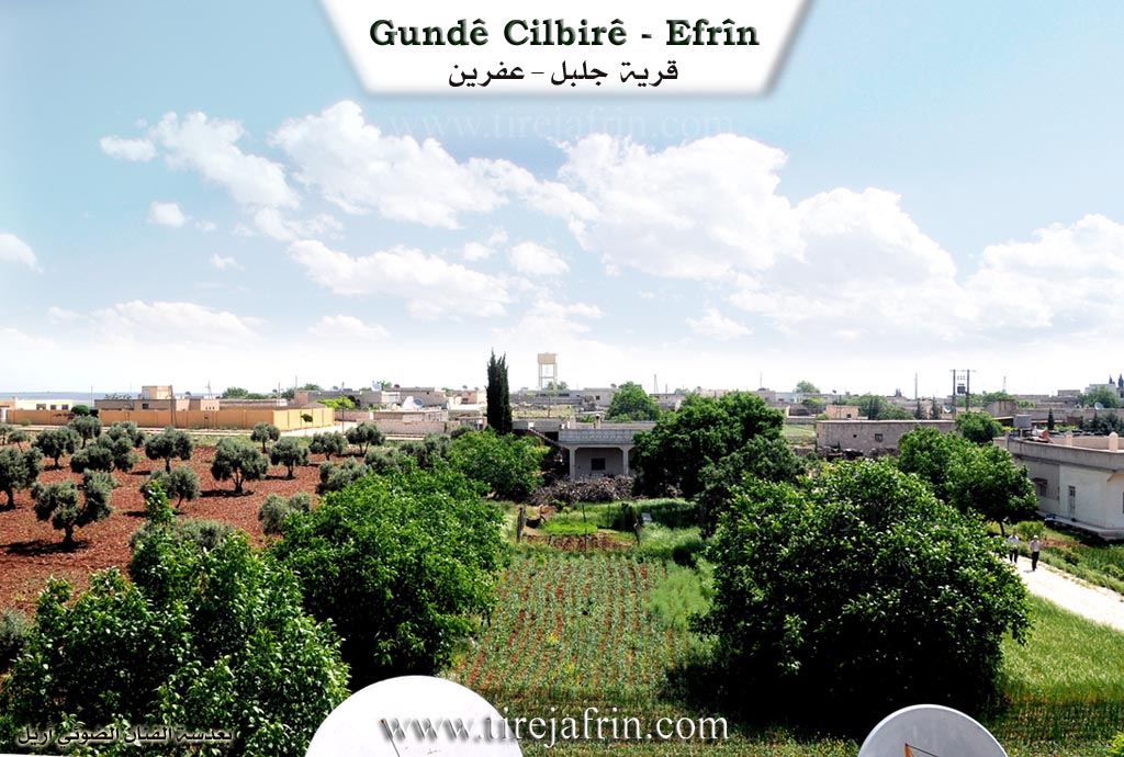
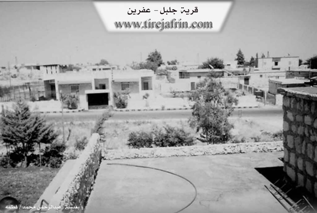
Description and Location
It is a medium-sized village located on Çiyayê Lêlûn. It is considered a center for the Xubarî family/clan, containing their main guest house. Modern and beautiful residences have been built there. Its site is archaeological, evidenced by the massive building stones found in the center of the village. It contains the home of the former member of the People's Council, the lawyer Ismet Xubarî.
The following is stated in the book Efrîn... Her River and Her Green Hills by the writer Ebdulrehman Mihemed from the village of Qetme:
Cilbir
It is a village on Çiyayê Lêlûn, following the sub-district of the villages of the Efrîn center and region, in the Aleppo governorate.
It is a small village located in the Xubariye (Rûbariye) area and Çiyayê Lêlûn, situated on an agricultural plateau. It is surrounded by forest trees and olive trees from all sides.
Boundaries
It is bordered to the north by a fertile agricultural plain and the villages of Kîştaar and Enab.
To the south, it is bordered by a wide fertile agricultural plain and the village of Çetal Ziyaret.
To the west, it is bordered by a wide plain, a mountain range planted with forest trees, and the villages of Kûbale, Zirîqat, and Basilhaya.
To the east, it is bordered by a wide agricultural plain and the nearby villages of Kîştaar and Teneb.
Infrastructure and Statistics
The number of houses reaches about 50, and its age is approximately 300 years. Its old houses are made of stone, mud, and wooden ceilings, while the modern ones are made of stone and cement. An electricity network and drinking water are available. A paved road passes through its center connecting to several neighboring villages up to the village of Kefer Cenê. There is a primary school, a small mosque, and a telephone center. It belongs to the Basilhaya municipality.
Economy
The residents of the village work in the cultivation of olives and grains, and in raising livestock.
Social Structure and Personalities
It is mentioned that the Rûbarî family lives in this village. Among its most historically known figures in the region are:
Qasim bin Şêxo Axa (owner of the village guest house), and his grandson Qasim still manages the guest house.
Arif bin Osman Axa.
Zihnî bin Osman Axa.
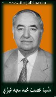
Seîd Osman Axa, father of the lawyer Ismet Xubarî, who became a member of the People's Council more than once and has known social footprints in the region.
Scientific and Academic Figures
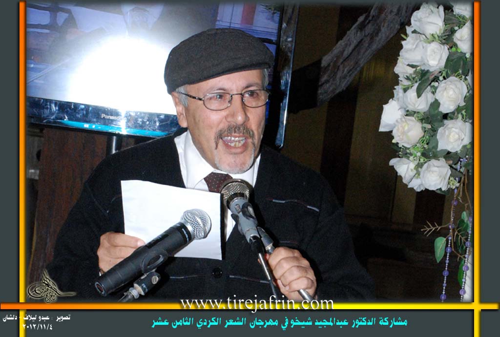
Dr. Ebdulmecîd Şêxo, an academic holding a PhD in Journalism.
Dr. Mistefa Ibrahîm Xubarî, PhD in Electrical Engineering from France.
The jurist Ehmed Cewdet El-Xubarî.
The doctor Cemal Eldîn Ebdo, member of the People's Council.
Many university degree holders in various specializations from the new generation.
Village Administration
The Mukhtar of the village is Mihemed Qasim Rifet.
Sources
Book: جبل الكرد (عفرين) دراسة جغرافية Çiyayê Kurmênc (Efrîn): A Geographical Study by د. محمد عبدو علي Dr. Mihemed Ebdo Elî.
Book: عفرين .... نهرها وروابيها الخضراء Efrîn... Her River and Her Green Hills by عبدالرحمن محمد Ebdulrehman Mihemed from the village of Qetme.
Preparation and Execution:
Manager of Navenda Tirej Efrîn: Ebdulrehman Hacî Osman
20/12/2013
Foundation/Origin Information of Cilbirê
It is considered a center for the Al-Ghabari family, containing their main guest house.
Source: TirejAfrin Site
Possible Village Name Meaning of Cilbirê
Composed of two parts: "Cil" (clothing/carpet) and "Bir" or "Ber" (carpet). Another possibility is "Cih" (place) and "Bel" (elevated), which merged to form "Cihbel" or "Cibel", later becoming "Cilbir". The Kurdish word "Cobel" indicates a small elevated place.
Source: TirejAfrin Site