General Information
Nahiya (Subdistrict)
Bilbilê
Also Known As
Cirqa, Jarqa, Jarqanli, جرقا, جرمقانلي
Tribes
Cirqa, Corqa, Corqan
Photos
Basic Information about Cirqa
Source: Tirej Afrin
Etymology: Cirqa: Name of a tribe found around Mêrdîn. Also Corqa or Corqan, a generation of Kurds living near Hulwan.
Foundation Date/Period: 450 years
Hills: Çiyayê Simaq
Trees: olive, vine
Summaries
I. Summary from TirejAfrin Site (English) of Cirqa
Source: https://www.tirejafrin.com/site/kura%20afrin%20%20%20bilbile%20-%20jarqa.htm
It came in the book جبل الكرد (عفرين) دراسة جغرافية Çiyayê Kurmênc (Efrîn): A Geographical Study: Cirqa, Cerqa, Cermqanlî / 690m - 5km /:
Cirqa: The name of a tribe found around Mêrdîn, /Lerech p. 49/. It appeared in the footnote of / Şerefname, p. 37 /: That Corqa or Corqan is a generation of Kurds inhabiting the outskirts of Hulwan northeast of Bexda, on one of the tributaries of the Diyala river... El-Mesûdî also mentions the name of this tribe, / Mûsilî, Arabs and Kurds, p. 445 /.
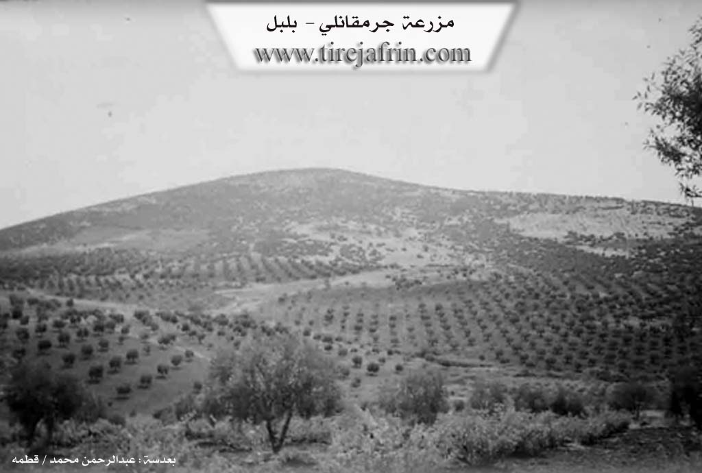
It is a small village located on the western slopes of Çiyayê Simaq.
It came in the book عفرين .... نهرها وروابيها الخضراء Efrîn... Her River and Her Green Hills: Çolaqlî: A village in Çiyayê Kurmênc following the township of Bilbil, district of Efrîn, province of Heleb. It is a small village situated on a slope and near a high mountain. It is bordered on the north by a slope, a plain planted with olive trees, the Riya Bilbil-Reco (Bilbil-Reco road), a valley, and the village of Xelîlak and Çelanlî; and on the south by a high mountain range and the village of Kêlanlî; and on the west by a slope, a deep valley planted with olive trees, and the village of Elemdar which is close to it from the western side; and on the east by a rugged mountain range and the village of Çolaqlî and Kurzêl.
The number of its houses reaches about 5 houses and its age is 450 years. An electricity network is available in it, and the road leading to it is mountainous and earthen. The residents work in the cultivation of olives and vines and in livestock breeding. Currently, the village suffers from migration to the cities, and there are no public facilities.
Sources of Information:
- Book: جبل الكرد (عفرين) دراسة جغرافية Çiyayê Kurmênc (Efrîn): A Geographical Study by د. محمد عبدو علي Dr. Mihemed Ebdo Elî.
- Book: عفرين .... نهرها وروابيها الخضراء Efrîn... Her River and Her Green Hills by the writer عبدالرحمن محمد Ebdulrehman Mihemed from the village of Qetme.
- Studies of Navenda Tirej Soft / Ebdulrehman Hacî Osman.
- Some residents of the villages.
Preparation and execution: Manager of the site Tirej Efrîn: Ebdulrehman Hacî Osman 20/12/2013 //
Possible Village Name Meaning of Cirqa
Name of a tribe around Mardin. Also mentioned as Jorqa or Jorqan, a generation of Kurds living near Halwan, northeast of Baghdad.
Source: TirejAfrin Site