General Information
Nahiya (Subdistrict)
Cindires
Also Known As
Diwan Foqani, Dêwê Jorin, ديوان فوقاني, ديوا فوقاني

Photos
Basic Information about Dêwê Jorin
Source: Tirej Afrin
Etymology: Derived from "Dêw" (demon/ogre) in Kurdish; or named after the Dîwan tribe near Diyarbekir; or named after Dîwan mountain of the Mirdês tribe; or a nickname for an early settler
Foundation Date/Period: About 300 years
Hills: Kiraç ê Roj, Çiyayê Sima
Other Landmarks: Çemê Efrînê
Summaries
I. Summary from TirejAfrin Site (English) of Dêwê Jorin
Source: https://www.tirejafrin.com/site/kura%20afrin%20Cindires%20-%20dewe%20jorin.htm
It is stated in the book Çiyayê Kurmênc (Efrîn): A Geographical Study by Dr. Mihemed Ebdo Elî:
Dîwan: The name comes from "Dêw" (Dw), meaning ogre or demon in Kurdish. There is a Kurdish tribe named Dîwan in the Diyarbekir regions. It is also one of the villages of the Kurdish Mirdês tribe in Turkey, located on the slope of a mountain called "Dîwan Mountain." Perhaps the name was a nickname for a person who inhabited the village in ancient times, or who belonged to that clan. They are two villages, Upper and Lower: Dîwan Jorin and Dîwan Jêrin.
Dîwan Jorin /594 inhabitants - 8km - 230m/: A medium-sized village located on the left side of the Efrîn river.
It is stated in the book Efrîn... Her River and Her Green Hills by the writer Ebdulrehman Mihemed from the village of Qetme:
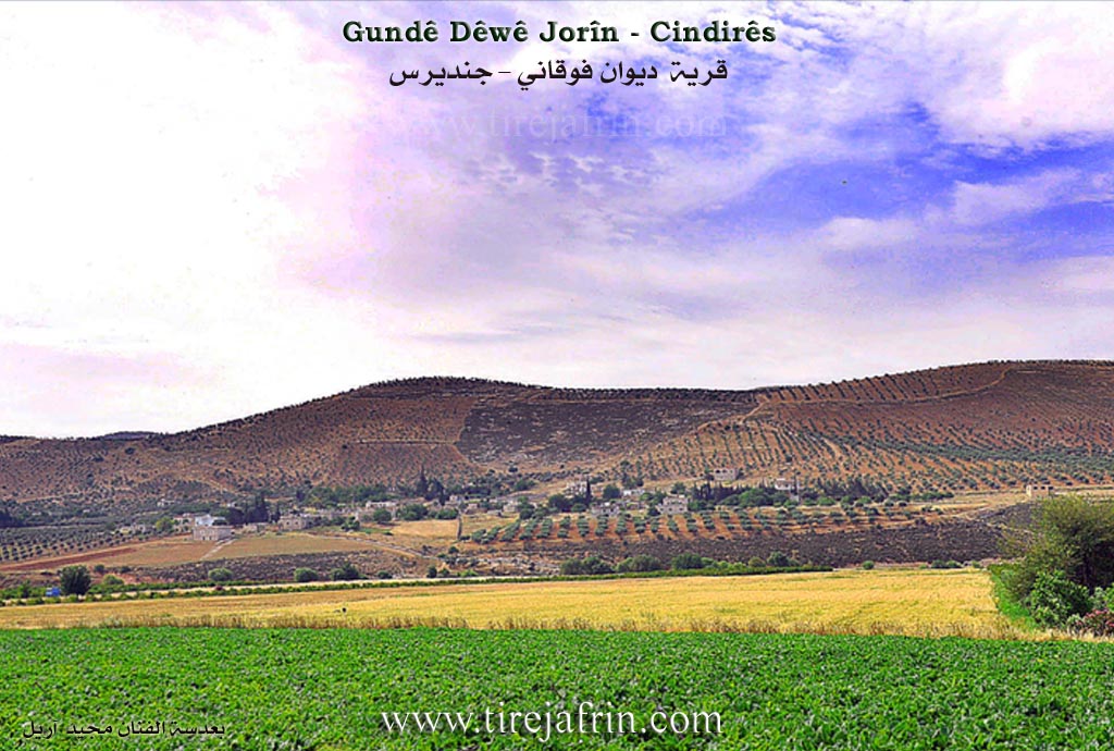
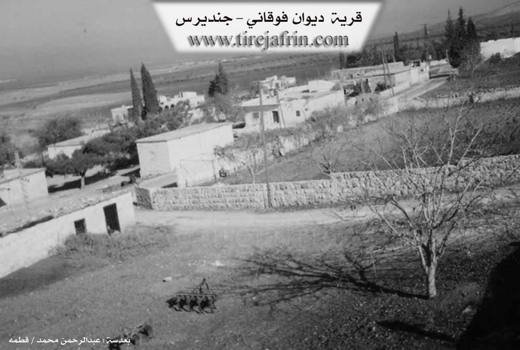
Dîwan Jorin: A village in the Efrîn valley, following the Cindirês district, Efrîn region, Heleb governorate. It is a medium-sized village located on a mountainous elevation at the end of the northwestern slope of Kiraç ê Roj mountain and the western Çiyayê Sima (Mount Simeon) chain. It sits at the beginning of the plain located south of the Efrîn river, which slopes gently with its fertile alluvial soil towards the river course. It is 10km away from the town of Cindirês towards the southwest.
It is bordered to the north by a fertile plain, the Efrîn river valley, and the villages of Mihemediye Şerqî and Mihemediye Xerbî. To the south, it is bordered by mountainous heights planted with olive trees and forest trees, and some villages of the Harim area of Idlib governorate, specifically the village of Atme. To the east, it is bordered by a fertile plain planted with pomegranate and olive trees and the village of Dîwan Jêrin (Lower). To the west, it is bordered by a fertile agricultural plain planted with pomegranate trees and the nearby village of Dêr Belût.
The number of its houses is about 55, and its age is about 300 years. Its old houses are made of mud with wooden roofs, and the modern ones are cement, spread to the west and east. A designated electricity network, a primary school, and a paved road passing through its center to the village of Dêr Belût and Mela Xelîl near the Turkish border are available in the village.
The village drinks from cistern water dug beside the houses and currently from artesian wells dug beside the homes. There is a telephone in the village. The Efrîn river passes on the northern side at a distance of 300m. The residents work in rainfed agriculture (grains, olives), while cotton, summer vegetables, and pomegranates are cultivated via irrigation from the Efrîn river or artesian wells.
The village mukhtar is Mr. Mihemed Elo.
Sources
Book: جبل الكرد (عفرين) دراسة جغرافية Çiyayê Kurmênc (Efrîn): A Geographical Study by د. محمد عبدو علي Dr. Mihemed Ebdo Elî.
Book: عفرين .... نهرها وروابيها الخضراء Efrîn... Her River and Her Green Hills by عبدالرحمن محمد Ebdulrehman Mihemed from the village of Qetme.
Studies of Navenda Tirej Soft / Ebdulrehman Hacî Osman.
Preparation and Execution:
Manager of Tirej Afrin Website: Ebdulrehman Hacî Osman
20/12/2013
Possible Village Name Meaning of Dêwê Jorin
The name "Dêw" means demon in Kurdish. There is a Kurdish tribe named Diwan in the Diyarbakir regions. Perhaps the name was a title for someone who lived in the village in the past, or belonged to that tribe.
Source: TirejAfrin Site