General Information
Nahiya (Subdistrict)
Reco
Also Known As
Al-Darwishiya, Dêwrîş, الدرويشية, درويش أوبه سي, درويش أوبه سي, دوريش, كونده ديرويش

Photos
Basic Information about Dêwrîş
Source: Tirej Afrin
Foundation Date/Period: Approximately 300 years
Other Landmarks: Geliyê Teyra
Summaries
I. Summary from TirejAfrin Site (English) of Dêwrîş
Source: https://www.tirejafrin.com/site/kura%20afrin%20%20%20Reco%20-%20Dwresh.htm
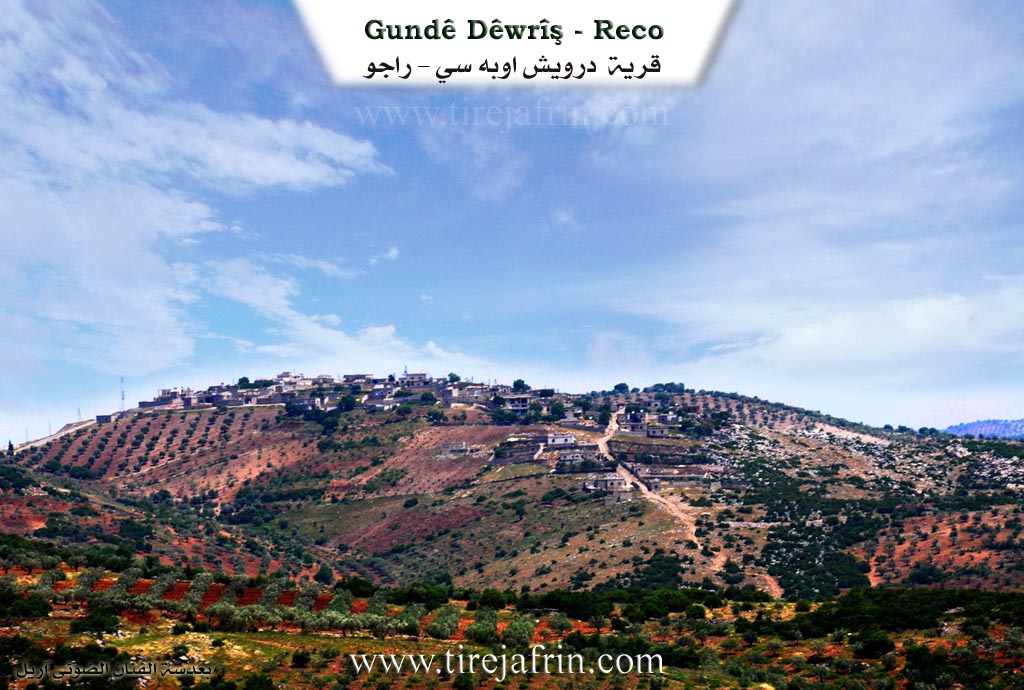
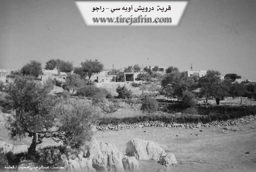
It is stated in the book جبل الكرد (عفرين) دراسة جغرافية Çiyayê Kurmênc (Efrîn): A Geographical Study by د. محمد عبدو علي Dr. Mihemed Ebdo Elî: Gundê Derwîş, Derwîş Obasî, El-Derwîşiye / 1052 people, 219 houses, 5km distance, 935m altitude /:
The name is a local Kurdish proper noun from Derwîş.
It is a small village situated on a wooded mountain plateau.
It is stated in the book عفرين .... نهرها وروابيها الخضراء Efrîn... Her River and Her Green Hills by the writer عبدالرحمن محمد Ebdulrehman Mihemed from the village of Qetme concerning Derwîş Obasî: It is a village in Çiyayê Kurmênc following the Reco subdistrict, Efrîn region, Heleb governorate. It is a small village situated on the highest mountain peak in the Reco subdistrict. It is bordered to the north by a steep rocky slope, a deep valley, and the village of Mosko Obasî. It is bordered to the south by a slope, a valley with rocky terrain planted with forest trees, and the village of Behdîna. It is bordered to the west by a rocky slope, a mountain range planted with olive trees, and the village of Qûde Kuy. It is bordered to the east by a steep and rocky slope, the village of Hemşilê, the valley of Geliyê Teyra, and the village of Goliyan Jorîn.
The number of its houses is approximately 50 houses and its age is approximately 300 years. Its old dwellings are made of stone and mud with flat wooden roofs, while the modern ones are of stone and cement. An electricity network and a prefabricated primary school are available in it. The village drinks from rainwater stored in pools or cisterns, and currently some residents use artesian wells dug next to the houses. The residents work in rain fed agriculture (grains, vines, and olives) alongside raising sheep and goats due to the abundance of pastures in its mountain heights. The village connects to the subdistrict via a leveled dirt road that is not paved.
Mukhtar of the village: Mihemed Seîd Hemo
Preparation and execution:
Manager of the Tirej Efrîn site: Ebdulrehman Hacî Osman
20/12/2013
Sources:
Book: جبل الكرد (عفرين) دراسة جغرافية Çiyayê Kurmênc (Efrîn): A Geographical Study by د. محمد عبدو علي Dr. Mihemed Ebdo Elî.
Book: عفرين .... نهرها وروابيها الخضراء Efrîn... Her River and Her Green Hills by عبدالرحمن محمد Ebdulrehman Mihemed from the village of Qetme.
Studies of Navenda Tirej Soft / Ebdulrehman Hacî Osman.
Possible Village Name Meaning of Dêwrîş
A local Kurdish proper name from Darwish (درويش).
Source: TirejAfrin Site