General Information
Nahiya (Subdistrict)
Şera
Also Known As
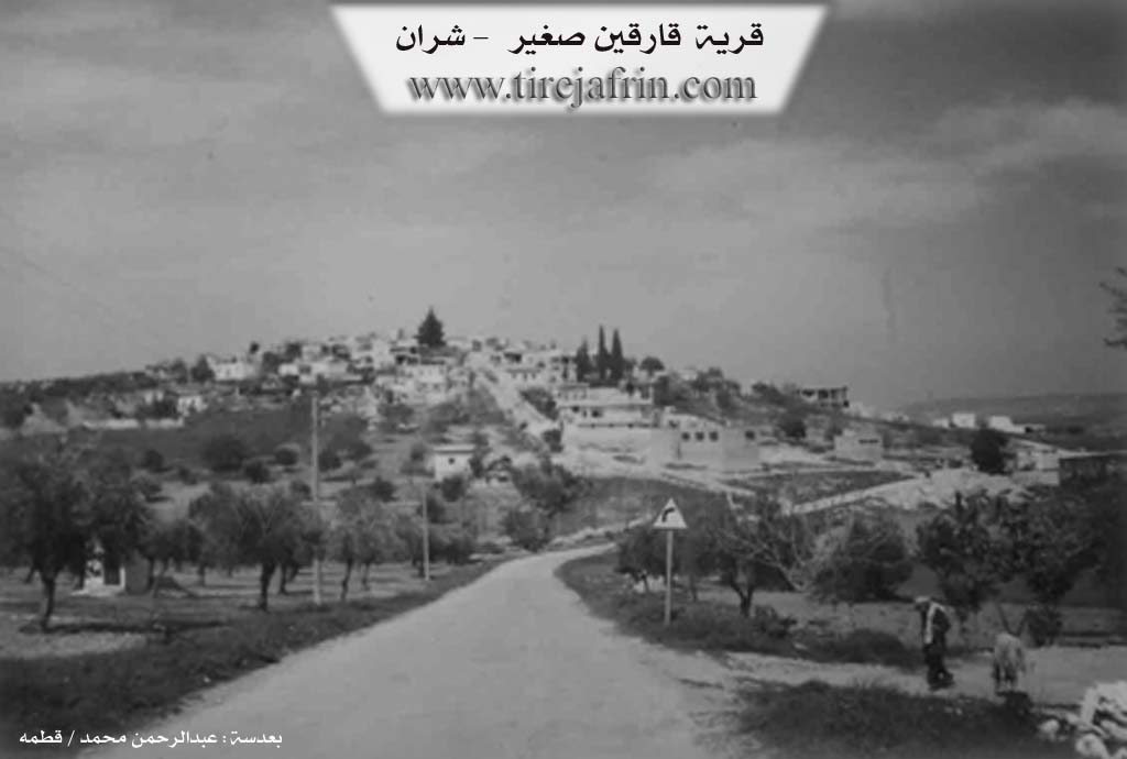
Al-Qara, Derwîş, Dorish Village, Dêwrîş, Qarqin Small, القارة, درويش, قارقين صغير
Families, Clans, etc.
Heso, Memo, Zeynlar, Şahîno

Photos
Basic Information about Dewrîş
Source: Tirej Afrin
Etymology: Known popularly as the "village of Duriş", which is a local Kurdish proper name. The name before Arabization is Qarqîn Sexîr. The Arabized name has no relation to its old name.
Foundation Date/Period: about 300 years
Summaries
I. Summary from TirejAfrin Site (English) of Dewrîş
Source: https://www.tirejafrin.com/site/kura%20afrin%20%20sheran%20-%20qarqen%20s.htm
It is stated in the book جبل الكرد (عفرين) دراسة جغرافية Çiyayê Kurmênc (Efrîn): A Geographical Study: Gund Dwrş, Qarqîn Sexîr, Al-Qara /979 people, 152 houses, 7km, 450m/:
It is known popularly as the "village of Duriş," which is a local Kurdish proper name. The name before Arabization is Qarqîn Sexîr. The Arabized name has no relation to its old name.
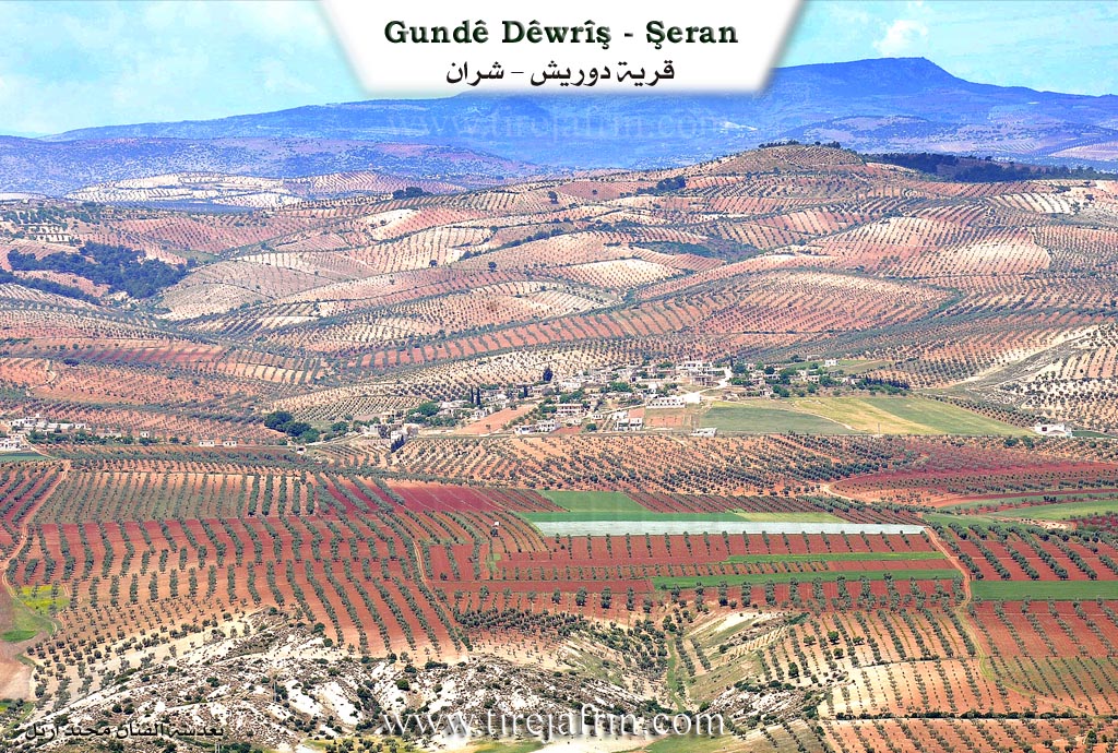
It is a small village located on the southeastern slope of a height.
It is stated in the book عفرين .... نهرها وروابيها الخضراء Efrîn... Her River and Her Green Hills: Qarqîn Sexîr: A village in Çiyayê Kurmênc following the Şeran district, Efrîn area, Heleb governorate, (964 people). It is a small village located in the northern part of the mountain and on the southeastern slope of a limestone height bordered by streams descending towards the southeast to end in the valley of Çemê Efrînê. Its soil is clay. It is 10 km away from the town of Şeran towards the north.
It is bordered to the north by a mountain range planted with olive trees, a deep valley, the village of Qizilbaş, and Bîlan Koy. To the south, a wide and agriculturally fertile plain extending to the course of the Çemê Efrînê valley, the village of Qarqîn Kebîr, and Elî Bazanlî. To the east, a slope and a wide plain of olive trees and the village of Duraqlî. To the west, a deep stream, a mountain range planted with olive trees, and the village of Naza or Şaxê.
The number of its houses reaches about 70 houses and its age is about 300 years. Its old dwellings are stone and mud with flat wooden roofs, and it contains several stone dwellings with reinforced concrete roofs that have extended towards the southwest along the public road. An electricity network, drinking water, and a primary school are available in it. A paved road passes near it at a distance of 100m towards Meydankê and Kelha Nebî Hûrî.
The residents work in the cultivation of olives and vines, livestock breeding, and other works.
Among the families present in the village: Şahîno family, Zeynlar family, Heso family, Memo family.
The village mukhtar: Mistefa Nûrî Mihemed.
Among the PhD holders from this village is Dr. Mihemed Mihemed Cuma / PhD in Archaeology from the University of Heleb, and many university degree holders.
Sources of Information:
- Book: جبل الكرد (عفرين) دراسة جغرافية Çiyayê Kurmênc (Efrîn): A Geographical Study by د. محمد عبدو علي Dr. Mihemed Ebdo Elî.
- Book: عفرين .... نهرها وروابيها الخضراء Efrîn... Her River and Her Green Hills by عبدالرحمن محمد Ebdulrehman Mihemed from the village of Qetme.
- Studies of Navenda Tirej Soft / Ebdulrehman Hacî Osman.
- Some residents of the villages.
Preparation and execution: Manager of the website Tirej Efrîn: Ebdulrehman Hacî Osman 20/12/2013
Possible Village Name Meaning of Dewrîş
Popularly known as "Dorish Village", which is a local Kurdish proper name. The name before Arabization was "Qarqin Small".
Source: TirejAfrin Site