General Information
Nahiya (Subdistrict)
Bilbilê
Also Known As
Alijara, Elcara', Jarê, Malê Jarê, علي جارو, على جارو
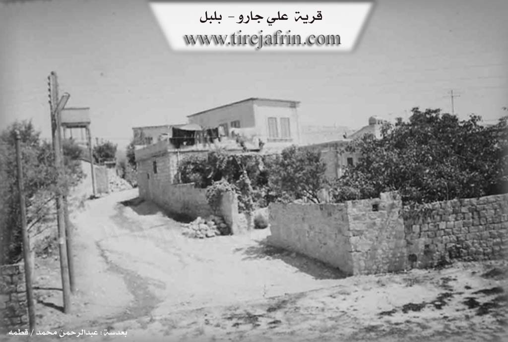
Photos
Basic Information about Elcara - Bilbilê
Source: Tirej Afrin
Etymology: The popular name implies "thin" or "frail" (jar), which is an adjective describing one of its inhabitants named Elî or a female resident. The Arabized name has no connection to the old name.
Foundation Date/Period: 1905
Other Landmarks: Geliyê Sîlê, Heftaro
Summaries
I. Summary from TirejAfrin Site (English) of Elcara - Bilbilê
Source: https://www.tirejafrin.com/site/kura%20afrin%20%20%20bilbile%20-%20eilcara.htm
Eliyê Jaro Village Entry Translation
It is stated in the book جبل الكرد (عفرين) دراسة جغرافية Çiyayê Kurmênc (Efrîn): A Geographical Study: Mal Jar - Gund Jar, Eliyê Jaro / 640m - 5km /:
The popular name implies "thin" or "frail" (jar), which is an adjective describing one of its inhabitants named Elî or a female resident, as the feminine grammatical form indicates it is a name for a woman. The Arabized name has no connection to the old name. It is a small village located on a mountainous height planted with olive trees.
It is stated in the book عفرين .... نهرها وروابيها الخضراء Efrîn... Her River and Her Green Hills: Eliyê Jaro is a village in Çiyayê Kurmênc following the district of Bilbil, within the Efrîn region of the Heleb governorate. It is a small and beautiful village located on a wide, undulating limestone plateau. Its slopes are gentle and furrowed by watercourses in all directions, overlooking its agricultural lands to the east and west. The soil is clay and alluvial.
The village is located 3km east of the village of Ewkanlî and 6km southeast of the town of Bilbil. It is bordered to the north by a mountain chain planted with olive trees, watercourses, and the village of Mehmûd Obasî. To the south, it is bordered by olive trees, several watercourses, and the village of Şêx Xûroz. To the west, it is bordered by a slope planted with olive trees, Geliyê Sîlê (Sîlê valley), the Riya Bilbil-Meydankê (Bilbil-Meydankê public road), and the village of Ewkanlî on a mountain rise. To the east, there is a slope, a fertile agricultural plain planted with olive trees, the village of Ebûdan, and the farm of Heftaro.
The construction of the village is modern; it was originally situated within green orchards. All the people of the village originated from the village of Ewkanlî. The number of houses is approximately 35, and its age is about 100 years, meaning its date of establishment is since 1905. Its residences are modern and made of cement. An electricity network and a primary school are available. They drink from a network that draws its water from a well in the town of Bilbil, 4km to the southeast. It is connected to the village of Ewkanlî by a paved dirt road, and to the district center by an asphalt road. Its residents cultivate rain-fed grains, legumes, olive trees, and vineyards alongside raising sheep and goats.
Sources of Information:
- Book: جبل الكرد (عفرين) دراسة جغرافية Çiyayê Kurmênc (Efrîn): A Geographical Study by د. محمد عبدو علي Dr. Mihemed Ebdo Elî.
- Book: عفرين .... نهرها وروابيها الخضراء Efrîn... Her River and Her Green Hills by عبدالرحمن محمد Ebdulrehman Mihemed from the village of Qetme.
- Studies of Navenda Tirej Soft / Ebdulrehman Hacî Osman.
- Some residents of the villages.
Preparation and Execution: Director of the Tirej Efrîn website: Ebdulrehman Hacî Osman 20/12/2013
I. Summary from TirejAfrin Site (English) of Elcara
Villages of Bilbile District / bilbile
Ali Jāro (علي جارو) - 'Elcara
===
According to the book جبل الكرد|Mountain of the Kurds (Afrin) Geographical Study:
Malê Jarê - Gundî Jarê, Ali Jāro (علي جارو) /640m -5km/:
- The popular name means "thin or frail," and it is a description for one of its inhabitants "Ali" or its inhabitant, where the feminine form indicates that it is a woman's name. The Arabic name has no connection with the old name.
- A small village located on a mountain elevation planted with olives.
According to the book Afrin... Her River and Green Hills:
Ali Jāro (علي جارو): A village in Kurdistan Mountain (جبل الكرد) belonging to Bilbile District (ناحية بلبل), Afrin City region (منطقة عفرين), Aleppo Governorate (محافظة حلب).
It is a small and beautiful village located on a wide and undulating summit of a limestone plateau, its slopes have little inclination and are carved by streams in all directions and overlook its agricultural lands in the east and west, which have fertile clay and loamy soil, 3km east of 'Ukānlī village (قرية عوكانلي), and 6km from Bilbile town (بلدة بلبل) to the southeast. It is bounded to the north by a mountain chain planted with olive trees and water streams and Maḥmūd Obāsī village (قرية محمود أوباسي), to the south by areas planted with olive trees and several streams and Sheikh Khorūs village (قرية شيخ خوروس), to the west by a slope planted with olive trees and Sîlî Valley (وادي سيلي) and the general Bilbile-Maydānkī road (طريق بلبل مييدانكي) and 'Ukānlī village (قرية عوكانلي) on a mountain elevation, and to the east by a slope and fertile agricultural plain planted with olive trees and 'Abūdān village (قرية عبودان) and Ḥaftāro farm (مزرعة حفتارو). The village construction is modern and the village was located within green orchards, and all the village people originally came from 'Ukānlī village (قرية عوكانلي). The number of houses is approximately 35 houses and its age is approximately (100) years, meaning its establishment date is since 1905. Its dwellings are modern concrete. It has an electricity network and an elementary school. They drink from a network that gets its water from a well in Bilbile town (بلدة بلبل) 4km to the southeast. It is connected to 'Ukānlī village (قرية عوكانلي) by a paved dirt road, and to the district center by a paved road. Its inhabitants cultivate rainfed grains and legumes, olive trees and grapes, in addition to raising sheep and goats.
- Book 'جبل الكرد' 'Mountain of the Kurds' (Afrin City) Geographical Study by Dr. Mohammed Abdo Ali (الدكتور محمد عبدو علي).
- Book: 'عفرين .... نهرها ورؤابيها الخضراء' 'Afrin City .... Its River and Green Hills' by writer Abdul Rahman Mohammed (عبدالرحمن محمد) from Qatmah village (قرية قطمه).
- Studies by Tîrêj Soft Center (مركز تيريج سوفت) / Abdul Rahman Haji Osman (عبدالرحمن حاجي عثمان)
- Some village residents.
Prepared and executed by: Tîrêj Afrin website manager: Abdul Rahman Haji Osman (عبدالرحمن حاجي عثمان)
20 / 12 / 2013
Foundation/Origin Information of Elcara - Bilbilê
All the village people originally came from 'Ukānlī village.
Source: TirejAfrin Site
Possible Village Name Meaning of Elcara - Bilbilê
The popular name means "thin or frail," a description for one of its inhabitants named "Ali" or a woman.
Source: TirejAfrin Site