General Information
Nahiya (Subdistrict)
Mabeta
Also Known As
عرب شيخو
Tribes
Emîrat
Families, Clans, etc.
Eyûb
Photos
Basic Information about Ereb Şêxo
Source: Tirej Afrin
Etymology: Named after its first inhabitant from the Arab Emîrat tribe, whose name was Şêxo
Foundation Date/Period: Around 75 years ago
Other Landmarks: Çemê Efrîn, Çemê Zerafkê
Summaries
I. Summary from TirejAfrin Site (English) of Ereb Şêxo
Source: https://www.tirejafrin.com/site/kura%20afrin%20%20%20mebetli%20-%20ereb%20shexo.htm
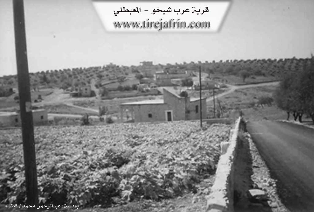
It is stated in the book Çiyayê Kurmênc (Efrîn): A Geographical Study by Dr. Mihemed Ebdo Elî: Ereb Şxo / 387 inhabitants - 340m altitude:
The village is named after its first inhabitant from the Arab Emîrat tribe, whose name was Şêxo. He came from the Ezaz area following a family dispute and settled in that location more than fifty years ago. It is a small village located approximately 1km southwest of the village of Gemrûk. It consists of several families of brothers and cousins.
It is stated in the book Efrîn... Her River and Her Green Hills by the writer Ebdulrehman Mihemed from the village of Qetme:
Ereb Şxo is a village in Çiyayê Kurmênc, administratively belonging to the Mabeta district, Efrîn region, Heleb governorate. It is a small village located in the central part of the mentioned mountain, on the southeastern slope of a limestone plateau furrowed by seasonal streams descending toward the Efrîn river. It overlooks an agricultural plain to the south and west. It lies 14km to the northeast of the town of Mabeta. Its soil is clay-alluvial, fertile, and rich in groundwater. It is situated near the Efrîn river and the Zerafkê river.
It is bordered to the north by a mountainous height, a seasonal valley, and the nearby village of Gemrûk at a distance of 1km. To the south, it is bordered by a slope, an agricultural plain, the valley of the Zerafkê river, the valley of the Efrîn river, and the villages of Eyn Elhecer Mezin and Eyn Elhecer Biçûk. To the west, it is bordered by mountainous heights planted with olive trees and the village of Şêx Hûtko. To the east, it is bordered by a slope, a plain, the course of the Efrîn river valley, and the villages of Helûbî Mezin and Helûbî Biçûk.
The number of its houses is about 15, and its age is approximately 75 years. It is a modern village; their origin is from sheep herders who settled in the caves found at the mentioned site. Its old dwellings are made of stone and mud, while the modern ones are of stone and cement, spread to the east and west. The village is divided into two parts (Eastern and Western) due to a seasonal valley flowing through its center toward the Efrîn river valley.
An electricity network is available, and a paved road passes through its center connecting to several neighboring villages and the district center. Its residents work in rainfed agriculture on an area of 98 hectares with grains and olive trees, and in irrigated agriculture from the Efrîn river or artesian wells producing summer vegetables, cotton, and fruit trees, alongside raising sheep and goats. The village drinks from cisterns that collect rainwater in winter, and currently from artesian wells dug next to the houses. It contains a modern olive press. Among its most important families is the Eyûb family, who are Arabs from the villages of the Heleb governorate.
Village Mukhtar: Eyûb Şêxo Mihemed
Preparation and Execution:
Manager of Tirej Efrîn site: Ebdulrehman Hacî Osman
20/12/2013
Sources:
- Book: جبل الكرد (عفرين) دراسة جغرافية Çiyayê Kurmênc (Efrîn): A Geographical Study by د. محمد عبدو علي Dr. Mihemed Ebdo Elî.
- Book: عفرين .... نهرها وروابيها الخضراء Efrîn... Her River and Her Green Hills by عبدالرحمن محمد Ebdulrehman Mihemed from the village of Qetme.