General Information
Nahiya (Subdistrict)
Şera
Also Known As
'Erebwêran, Ereb wêranê, al-Aruba, العروبة, عرب ويران
Families, Clans, etc.
Hec Omer, Mihemed Deran

Photos
Basic Information about Ereb Wêranê
Source: Tirej Afrin
Etymology: The name means "Ruin of the Arabs" (xirbe + ereb), because wêran means "ruin or tuberculosis" in the Kurdish language
Foundation Date/Period: Approximately 200 years ago
Summaries
I. Summary from TirejAfrin Site (English) of Ereb Wêranê
Source: https://www.tirejafrin.com/site/kura%20afrin%20%20sheran%20-%20erb%20weran.htm
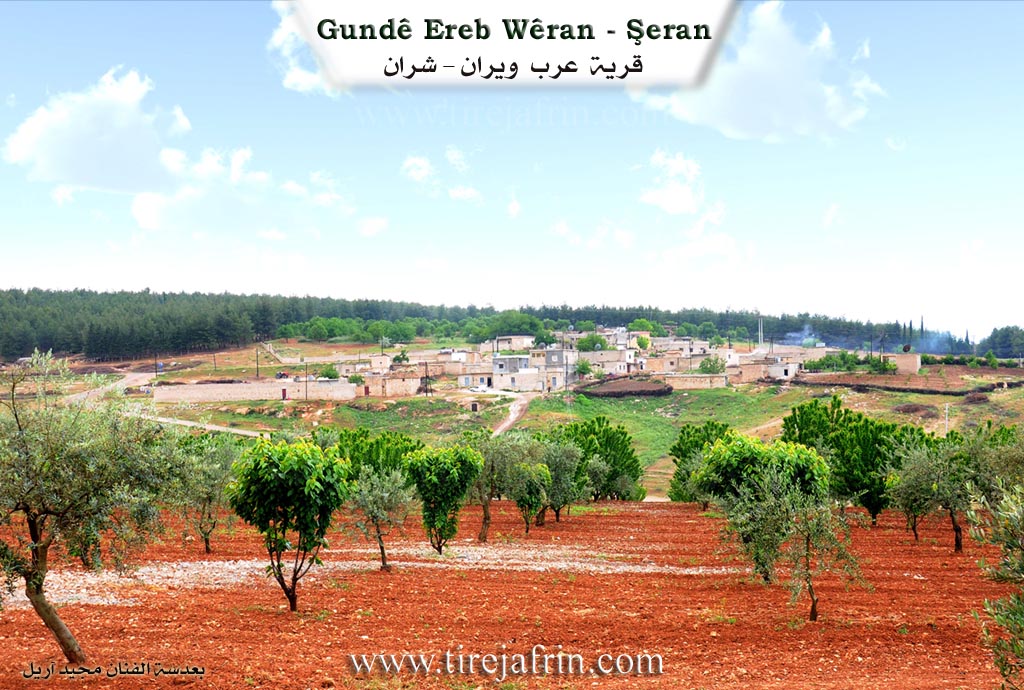
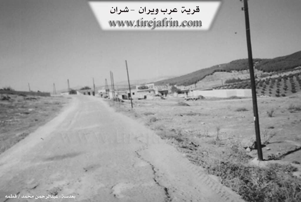
It came in the book Çiyayê Kurmênc Efrîn Geographical Study: Erebwêran, El-Urûba /426 inhabitants 565 m altitude/:
Erebwêran: With the meaning "Ruin of the Arabs" (xirbe + ereb), because wêran: is with the meaning of "ruin or tuberculosis" in the Kurdish language. And El-Urûba (Arabism) has no connection to this small village far from politics.
It is a small village distant a distance of 2km from the Turkish borders. Artificial pine forests surround it from the south, and it is from the villages of the Aghas of Hec Omer.
It came in the book Efrîn... Her River and Her Green Hills: Erebwêran: A village in Çiyayê Kurmênc following the township of Şeran, region of Efrîn, province of Heleb, (411 inhabitants).
It is a very small village located in the northern part of the mentioned mountain block and on the northeastern slope of an undulating limestone plateau furrowed by spillways sloping towards the north and the west to the valley of the river of Efrîn. Its soil is clay. It is distant from the Turkish borders 3km westward and from the town of Şeran 8km towards the northeast.
It is bounded north by a slope and mountain chains and valleys and the Ancient Roman Bridge and the village of Dêr Sewan; and south by mountain chains and valleys planted with olive trees and the village of Qestel Cindo; and east by a deep valley and a mountain chain planted with forestry trees and olives and the farm of El-cemîl and the village of Dîkmetaş; and west by a mountain chain planted with forestry trees and the valley of the village of Omranlî.
The number of its houses reaches about 20 houses and its age is about 200 years. It used to previously comprise one family, the family of Mihemed Deran. Available in it is an electricity network and a paved road passing through the village to Dêr Sewan and Nebî Hûrî. The residents drink from artesian wells and cisterns. Its houses are modern made of cement and stones. Its inhabitants work in the cultivation of olives and vines and the rearing of sheep.
Sources of Information:
- Book: جبل الكرد (عفرين) دراسة جغرافية Çiyayê Kurmênc (Efrîn): A Geographical Study by د. محمد عبدو علي Dr. Mihemed Ebdo Elî.
- Book: عفرين .... نهرها وروابيها الخضراء Efrîn... Her River and Her Green Hills by عبدالرحمن محمد Ebdulrehman Mihemed from the village of Qetme.
- Studies of Navenda Tirej Soft / Ebdulrehman Hacî Osman.
- Some residents of the villages.
Preparation and Execution: Manager of the site Tirej Efrîn: Ebdulrehman Hacî Osman 20/12/2013
Foundation/Origin Information of Ereb Wêranê
In the past, it had one family, the family of Mohammed Daran.
Source: TirejAfrin Site
Possible Village Name Meaning of Ereb Wêranê
Means "ruins of the Arabs." "Weiran" means "ruin" in Kurdish.
Source: TirejAfrin Site