General Information
Nahiya (Subdistrict)
Reco
Also Known As
Firfirk Tahtani, Firfirkê Jêrin, Şêx 'Evdal, شيخ عبدال, شيخ عڤدال, فرفركا ،Şêx 'Evdal, فرفريك تحتاني, فرفركه

Photos
Basic Information about Firfirkê Jêrin
Source: Tirej Afrin
Etymology: Şêx 'Evdal is the name and title of one of its early inhabitants, and Firfirk means the fan in Kurdish
Foundation Date/Period: Approximately 60 years ago (referring to the lower village)
Caves: Nefeqa Duyemîn
Hills: Çiyayê Belalîko
Ruins: Pira Heşerke
Other Landmarks: Çemê Reş
Summaries
I. Summary from TirejAfrin Site (English) of Firfirkê Jêrin
Source: https://www.tirejafrin.com/site/kura%20afrin%20%20%20Reco%20-%20firfirke%20jerin.htm
It is stated in the book جبل الكرد (عفرين) دراسة جغرافية Çiyayê Kurmênc (Efrîn): A Geographical Study by د. محمد عبدو علي Dr. Mihemed Ebdo Elî:
Şêx 'Evdal - Firfirk
The village is known by two names: village of Şêx 'Evdal, which is the name and title of one of its early inhabitants, and Firfirk, meaning "the fan" in Kurdish. It consists of two parts.
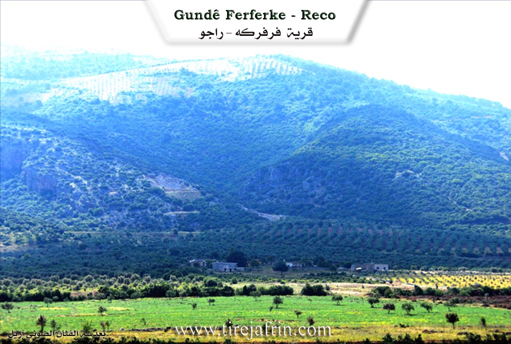
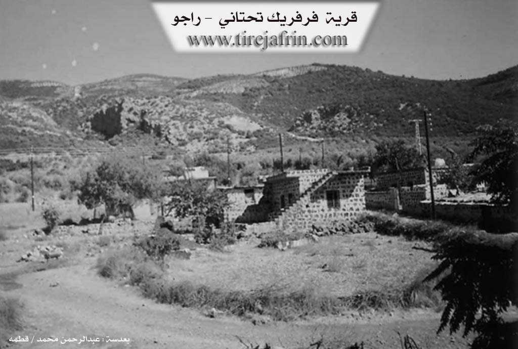
Firfirk Jêrîn (Firfirk Lower) /290m/: It is located on the western slopes of Çiyayê Belalîko and is 1 km away from the Turkish border.
It is stated in the book عفرين .... نهرها وروابيها الخضراء Efrîn... Her River and Her Green Hills by the writer عبدالرحمن محمد Ebdulrehman Mihemed from the village of Qetme:
Firfirk Jêrîn
It is a farm (mezre'e) in Çiyayê Kurmênc belonging to the Reco sub-district, Efrîn district, Heleb governorate. It is a small farm located in the northern part of Çiyayê Kurmênc near a plain.
It is bordered to the north by a plain and the village of Xerab Slûk; to the south by a high, rugged mountain range, the Xeta Hesinî ya Reco-Meydan Ekbez (Reco-Meydan Ekbez railway line), the historic Pira Heşerke (Heşerke bridge), which was built in 1911 AD by the Germans, and the village of Maskenlî; to the east by a high, rugged mountain range and the village of Firfirk Jorîn (Upper Firfirk); and to the west by a plain, the Riya Reco-Meydan Ekbez (Reco-Meydan Ekbez road), Çemê Reş, and Deşta 'Emqê.
The number of its houses is about 10, and its age is approximately 60 years. Its houses are made of stone and cement. A paved road is available up to the village, and it was recently supplied with electricity. The residents work in rain-fed agriculture (olives, grains, vines) and irrigate summer vegetables from Çemê Reş.
This village is beautiful, located near the old historic bridge (situated between two mountains, with a deep valley below the bridge and a height from the ground reaching about 300 m) and the "Second Tunnel" (Nefeqa Duyemîn). The origin of the residents of this farm is from the village of Firfirk Jorîn, who moved to the current location of the village due to its proximity to the public road. Administratively, it follows the mukhtar of Reco.
Sources
- Book: جبل الكرد (عفرين) دراسة جغرافية Çiyayê Kurmênc (Efrîn): A Geographical Study by د. محمد عبدو علي Dr. Mihemed Ebdo Elî.
- Book: عفرين .... نهرها وروابيها الخضراء Efrîn... Her River and Her Green Hills by عبدالرحمن محمد Ebdulrehman Mihemed from the village of Qetme.
Preparation and execution: Manager of Tirej Efrîn website, Ebdulrehman Hacî Osman, 20/12/2013.
Foundation/Origin Information of Firfirkê Jêrin
The original residents are from Upper Firfirk Village who moved to the current location due to its proximity to the public road.
Source: TirejAfrin Site
Possible Village Name Meaning of Firfirkê Jêrin
Known by two names: Sheikh Abdul Village (Şêx 'Evdal), which is the name and title of one of its first inhabitants, and Firfirkê, which is Kurdish.
Source: TirejAfrin Site