General Information
Nahiya (Subdistrict)
Reco
Also Known As
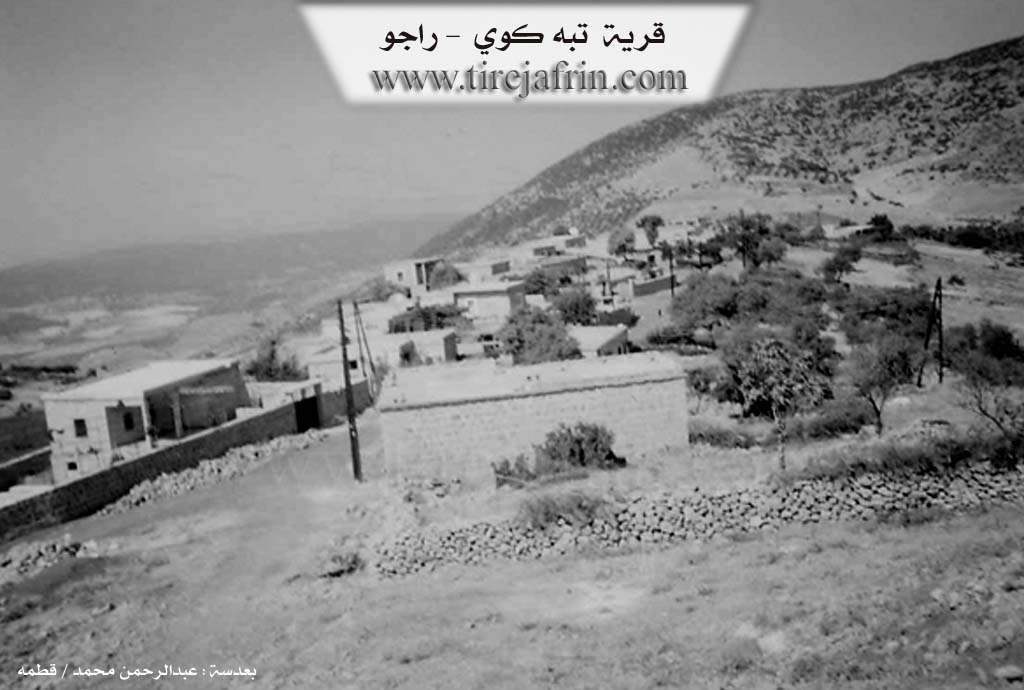
Tepe Koy, تبه كوي
Photos
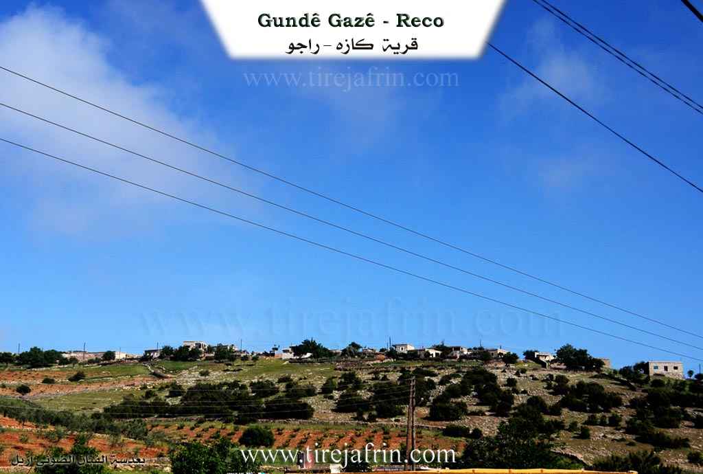
Basic Information about Gazê - Reco
Source: Tirej Afrin
Etymology: Gazê: Meaning "the elongated hill". The official name before Arabization was Tepe Koy, which is of Turkish origin meaning "the hill village".
Foundation Date/Period: About 300 years ago
Hills: Çiyayê Kurê, Çiyayê Bêhîvê
Summaries
I. Summary from TirejAfrin Site (English) of Gazê - Reco
Source: https://www.tirejafrin.com/site/kura%20afrin%20%20%20Reco%20-%20gaze.htm
It is stated in the book جبل الكرد (عفرين) دراسة جغرافية Çiyayê Kurmênc (Efrîn): A Geographical Study: Gaz, Tepe Koy, Telîle /722 inhabitants 810 m/:
Gazê: Meaning "the elongated hill". The official name before Arabization was Tepe Koy, which is of Turkish origin meaning "the hill village". It is a small village from the Meydaniyat villages.
It is stated in the book عفرين .... نهرها وروابيها الخضراء Efrîn... Her River and Her Green Hills: Tepe Koy: A farm in Çiyayê Kurmênc following the Reco district, Efrîn region, Heleb governorate. It is a small and old farm located on the northeastern edge of a limestone height (Çiyayê Kurê) in the northwestern part of Çiyayê Kurmênc. It is located 1 km north of the village of Şêx Mihemedlî. Its soil is clay like, and pastures are abundant there.
It is bordered to the north by a harsh, rugged slope and the farm of Ereblî; to the south by a slope, a watercourse, and the nearby village of Şêx Mihemedlî; to the east by the (Riya Bilbile-Meydan Ekbez road), the village of Walîklî, and Çiyayê Bêhîvê (Almond Mountain); and to the west by a mountain range planted with olive trees and the village of Semalklî.
The number of its houses reaches about 25 houses, and its age is about 300 years according to the account of one of the elderly residents of the village. Its old dwellings are stone and mud with flat wooden roofs, while modern cement dwellings are increasing towards the east and west. An electricity network, water network, and telephone network are available in it, as well as a dirt road for a distance of 500 m from the paved public road.
The residents work in rain fed agriculture (olives, vines) on the slopes to its west and north. They also raise sheep and goats, in addition to the industry of grape extract. It is one of the old Meydaniyat villages and is administratively attached to the village of Şêx Mihemedlî.
Sources:
- Book: جبل الكرد (عفرين) دراسة جغرافية Çiyayê Kurmênc (Efrîn): A Geographical Study by د. محمد عبدو علي Dr. Mihemed Ebdo Elî.
- Book: عفرين .... نهرها وروابيها الخضراء Efrîn... Her River and Her Green Hills by عبدالرحمن محمد Ebdulrehman Mihemed from the village of Qetme.
- Studies of Navenda Tirej Soft / Ebdulrehman Hacî Osman.
- Some residents of the villages.
Preparation and execution: Manager of the site Tirej Efrîn: Ebdulrehman Hacî Osman 20/12/2013