General Information
Nahiya (Subdistrict)
Mabeta
Also Known As
Al-Sarrah, Gobakê, Gobek, Gulika, Gulîka, Gobekê, الصرة, كوبك, كوباكه
Tribes
Koçer

Photos
Basic Information about Gulîka
Source: Tirej Afrin
Etymology: The village consists of two parts. The eastern part is Gobek, meaning "the center" or "the navel" (gobek), referring to the site where it was built; the Arabized name is a translation of the Kurdish. The western part is Gulîka, a descriptive name derived from the long sideburns or braids (gulî) characteristic of its inhabitants from the Koçer tribe, who used to grow their hair long.
Foundation Date/Period: Approximately 200 years ago
Hills: Çiyayê Hawar, Dax Obasî
Summaries
I. Summary from TirejAfrin Site (English) of Gulîka
Source: https://www.tirejafrin.com/site/kura%20afrin%20%20%20mebetli%20-gobeke.htm
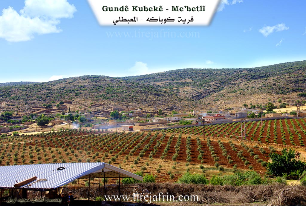
It is stated in the book جبل الكرد (عفرين) دراسة جغرافية Çiyayê Kurmênc (Efrîn): A Geographical Study by د. محمد عبدو علي Dr. Mihemed Ebdo Elî: Gobek / Gulîka, "The Navel" / 1407 inhabitants, 540m altitude: This village consists of two parts. The eastern part is Gobek: this is the name of the site where the village was established, and its meaning is "the center" or "the navel" (gobek). The Arabized name is a translation of the Kurdish name. The western part is Gulîka: this is a personal characteristic derived from the elongation of sideburns or braids (gulî), which was one of the characteristics of its inhabitants from the Koçer tribe, as they used to grow their hair long.
It is a medium-sized village, located on both sides of a valley on the southern slopes of Çiyayê Hawar; its location is adjacent to Çiyayê Hawar from the north.
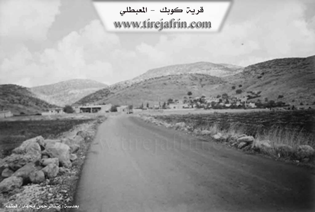
It is stated in the book: عفرين .... نهرها وروابيها الخضراء Efrîn... Her River and Her Green Hills by the writer عبدالرحمن محمد Ebdulrehman Mihemed from the village of Qetme: Gobek is a village in Çiyayê Kurmênc, administratively belonging to the sub-district of Mabeta, district of Efrîn, governorate of Heleb. It is a small village located in the central part of the mentioned mountain, on the southern slope of the limestone Çiyayê Hawar. It is 13km away from the town of Mabeta towards the northeast.
It is bordered to the north by the high mountain chain of Çiyayê Hawar and the village of Dax Obasî at the highest peak of the mountain. It is bordered to the south, 800m away, by the nearby village of Şêx Kêlo. To the west, it is bordered by mountainous heights planted with olive trees and the village of Heyat and the village of Oksuzlî. To the east is the nearby village of Ebrez, 500m away.
The number of its houses is about 25, and its age is approximately 200 years. Its old houses are made of stone and mud with flat wooden roofs, while the modern ones are concrete, spreading east, west, and south. An electricity network is available, as well as a school shared with the village of Ebrez. The village drinks from cisterns that collect rainwater in winter, and currently from artesian wells drilled next to the houses. Its inhabitants rely on rainfed agriculture on an area of 255 hectares, cultivating grains and olive trees, alongside raising sheep and goats. A newly paved road connects it to the sub-district center, reaching the center of the village and the village of Ebrez.
Among the holders of higher degrees in the village:
Mihemed Emîn Hemo / Doctorate in Engineering / Pumps Department / Russia
Village Mukhtar: Mihemed Hemîd Husên
Preparation and execution:
Director of the Tirej Efrîn site: Ebdulrehman Hacî Osman
20/12/2013
Sources:
- Book: جبل الكرد (عفرين) دراسة جغرافية Çiyayê Kurmênc (Efrîn): A Geographical Study by د. محمد عبدو علي Dr. Mihemed Ebdo Elî.
- Book: عفرين .... نهرها وروابيها الخضراء Efrîn... Her River and Her Green Hills by عبدالرحمن محمد Ebdulrehman Mihemed from the village of Qetme.
- Preparation by Navenda Tirej Efrîn / Ebdulrehman Hacî Osman.
II. Ax û Walat Book 1
THE VILLAGES OF GULÎKA AND GOBEKÊ
2.2.2016
The villages of Gulîka and Gobekê are affiliated with the Mabeta district of the Efrîn canton. They are located 4 km north of the town of Mabeta and 18 km northwest of the city of Efrîn.
The villages of Gulîka and Gobekê are surrounded on 3 sides by the slopes of the Hawarê mountain. To the east is Pozê Hêştir, to the north is Zinarê Sor, and to the west is Pozê Dukun. All the mountains are of blue stone; the villagers used to build their houses with this stone because it is a solid type and very good for houses.
102
Around 50 houses and nearly 400 people live in the village of Gulîka, and there are 4 families in the village:
The family of Mistê Kinê, Silêmanê Kinê, Me’mê Kinê, and the family of Betêl. All the families are from one root. It is worth noting that they are all from the Koçerên Gulîkê, which is a branch of the Milan tribe. Therefore, the name Gulîka was given to the village. It is also said that there is another village with the same name across the border, that is, north near the Rojava border, and its residents are relatives of this village and are from the same tribe, so social relations between the two villages have not been broken.
The villages of Gulîka and Gobekê are the first villages to trade in livestock such as sheep and goats. Therefore, the people of the village make their living by buying and selling, as well as raising livestock, and they sell their products like milk, yogurt, cheese, strained yogurt, and butter in the markets of Efrîn and its districts. There are 3 sheepfolds in the village where nearly 300 sheep and lambs are raised for slaughter. Butchers from Efrîn and its towns come and buy lambs for meat from here.
Twice a year, merchants shear their sheep and lambs and sell the wool to merchants, or the villagers make pillows and mattresses for themselves. Along with that, the villagers also do agricultural work.
103
they do, and primarily it is olive trees, along with the cultivation of grains and fields of barley, wheat, and chickpeas...
The availability of work in the village has caused the stability of settlement in the village to be high and has prevented migration.
In front of both villages and to the south is the Avrazê Plain, all with olive trees. To the south is a water well named (Bîra Avrazê), and its water is still available today. In the past, villagers would draw drinking water with animals. To the northeast and on the Hawarê mountain is the Hawarê Castle, and its history is very ancient, going back to the Hurrians.
The shrine of (Fadil) is located above, to the north. It has water, and its water never decreases. The people of the village go there for rain and pray to God, perhaps He will grant their wish and gladden their hearts with the falling of rain. To the west is the (Gerê valley), which starts from the village of Şêx and continues until it reaches (Deşta Kitix).
There are 3 martyrs from the village of Gulîka who lost their lives in the war for the National Liberation of Kurdistan: Zinar, Canda, and Mihemed Elî.
The village commune is named after Ş. Zinar.
There are 4 founding families in the village of Gobeke:
104
The family of Selman, Şahîn, Mihemed Xelê, and the family of Dedo.
Each family came from a different place. Because the location of Gobeke was suitable for raising livestock, many people raised sheep here.
The village of Gobekê is very ancient, and its history goes back more than 400 years. Many people from the village went to the cities of Efrîn, Heleb, and Şam and settled there, so the village did not expand.
There are 25 houses and nearly 200 people living there, but many people live in other places as well.
The village of Gobekê is famous for its abundance of caves, and there are nearly 10 caves there. In the past, these caves were used as houses, and the villagers lived in them. They were also used as places for livestock and as storage.
Previously, there was a water spring in the village, and the people of the village got their drinking water from it, but now its water has dried up.
Both villages of Gulîka and Gobekê have good relations and strong cooperation, and they live and act together as one village.
Possible Village Name Meaning of Gulîka
The village has two parts. The eastern part, Gobek, means 'center' or 'core'. The western part, Gulîka, refers to a characteristic of its residents from the Goçer tribe who used to grow their hair long.
Source: TirejAfrin Site