General Information
Nahiya (Subdistrict)
Şera
Also Known As
Al-Hafra, Kortak, Kortikê, الحفرة, كورتك, كورتكه
Tribes
Şikak
Families, Clans, etc.
Celûsî

Photos
Basic Information about Kortikê
Source: Tirej Afrin
Etymology: Kortik means "the pit" or "hole" (kort/kortik). It is a Kurdish designation for the low-lying site shaped like a large pit with a diameter of about 1.5km.
Foundation Date/Period: 200 years
Other Landmarks: Çemê Kefer Cenê, Navenda Efrînê ya Dexl û Dan
Summaries
I. Summary from TirejAfrin Site (English) of Kortikê
Source: https://www.tirejafrin.com/site/kura%20afrin%20%20sheran%20-%20kortak.htm
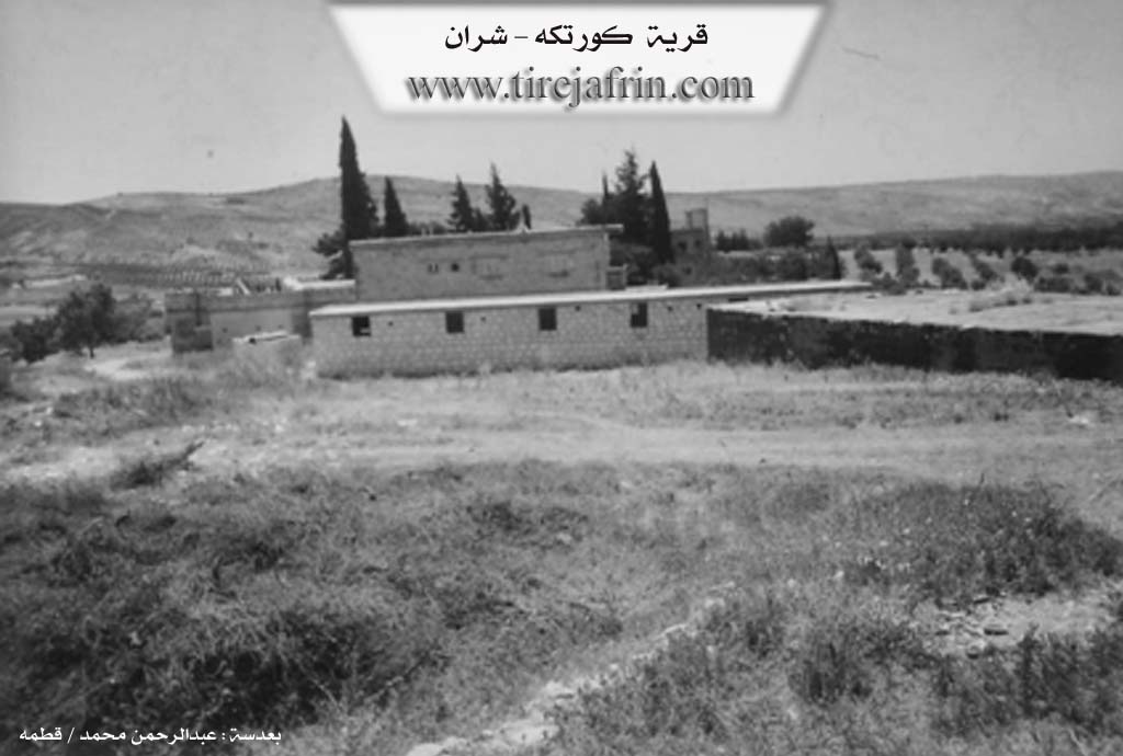
Kortik (The Pit) / 35 inhabitants - 400m altitude/
Etymology and Location
Kortik: Meaning "the pit" or "hole" (kort/kortik), which is a Kurdish designation for the low-lying site that takes the form of a large pit with a diameter of about 1.5km. It is located west of the grain purchase center. The village dwellings are situated on the eastern edge of the pit, so the village derived its name from the characteristics of the place. The Arabic designation "Al-Hufra" is a translation of the Kurdish name.
It consists of several residential houses, containing a mansion for the Celûsî family from the Aghas of the Şikak tribe, and the ownership of the village belongs to them. The site is wooded with forest trees and has become a wide and beautiful forest.
Geography and Boundaries
According to the book "Efrîn... Her River and Her Green Hills": Kortik is a village in Çiyayê Kurmênc following the township of Şera, district of Efrîn, governorate of Heleb, (34 inhabitants). It is a very small village located on a plateau and an agriculturally fertile plain.
It is bordered to the north by mountain heights planted with forest trees, the Riya Meydankê-Bilbil-Kefer Cenê (Meydankê-Bilbil-Kefer Cenê road), the village of Helûbiya Mezin, and Gûbêlek. To the south, it is bordered by a valley and plain planted with olive trees and forest trees, and the village of Qere Têbê. To the east lies a slope, the Xeta Trêna Heleb-Meydan Ekbez (Heleb-Meydan Ekbez railway line), the course of the Kefer Cenê river, the village of Meşelê, and the village of Kefer Mez. To the west, it is bordered by a mountain range planted with forest trees and olives, and the village of Qurt Qûlaqa Mezin.
Infrastructure and Population
Its modern houses are made of stone, consisting of three villas, where the number of its houses reaches about five houses, and its age is 200 years. It is inhabited by one family named Elî Beg, Ehmed Celûsî, and Farûq Celûsî.
The village has an electricity network and drinking water from artesian wells dug in front of the houses, and the road connecting to it is paved up to the center of the village. It contains the Efrîn center for grains (Navenda Efrînê ya Dexl û Dan) for the entire region. The residents work in the cultivation of olives and vines, and it is essentially a garden surrounded by olive and cypress trees from all sides.
Sources
Book: جبل الكرد (عفرين) دراسة جغرافية Çiyayê Kurmênc (Efrîn): A Geographical Study by د. محمد عبدو علي Dr. Mihemed Ebdo Elî.
Book: عفرين .... نهرها وروابيها الخضراء Efrîn... Her River and Her Green Hills by عبدالرحمن محمد Ebdulrehman Mihemed from the village of Qetme.
Studies of Navenda Tirej Soft / Ebdulrehman Hacî Osman.
Some residents of the villages.
Preparation and execution: Manager of the Tirej Efrîn website: Ebdulrehman Hacî Osman 20/12/2013
Foundation/Origin Information of Kortikê
It is inhabited by one family called Ali Bek and Ahmed Jalosi and Faruq Jalosi, and village ownership belongs to them.
Source: TirejAfrin Site
Possible Village Name Meaning of Kortikê
"Kortik" means "the pit," a Kurdish name for the low site that takes the shape of a large pit. The Arabic name "Al-Hafra" is a translation of the Kurdish name.
Source: TirejAfrin Site