General Information
Nahiya (Subdistrict)
Bilbilê
Also Known As
Al-Aliya, Hai Oghli, Kurdo, العالية, كردو, هاي أوغلي

Photos
Basic Information about Kurdo
Source: Tirej Afrin
Etymology: The popular name means "the Kurd's village" (Gund + Kurd). The Ottoman name Hay Oghlî means "son of the Armenian".
Foundation Date/Period: Approximately 200 years ago
Other Landmarks: Çemê Sabûn, Geliyê Spî
Summaries
I. Summary from TirejAfrin Site (English) of Kurdo
Source: https://www.tirejafrin.com/site/kura%20afrin%20%20%20bilbile%20-%20Kurdo.htm
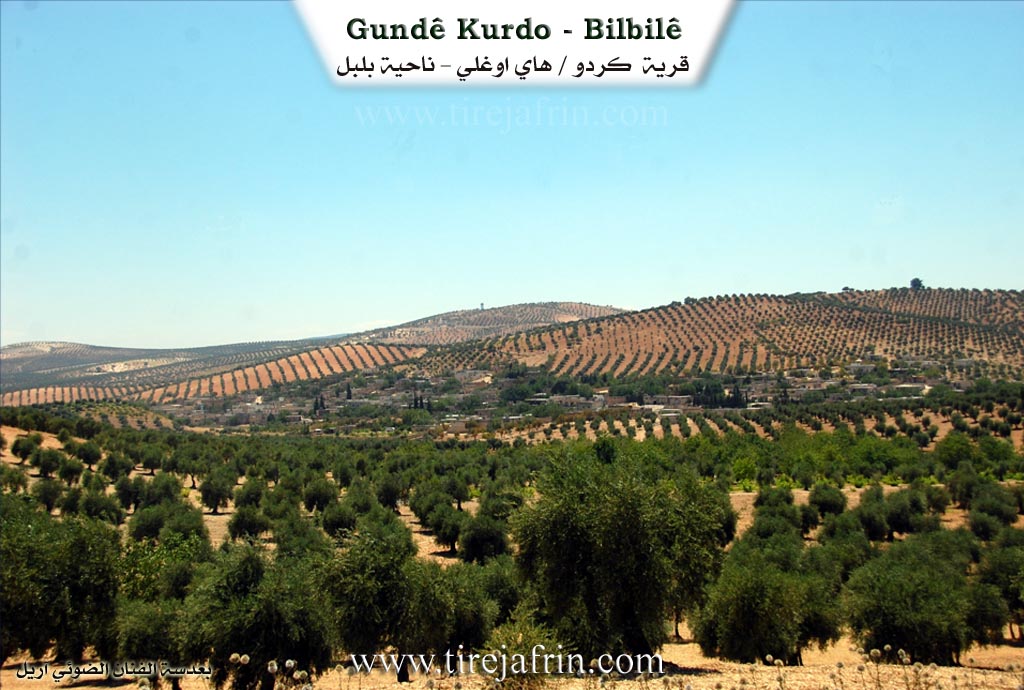
It is stated in the book Çiyayê Kurmênc (Efrîn): A Geographical Study: Gund Kurdo, Hay Oghlî, El-Aliyeh /554 inhabitants, 680 hectares, 5 km, 570 m/:
The popular name means "the Kurd's village" (Gund + Kurd). The Ottoman name Hay Oghlî means "son of the Armenian". The Arabized name has no connection to either the Ottoman designation or the Kurdish name of the village.
It is a small village consisting of two parts, upper and lower, located on a mountain slope. It overlooks the Sabûn river, which forms part of the Syrian Turkish border there, from the north and east at a distance of 500 meters.
It is stated in the book Efrîn... Her River and Her Green Hills: Kurdo is a small village located on a rocky flat, on the northeastern slope with a slight incline, on a limestone plateau near the Turkish border, just meters away. Its soil is furrowed clay and covered with pine forests. It is 15 km away from the town of Bilbil towards the northeast. It overlooks the Sabûn river from its northern and eastern sides at a distance of 500 meters, which forms part of the Syrian Turkish border line.
It is bordered to the north directly by the borders of Turkey just meters away, to the south by a fertile plain planted with olive trees and the village of Ebûdan, to the west by a plain planted with olive trees and the village of Mehmûd Obasî, and to the east by a valley called Geliyê Spî (White Valley) and the Turkish borders.
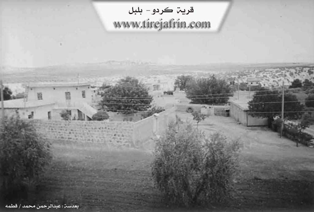
The number of its houses reaches approximately 20 houses and its age is approximately 200 years. Its dwellings were stone and mud with flat wooden roofs, while modern cement houses have now overwhelmed them. An electricity network and a primary school are available in the village.
The village drinks from cisterns where rainwater is collected, and currently from artesian wells. Its residents work in the cultivation of olives, vines, grains, and legumes via rain fed farming on an area of 680 hectares, and via irrigation from artesian wells for summer vegetables, walnuts, and apples, alongside raising sheep and goats. The road from it to the town of Bilbil and the neighboring villages is asphalted, while the road to the village itself is paved dirt.
Sources of Information:
- Book: جبل الكرد (عفرين) دراسة جغرافية Çiyayê Kurmênc (Efrîn): A Geographical Study by د. محمد عبدو علي Dr. Mihemed Ebdo Elî.
- Book: عفرين .... نهرها وروابيها الخضراء Efrîn... Her River and Her Green Hills by عبدالرحمن محمد Ebdulrehman Mihemed from the village of Qetme.
- Studies of Navenda Tirej Soft / Ebdulrehman Hacî Osman.
- Some residents of the villages.
Preparation and execution: Manager of the website Tirej Efrîn: Ebdulrehman Hacî Osman 20/12/2013
Possible Village Name Meaning of Kurdo
The popular name means "Kurdish village." The Ottoman name, Hai Oghlu, means "son of the Armenian."
Source: TirejAfrin Site