General Information
Nahiya (Subdistrict)
Bilbilê
Also Known As
Al-Sa'ida, Korzîlê, Kurzêl, السعيدة, كورزيل, كورزيلي
Families, Clans, etc.
Al Şêx Ismaîl, Mihemed Reşîd

Photos
Basic Information about Kurzêl
Source: Tirej Afrin
Etymology: Its name resembles the name of the village of Kurzêl of Cûme, and it is said that there are kinship ties between families of those two villages. The Arabized name has no connection to the meaning of the old name.
Foundation Date/Period: approximately 350 years
Hills: Çiyayê Simaq
Other Landmarks: Wadî Cerqa
Summaries
I. Summary from TirejAfrin Site (English) of Kurzêl
Source: https://www.tirejafrin.com/site/kura%20afrin%20%20%20bilbile%20-%20Kuzel.htm
It is stated in the book Jebel al-Kurd / Afrin / Geographical Study: Kurzêlê, el-Seîde /754 inhabitants, 14km, 740m/:
Its name resembles the name of the village of Kurzêl of Cûme, and it is said that there are kinship ties between families of those two villages. The number of its houses in the year 1923 was thirty houses /Cemîl Kene.../. The Arabized name has no connection whatsoever to the meaning of the old name.
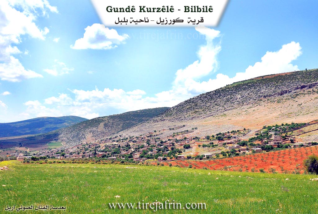
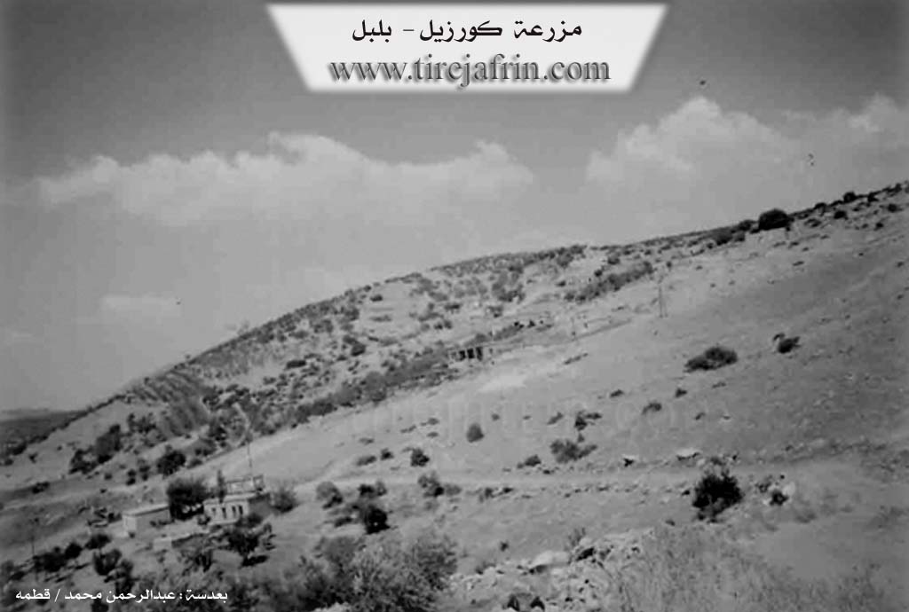
It is a small village located at the western slope of one of the heights of Çiyayê Simaq. Around it, there are many watercourses that head west towards Wadî Cerqa. Families of the Al Şêx Ismaîl lineage live there.
It is stated in the book Afrin... Her River and Her Green Hills: Kurzêlê: A village in Çiyayê Kurmênc that follows the Bilbile district, Efrîn region, Heleb governorate. It is a medium-sized village located on the middle and northern slope and on three mountain heights. It is approximately 15km away from the town of Bilbile towards the southwest.
It is bordered to the north by a torrential valley, a mountain range, the Riya Bilbile-Reco (Bilbile-Reco road), and the village of Solaqlî. To the south, it is bordered by a deep torrential valley, a mountain range, and the village of Qotanlî. To the west, it is bordered by a torrential valley, a fertile plain, the village of Alemdar, and the village of Zerkanlî. To the east, it is bordered by a torrential valley, mountain heights, and the village of Berkeşlî.
The number of its houses reaches approximately 35 houses, and its age is approximately 350 years. Its old houses are stone and mud with flat wooden roofs, while the modern ones are cement. A modern electricity network is available (under construction), as well as a primary school. Its residents work in rain-fed agriculture of olives, grains, and legumes, and in raising sheep and goats. The village drinks from cisterns where rainwater collects in winter. The road to the district center and neighboring villages is dirt, mountainous, and unpaved. Its most important families include the Mihemed Reşîd family located in the western side of the village.
Village Mukhtar: Reşîd Husên
Sources of Information:
- Book: جبل الكرد (عفرين) دراسة جغرافية Çiyayê Kurmênc (Efrîn): A Geographical Study by د. محمد عبدو علي Dr. Mihemed Ebdo Elî.
- Book: عفرين .... نهرها وروابيها الخضراء Efrîn... Her River and Her Green Hills by عبدالرحمن محمد Ebdulrehman Mihemed from the village of Qetme.
- Studies of Navenda Tirej Soft / Ebdulrehman Hacî Osman.
- Some residents of the villages.
Preparation and Execution: Director of the Tirej Efrîn website: Ebdulrehman Hacî Osman 20/12/2013
Foundation/Origin Information of Kurzêl
Al Sheikh Ismail families live in it.
Source: TirejAfrin Site
Possible Village Name Meaning of Kurzêl
Its name resembles the name of Kurzil-Juma Village, and it is said that there are kinship relations between families from those two villages.
Source: TirejAfrin Site