General Information
Nahiya (Subdistrict)
Cindires
Also Known As
Mehmediye Eastern, Mehmediyê Şerqî, محمدية شرقي
Families, Clans, etc.
Meĥmediye
Photos
Basic Information about Mehmediyê Şerqî
Source: Tirej Afrin
Etymology: Meĥmediy is a name Yezidi Kurds give to Muslims, especially those who converted to Islam from Yezidism
Foundation Date/Period: 19th century (approximately 150 years ago)
Hills: Til Silor
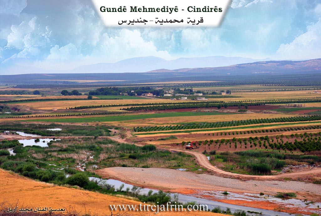
Other Landmarks: Efrîn River, Cûm Plain
Summaries
I. Summary from TirejAfrin Site (English) of Mehmediyê Şerqî
Source: https://www.tirejafrin.com/site/kura%20afrin%20Cindires%20-%20mehmediye%20shrqi.htm
The following is stated in the book جبل الكرد (عفرين) دراسة جغرافية Çiyayê Kurmênc (Efrîn): A Geographical Study by د. محمد عبدو علي Dr. Mihemed Ebdo Elî:
Meĥmediy
Elevation: 140m.
Meĥmediy: This is a name that the Êzîdî Kurds give to Muslims, especially those who converted to Islam from the Êzîdî faith. In the 19th century, some Êzîdîs who embraced the Islamic religion settled there. They are two villages, Meĥmediye Şerqî (Eastern) and Meĥmediye Rojavayî (Western).
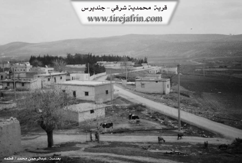
Meĥmediye Şerqî: It has 118 inhabitants. It is located on a rocky cliff on the right bank of the Efrîn river.
The following is stated in the book عفرين .... نهرها وروابيها الخضراء Efrîn... Her River and Her Green Hills by the writer عبدالرحمن محمد Ebdulrehman Mihemed from the village of Qetme:
Meĥmediye Şerqî is a village in the Efrîn valley, administratively following the township of Cindirês, Efrîn region, Heleb governorate. It is a small village located in the fertile Cûm plain, near the Efrîn river which possesses alluvial soil and abundant groundwater. It sits on the right bank of the Efrîn river, rising above the level of the watercourse on a rocky cliff that is 10 meters high. It is 5 km away from the town of Cindirês towards the south.
It is bordered to the north by an agricultural plain planted with olive trees and the village of Axcele. It is bordered to the south, at a distance of 200 meters, by the watercourse of the valley of the Efrîn river and the village of Dêr Belût on the upper height. It is bordered to the west, meters away, by the farm of Meĥmediye Rojavayî. It is bordered to the east by a fertile agricultural plain, the village of Medaya, and Til Silor.
The number of its houses reaches approximately 35 houses, and its age is approximately 150 years. Its old houses are made of mud with wooden ceilings covered with tree branches or zinc sheets, while the modern ones are concrete and have expanded towards the east, west, and north. An electricity network, a primary school, and a small mosque are available there. It gets drinking water from artesian wells dug next to the homes, and it connects with the town of Cindirês and neighboring villages by an asphalt road.
Its residents work in the cultivation of rainfed grains and legumes, and irrigated crops via pumping from the Efrîn river, such as cotton, sugar beet, and tobacco, alongside raising sheep, cows, and goats. It was previously inhabited by the Meĥmediye family and the Armenian community. Currently, it is inhabited by farmers benefiting from the Agrarian Reform Law who had lands distributed to them, and none of its original inhabitants remain.
Preparation and Execution:
Director of the Navenda Tirej Efrîn site: Ebdulrehman Hacî Osman
20/12/2013
Sources:
- Book: جبل الكرد (عفرين) دراسة جغرافية Çiyayê Kurmênc (Efrîn): A Geographical Study by د. محمد عبدو علي Dr. Mihemed Ebdo Elî.
- Book: عفرين .... نهرها وروابيها الخضراء Efrîn... Her River and Her Green Hills by عبدالرحمن محمد Ebdulrehman Mihemed from the village of Qetme.
Foundation/Origin Information of Mehmediyê Şerqî
Inhabited in the nineteenth century by some Yazidis who embraced Islam. It was previously inhabited by the Mehmediye family and the Armenian Jaliye family. Currently inhabited by farmers benefiting from the agricultural reform law.
Source: TirejAfrin Site
Possible Village Name Meaning of Mehmediyê Şerqî
Meḧmedî is a name given by Yazidis to Muslims, especially those who converted from Yazidism.
Source: TirejAfrin Site