General Information
Nahiya (Subdistrict)
Cindires
Also Known As
Mehmediye Western, Mehmediyê Xerbî, Mihemediyê, محمدية غربي
Families, Clans, etc.
Mehmûdiya

Photos
Basic Information about Mehmediyê Xerbî
Source: Tirej Afrin
Etymology: Meĥmediy: A name Êzîdî Kurds use for Muslims, especially those who converted to Islam from Êzîdîism.
Foundation Date/Period: 19th century
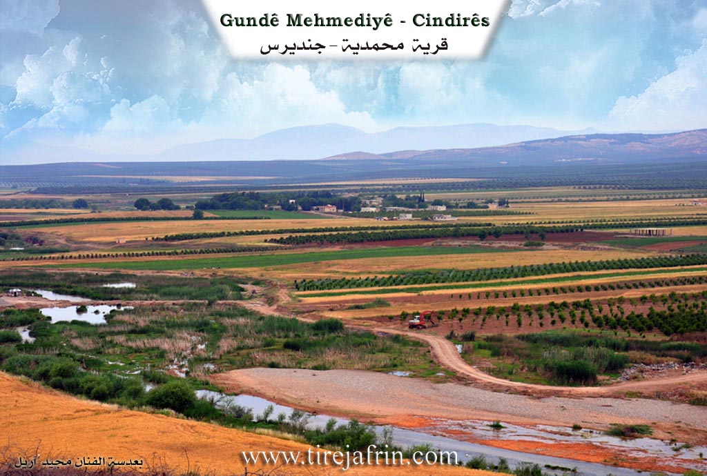
Other Landmarks: River of Efrîn
Summaries
I. Summary from TirejAfrin Site (English) of Mehmediyê Xerbî
Source: https://www.tirejafrin.com/site/kura%20afrin%20Cindires%20-%20mehmediye%20xrqi.htm
Meĥmediy / Mehmûdiyê
Based on the book Çiyayê Kurmênc (Efrîn): A Geographical Study by Dr. Mihemed Ebdo Elî:
Meĥmediy
/ km - 140m /
Meĥmediy: This is a name that Êzîdî Kurds use for Muslims, especially those who converted to Islam from Êzîdîism. It was settled in the 19th century by some Êzîdîs who embraced the Islamic religion. They are two villages, Mehmûdiya Rojhilat (Eastern) and Mehmûdiya Rojava (Western).
Mehmûdiya Rojava
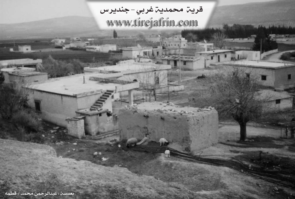
/202 inhabitants/: It is currently abandoned.
According to the book Efrîn... Her River and Her Green Hills by the writer Ebdulrehman Mihemed from the village of Qetme:
Mehmûdiya Rojava: It is a small farm in the Efrîn valley belonging to the village of Mehmûdiya Rojhilat of the Cindirês township, Efrîn region, Heleb governorate. It is located on the right bank of the Efrîn river, at a distance of 200m from Mehmûdiya Rojhilat.
It is bordered north by the town of Cindirês; south at a distance of 500m by the course of the Efrîn river valley and the village of Dêr Belût; east by Mehmûdiya Rojhilat at a distance of meters; and west by the course of the Efrîn river valley and the village of Nisriyê in the far west.
It was previously a farm for the Mehmûdiya family, the first to settle it in ancient times. An electricity network is available there, as well as a school shared with Mehmûdiya Rojhilat and a paved road. Its residents work in irrigated and rain-fed agriculture, alongside raising cows and goats.
Sources:
- Book: جبل الكرد (عفرين) دراسة جغرافية Çiyayê Kurmênc (Efrîn): A Geographical Study by د. محمد عبدو علي Dr. Mihemed Ebdo Elî.
- Book: عفرين .... نهرها وروابيها الخضراء Efrîn... Her River and Her Green Hills by عبدالرحمن محمد Ebdulrehman Mihemed from the village of Qetme.
Preparation and execution:
- Manager of Tirej Efrîn site: Ebdulrehman Hacî Osman
- 20/12/2013
Foundation/Origin Information of Mehmediyê Xerbî
Inhabited in the nineteenth century by some Yazidis who embraced Islam. It was previously a farm belonging to the Mehmediye family.
Source: TirejAfrin Site
Possible Village Name Meaning of Mehmediyê Xerbî
Meḧmedî is a name given by Yazidis to Muslims, especially those who converted from Yazidism.
Source: TirejAfrin Site