General Information
Nahiya (Subdistrict)
Cindires
Also Known As
Merwanê Jorin, مرونة فوقاني, مروونة فوقاني, مرونيه فوقاني
Families, Clans, etc.
Kunc

Photos
Basic Information about Merwanê Jorin
Source: Tirej Afrin
Etymology: The text states it took its name from its first inhabitant: Xelîl, whose religious title in Kurdish is: Mela
Foundation Date/Period: Approximately 300 years ago
Hills: Merwanê
Ruins: Qesra Kunc
Other Landmarks: Cercim, Deveyol, Hemamên Şîfa, Amuq
Summaries
I. Summary from TirejAfrin Site (English) of Merwanê Jorin
Source: https://www.tirejafrin.com/site/kura%20afrin%20Cindires%20-%20merwane%20jorin.htm
It is stated in the book جبل الكرد (عفرين) دراسة جغرافية Çiyayê Kurmênc (Efrîn): A Geographical Study by د. محمد عبدو علي Dr. Mihemed Ebdo Elî:
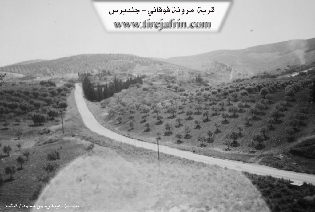
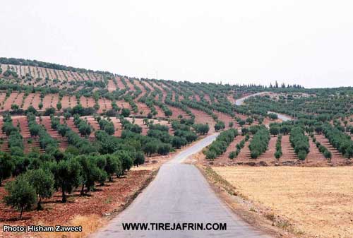
Merwanê Jorîn /584 inhabitants - 12km - 250m/: A small village located on the western slope of the Merwanê mountain elevation, which is forested with pines, and at the western end of the known Deveyol (Camel Road) pass and road. It also overlooks the Amuq plain to the west. It is 1km away from Merwanê Jêrîn, and they are separated by the Cercim valley.
It took its name from the name of its first inhabitant: Xelîl, and his religious title in Kurdish is: Mela.
A small village located on the southern bank of the Efrîn river. It is a few hundred meters away from the Turkish border. Within it is an uninhabited palace for the Aghas of the Kunc family.
It is stated in the book عفرين .... نهرها وروابيها الخضراء Efrîn... Her River and Her Green Hills by the writer عبدالرحمن محمد Ebdulrehman Mihemed from the village of Qetme:
Merwanê Jorîn: A village in Çiyayê Kurmênc, administratively belonging to the Cindirês district, Efrîn region, Heleb governorate. It is located on the western slope of the southwestern extension of the mentioned mountain block. It overlooks to the west the edges of the Amuq plain, which has fertile alluvial soil.
It is bordered to the north by a deep valley called the Cercim valley, mountainous heights planted with olive trees, and the village of Hêkiçê. To the south, it is bordered by a mountain range planted with forest trees and olives, and the border village of Hemamê. To the west, a deep valley, a slope planted with olive trees, and the village of Merwanê Jêrîn. To the east, a high, rugged mountain range planted with forest trees and olives, the village of Aşkanê Rojava, and the village of Kefer Sefrê.
The number of its houses is about 20, and its age is about 300 years. Its old houses are made of stone and mud, while the modern ones are cement and have expanded to the outskirts. An electricity network is available, as well as a paved road passing through its center to the districts of Şiyê and Cindirês. A second road passes through the center of Merwanê from the southern side to the village of Hemamê. It contains the Hemamên Şîfa (Healing Baths) and the Cercim valley, in which water flows and pours into the Amuq valley.
Its residents work in the cultivation of olives, grains, and legumes via rainfed farming on the lands of their village and the lands of the two farms belonging to it (1804 hectares), and the cultivation of cotton and summer vegetables via irrigation from wells (66 hectares), alongside raising sheep and goats. The village drinks from the water of wells and cisterns that collect rainwater. Its lands are generally mountainous and sloping.
Village Mukhtar: Mihemed Emîn Hesen
Preparation and execution:
Director of the Tirej Efrîn site: Ebdulrehman Hacî Osman
20/12/2013
Sources:
- Book: جبل الكرد (عفرين) دراسة جغرافية Çiyayê Kurmênc (Efrîn): A Geographical Study by د. محمد عبدو علي Dr. Mihemed Ebdo Elî.
- Book: عفرين .... نهرها وروابيها الخضراء Efrîn... Her River and Her Green Hills by عبدالرحمن محمد Ebdulrehman Mihemed from the village of Qetme.
- Ebdulrehman Hacî Osman, director of Tirej Efrîn.