General Information
Nahiya (Subdistrict)
Efrîn
Also Known As
موسانكي, ميسونكه
Photos
Basic Information about Mosankî
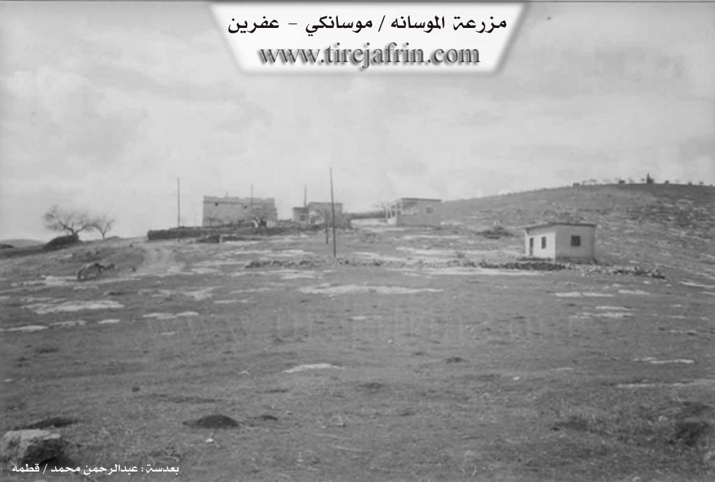
Source: Tirej Afrin
Foundation Date/Period: Approximately 80 years ago
Hills: Çiyayê Ziyaret, Çiyayê Sirtê Xoce
Summaries
I. Summary from TirejAfrin Site (English) of Mosankî
Source: https://www.tirejafrin.com/site/kura%20afrin%20markaz-%20Mosanke.htm
It was stated in the book: عفرين .... نهرها وروابيها الخضراء Efrîn... Her River and Her Green Hills by the writer عبدالرحمن محمد Ebdulrehman Mihemed from the village of Qetme:
Mûsankê: A farm in Çiyayê Kurmênc, following the subdistrict of the center villages and the district of Efrîn, Heleb governorate. It is a small farm located on the eastern slope of Çiyayê Ziyaret, and the northern slope of Çiyayê Sirtê Xoce.
It is bordered to the north by mountainous highlands planted with olive trees and the village of Cûyê, and to the south by a slope planted with olive trees and the village of Kefer Şîl, and to the west by a mountain range and the village of Xelner, and to the east by a slope planted with olive trees and the city of Efrîn.
The number of its houses reaches about 10 houses and its age is about 80 years according to the statements of one of the elders in the farm. Their origin is from the village of Ebîn belonging to the Efrîn area.
Its modern houses are made of cement and stone. An electricity network is available in it which arrived recently. The road to the farm is dirt, unpaved, and mountainous. No other services are available in it.
Preparation and Execution:
Manager of the Tirej Efrîn site: Ebdulrehman Hacî Osman
20/12/2013
Sources
Book: عفرين .... نهرها وروابيها الخضراء Efrîn... Her River and Her Green Hills by عبدالرحمن محمد Ebdulrehman Mihemed from the village of Qetme.
Foundation/Origin Information of Mosankî
The origins of the residents are from Abein village.
Source: TirejAfrin Site