General Information
Nahiya (Subdistrict)
Cindires
Also Known As
Nasriya, Nisriyê, نسرية, نسريه
Families, Clans, etc.
Abidîn Genc Axa, Mihemed Genc, Mihemed Henîf Mûsa
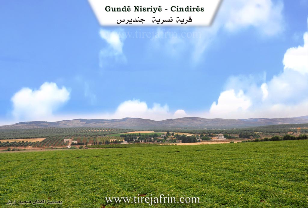
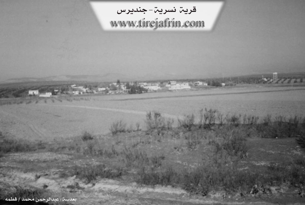
Photos
Basic Information about Nisriyê
Source: Tirej Afrin
Etymology: Perhaps from the word 'eagle' (nasr) in Arabic
Foundation Date/Period: About 150 years
Summaries
I. Summary from TirejAfrin Site (English) of Nisriyê
Source: https://www.tirejafrin.com/site/kura%20afrin%20Cindires%20-%20nisriye.htm
It is stated in the book جبل الكرد (عفرين) دراسة جغرافية Çiyayê Kurmênc (Efrîn): A Geographical Study by د. محمد عبدو علي Dr. Mihemed Ebdo Elî: Nisriyê / 1004 people, 7km, 140m /.
Its name might come from "eagle" (nasr) in Arabic. It is a small village located on the northern bank of the Efrîn river.
And it is stated in the book عفرين .... نهرها وروابيها الخضراء Efrîn... Her River and Her Green Hills by the writer عبدالرحمن محمد Ebdulrehman Mihemed from the village of Qetme:
Nisriyê is a village in the Efrîn valley, administratively belonging to the Cindirês district, Efrîn region, Heleb governorate. It is a small village located in the Cindirês plain, which possesses fertile alluvial soil and abundant underground water. It sits on a cliff on the right bank of the Efrîn river, rising 10 meters above the level of the river course. It is 6km away from the town of Cindirês toward the southwest.
It is bordered to the north by a fertile agricultural plain, a flood valley, and the village of Hac Îskender. It is bordered to the south, 300m away, by a valley, the course of the Efrîn river, a fertile plain planted with cotton, and the village of Mela Xelîl in the southwestern corner of the Cindirês district, 1km from the village. To the west, it is bordered by a fertile plain planted with olive trees, the village of Seferiye, Hemam, and the Turkish border directly. To the east, it is bordered by a fertile plain, the valley of the Efrîn river, and the village of Mihemediye (West and East).
The number of its houses is about 30, and its age is about 150 years. Its old houses are made of stone and mud with two sloped roofs covered with tree branches and zinc sheets, while the modern ones are concrete and have expanded at the outskirts. An electricity network is available, as well as a drinking water network from a well dug recently east of the village at a distance of 500m, or from artesian wells dug next to the houses. There is a primary school and a telephone center. The road to the district is a leveled dirt road, not asphalted.
Its inhabitants work in the cultivation of olives, grains, and legumes via rainfed farming (425 hectares) and cotton, sugar beet, watermelon, and pomegranate via irrigation by pumping from the Efrîn river (110 hectares), alongside raising sheep, cows, and goats.
Its most important former families are the family of Abidîn Genc Axa, who are the owners of the village and the first to inhabit it since old times. There are also three modern villas belonging to this family 1km east of the village of Nisriyê, owned by the family of Mihemed Genc and his brothers.
Mukhtar of the village: Mihemed Henîf Mûsa
Sources:
- Book: جبل الكرد (عفرين) دراسة جغرافية Çiyayê Kurmênc (Efrîn): A Geographical Study by د. محمد عبدو علي Dr. Mihemed Ebdo Elî.
- Book: عفرين .... نهرها وروابيها الخضراء Efrîn... Her River and Her Green Hills by عبدالرحمن محمد Ebdulrehman Mihemed from the village of Qetme.
- Preparation and execution by Navenda Tirej Efrîn director: Ebdulrehman Hacî Osman.
- 20/12/2013
Foundation/Origin Information of Nisriyê
The Abidin Kunj agha family are the village owners and the first to inhabit it since ancient times.
Source: TirejAfrin Site
Possible Village Name Meaning of Nisriyê
Perhaps its name came from the eagle in Arabic.
Source: TirejAfrin Site