General Information
Nahiya (Subdistrict)
Cindires
Also Known As
Qila, Qîlê, قيله
Families, Clans, etc.
Mihemed Xelîl Sîdo Mîmî Axa

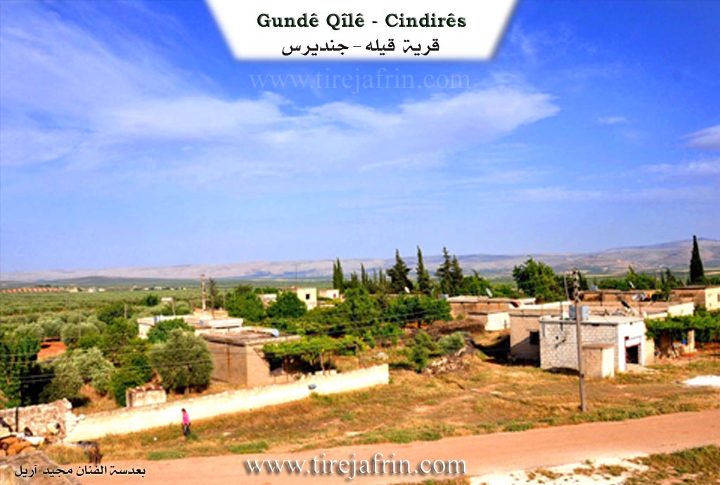
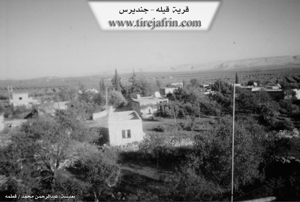
Photos
Basic Information about Qîlê
Source: Tirej Afrin
Etymology: According to the Goranî dictionary, "Qîl" means the udder of an animal, or the tusk of an elephant, camel, or dog. The name in local Kurdish means: the bright one. Some sources state it is a Syriac-Greek name meaning the house of the monk.
Foundation Date/Period: Approximately 150 years ago
Other Landmarks: Newala Xeltan
Summaries
I. Summary from TirejAfrin Site (English) of Qîlê
Source: https://www.tirejafrin.com/site/kura%20afrin%20Cindires%20-%20qela.htm
The following details appear in the book جبل الكرد (عفرين) دراسة جغرافية Çiyayê Kurmênc (Efrîn): A Geographical Study by د. محمد عبدو علي Dr. Mihemed Ebdo Elî:
Qîlê / 547 inhabitants - 5km - 270m /
According to the Goranî dictionary, "Qîl" means the udder of an animal, or the tusk of an elephant, camel, or dog. The name in local Kurdish means: the bright one. It has also appeared in some sources as a Syriac-Greek name meaning the house of the monk.
It is a small village situated on a site of low elevation, which represents an archaeological site. It is one of the villages that flourished after the Agrarian Reform, and it is located on the western bank of the Xeltan valley.
The following details appear in the book عفرين .... نهرها وروابيها الخضراء Efrîn... Her River and Her Green Hills by the writer عبدالرحمن محمد Ebdulrehman Mihemed from the village of Qetme:
Qîlê is a village in Çiyayê Kurmênc that follows the Cindirês district, Efrîn region, Heleb governorate. It is a small village located on the northeastern edge of the undulating Cindirês plain, which possesses fertile alluvial soil. It lies 3km east of the town of Cindirês.
The village is bordered to the north by a waterway and a fertile plain planted with olive trees and the village of Komuş Burc. To the south, it is bordered by a fertile plain planted with olive trees, the Riya Efrîn-Cindirês (Efrîn-Cindirês road), and the village of Hemîlk. To the west, there is a wide and agriculturally fertile plain planted with olive trees and the villages of Zindikan and Yalanqoz. To the east, there is a wide and agriculturally fertile plain planted with olive trees and the village of Qurbê.
The number of houses reaches approximately 20, and the village is about 150 years old. The origin of this village goes back to the family of Mihemed Xelîl Sîdo Mîmî Axa, and they are the owners of the village. Its modern houses are made of cement and stone. An electricity network is available, as well as a paved road up to the center of the village and from there to several neighboring villages.
The residents work in the cultivation of cereals, olives, and legumes through rain fed farming, and irrigation from artesian wells for the cultivation of summer vegetables, alongside the raising of sheep and goats. The village gets its drinking water from artesian wells drilled next to the homes.
Village Mukhtar: Mihemed Êbo
Preparation and execution:
Manager of the Tirej Efrîn site: Ebdulrehman Hacî Osman
20/12/2013
Sources
Book: جبل الكرد (عفرين) دراسة جغرافية Çiyayê Kurmênc (Efrîn): A Geographical Study by د. محمد عبدو علي Dr. Mihemed Ebdo Elî.
Book: عفرين .... نهرها وروابيها الخضراء Efrîn... Her River and Her Green Hills by عبدالرحمن محمد Ebdulrehman Mihemed from the village of Qetme.
Foundation/Origin Information of Qîlê
The origin of the village goes back to the Mohammed Khalil Sido Mimi agha family, who are the village owners.
Source: TirejAfrin Site
Possible Village Name Meaning of Qîlê
'Qîl' means animal teat or tusk. In local Kurdish it means 'the protruding'. It also appeared in some sources as a Syriac-Greek name meaning monk's house.
Source: TirejAfrin Site