General Information
Nahiya (Subdistrict)
Bilbilê
Also Known As
قسطل خضريانلي
Photos
Basic Information about Qestelê Xidiriya
Source: Tirej Afrin
Etymology: Qestel means an artificial water source whether ancient or modern, and Xidiriya is the name of the old village that was nearby
Foundation Date/Period: 1960s
Summaries
I. Summary from TirejAfrin Site (English) of Qestelê Xidiriya
Source: https://www.tirejafrin.com/site/kura%20afrin%20%20%20bilbile%20-%20Q%20%20Xidiriya.htm
It stated in the book جبل الكرد (عفرين) دراسة جغرافية Çiyayê Kurmênc (Efrîn): A Geographical Study: Qestel Xidiriyanlî, /720m/:
Qestel: An artificial water source, whether it was ancient or modern. And Xidiriya is the name of the old village that was nearby.
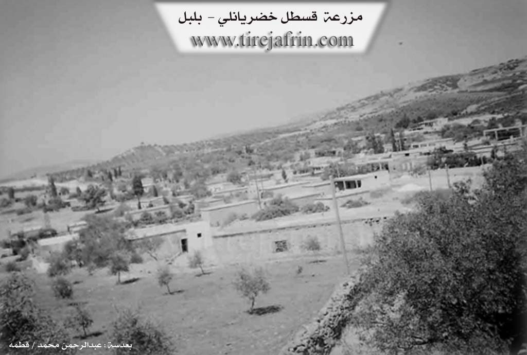
The village was established in the sixties of the twentieth century through the migration of the population to it from the neighboring villages. Then it expanded, and small professions appeared in it, such as carpentry and blacksmithing, in addition to shops for selling consumer goods.
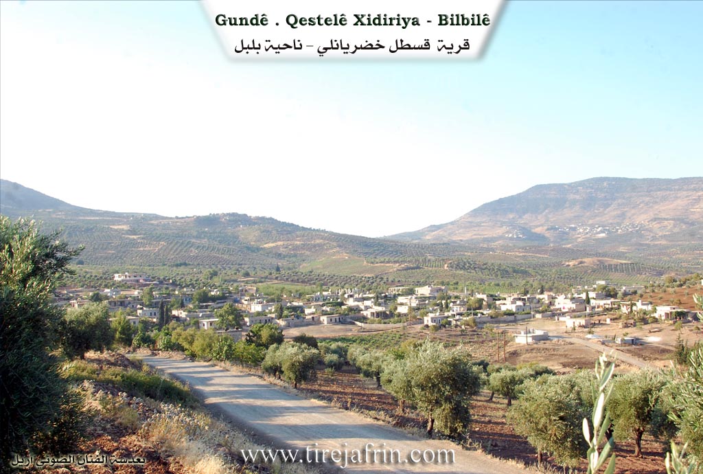
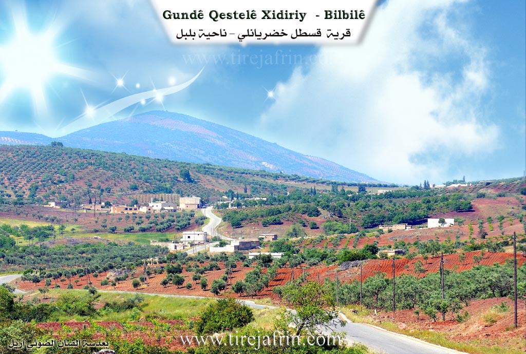
It stated in the book عفرين .... نهرها وروابيها الخضراء Efrîn... Her River and Her Green Hills: Qestel Xidiriyanlî: A farm in Çiyayê Kurmênc belonging to the district of Bilbile, area of Efrîn, governorate of Heleb. It is a small farm located in a fertile agricultural plain on both sides of the Riya Bilbile-Reco (Bilbile-Reco public road). Most of its residents are from the village of Qestel Xidiriyanlî and the villages neighboring it. It is about 7km away from the town of Bilbile towards the southwest.
It is bordered to the north by mountainous heights planted with olive trees and the village of Sehriyanlî, Hêyamli, and Baxçe Qonax; to the south by a torrential valley and the village of Qestel Xidiriyanlî; to the west by a wide agricultural plain and the village of Gurzêl and Solaqlî; and to the east by a torrential valley and the town of Bilbile.
The number of its houses reaches about 40 houses, and its age is about 40 years. Its dwellings are of stone and cement, and they are recent. An electricity network and drinking water from artesian wells are available in it, and an asphalt road passes through its center to several neighboring villages. It contains several shops, blacksmithing and machinery repair workshops, and service shops. Most of its residents work in the cultivation of olives and vines alongside raising sheep and goats.
Village Mukhtar:
Sources of Information:
- Book: جبل الكرد (عفرين) دراسة جغرافية Çiyayê Kurmênc (Efrîn): A Geographical Study by د. محمد عبدو علي Dr. Mihemed Ebdo Elî.
- Book: عفرين .... نهرها وروابيها الخضراء Efrîn... Her River and Her Green Hills by عبدالرحمن محمد Ebdulrehman Mihemed from the village of Qetme.
- Studies of Navenda Tirej Soft / Ebdulrehman Hacî Osman.
- Some residents of the villages.
Preparation and Execution: Manager of the website Tirej Efrîn: Ebdulrehman Hacî Osman 20/12/2013
Foundation/Origin Information of Qestelê Xidiriya
Some of its inhabitants migrated to a new location 1km north of it where water is available, and the new village is called: Qastal Khadryanli.
Source: TirejAfrin Site
Possible Village Name Meaning of Qestelê Xidiriya
Khadryanlu: Name of a clan from the large Kurdish Rashwan tribe, and some say it is from the Milan tribe.
Source: TirejAfrin Site