General Information
Nahiya (Subdistrict)
Bilbilê
Also Known As
Qiri Golê, Quru Gol, اليابسة, قره كول, قوري كول

Photos
Summaries
I. Summary from TirejAfrin Site (English) of Qiri Golê
Villages of Bilbile District / bilbile
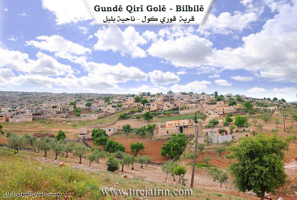
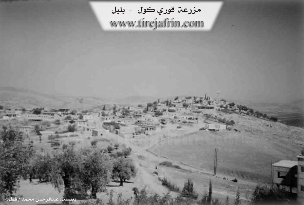
Qiri Gol (قوري كول) - Qiri Golê
===
According to the book 'جبل الكرد' 'Mountain of the Kurds' / Afrin City / Geographical Study:
Qirigol, Qiri Gol (قوري كول), Al-Yabisah (الياسة) /2324N - 600E - 15km - 517m/:
- Qiri means "dry" in Turkish, and Gol means "lake" in Kurdish and Turkish, and the complete meaning is "the dry lake." The Arabic name is an incomplete translation of the name.
- The village is located on top of a mountain mass, its dwellings spread over two peaks so it became two sections: eastern, old and large, and western, modern and small. Oak groves are scattered around it.
According to the book 'عفرين .... نهرها ورؤابيها الخضراء' 'Afrin City .... Its River and Green Hills':
Qiri Gol (قوري كول): A village in Kurdistan Mountain (جبل الكرد) belonging to Bilbile District (ناحية بلبل), Afrin City region (منطقة عفرين), Aleppo Governorate (محافظة حلب).
It is a large village standing on top of a wide, undulating summit of a limestone mountain mass where streams carve its slopes with fertile clay soil, oak groves are scattered on it, 15km away from Bilbile town (بلدة بلبل) to the south. It overlooks from its fortified location its fertile agricultural lands located to its northwest. It is bounded to the north by a rough slope and Sîlî Valley (وادي سيلي) and Ābil Oshāġī village (قرية آبيل أوشاغي), to the south by a slope and Sîlî Valley (وادي سيلي) and Qudur Mountain (جبل قدور) and Ḥasan Dîrlī village (قرية حسن ديرلي), to the west by a slope and Sîlî Valley (وادي سيلي) and Khalîlāk Oshāġī village (قرية خليلاك أوشاغي) and Hawārī Mountain (جبل هواري), and to the east by a slope and Sîlî Valley (وادي سيلي) planted with olive trees and Bîlān Koy village (قرية بيلان كوي) on a high mountain elevation. Note that the village is divided into three sections: the first is located on an elevated hill to the east, the second is located in a low center, and the third on an elevation from the western side. It was named thus in relation to a large water pool that collects floodwater in winter and dries up in summer. Its old dwellings are stone-clay with flat wooden roofs, and the modern ones are stone-concrete that expanded north and south. The number of houses is approximately 150 houses and its age is approximately 500 years. It has an electricity network, an elementary school, a mosque, an agricultural cooperative association, and two modern olive presses. There is a shrine called Madour Shrine (مزار مدور) on a high peak. The village drinks from cisterns that collect rainwater in winter or from artesian wells dug beside the houses. Most inhabitants work in rainfed agriculture on an area of /517/ hectares in addition to raising sheep and goats. It is connected to the district center by a paved road.
Among the social figures in the village: Abu Ibrahim (أبو ابراهيم) / former traffic policeman
Village headman: Qambar Ali (قمبر علي)
Sources:
- Book 'جبل الكرد' 'Mountain of the Kurds' (Afrin City) Geographical Study by Dr. Mohammed Abdo Ali (الدكتور محمد عبدو علي).
- Book: 'عفرين .... نهرها ورؤابيها الخضراء' 'Afrin City .... Its River and Green Hills' by writer Abdul Rahman Mohammed (عبدالرحمن محمد) from Qatmah village (قرية قطمه).
- Studies by Tîrêj Soft Center (مركز تيريج سوفت) / Abdul Rahman Haji Osman (عبدالرحمن حاجي عثمان)
- Some village residents.
Prepared and executed by: Tîrêj Afrin website manager: Abdul Rahman Haji Osman (عبدالرحمن حاجي عثمان)
20 / 12 / 2013
Possible Village Name Meaning of Qiri Golê
Qiri means 'dry' in Turkish, and Gol means 'lake' in Kurdish and Turkish, so 'the dry lake.' It was named in relation to a large water pool that collects floodwater in winter and dries up in summer.
Source: TirejAfrin Site