General Information
Nahiya (Subdistrict)
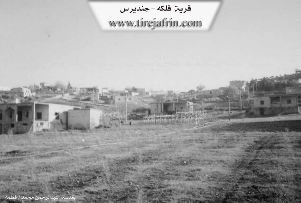
Cindires
Also Known As
Qulkê, خربة علوش, علوش, قرية علوش, قلكه, خرابة علوش
Photos
Basic Information about Qulkê
Source: Tirej Afrin
Etymology: The name Qulk means "the hole" or "puncture" (qul/qulk). Elûş is the name of the first inhabitant of the village.
Foundation Date/Period: 50 years (as of 2013)
Summaries
I. Summary from TirejAfrin Site (English) of Qulkê
Source: https://www.tirejafrin.com/site/kura%20afrin%20Cindires%20-%20qlaka.htm
It is stated in the book Çiyayê Kurmênc (Efrîn): A Geographical Study by Dr. Mihemed Ebdo Elî:
Qulk, Village of Elûş / 7km - 230m /:
Qulk: The literal Kurdish meaning of the name is: the hole (qul/qulk). Elûş: The name of the first inhabitant of the village.
It is a small village located on the northern slope of the highlands of Çiyayê Lêlûn, south of the village of Tel Selûr.
It is stated in the book: Efrîn... Her River and Her Green Hills by the writer Ebdulrehman Mihemed from the village of Qetme:
Qelke - Xirbet Elûş:
A farm/hamlet in Çemê Efrînê (Afrin valley), belonging to the Cindirês district, Efrîn region, Heleb governorate. It is a small farm/hamlet located on a mountain slope near the northwestern foot of Çiyayê Sem‘an. Administratively, it belongs to the village of Celemê.
It is bordered to the north by an agriculturally fertile plain, the course of Çemê Efrînê (Afrin valley), the village of Ebû Ke‘b Xerbî, and the village of Tel Selûr. To the south, it is bordered by a rugged mountain range of the western Çiyayê Sem‘an. To the west, it is bordered by an agriculturally fertile plain planted with pomegranate trees and the village of Dîwan Tahtanî. To the east, there are mountain highlands, a fertile plain, and the village of Celemê.
The number of its houses reaches about 35 houses, and its age is 50 years. It is a modern village; its houses are modern, built of stone and cement. An electricity network is available, as well as a paved dirt road branching off the Riya Celemê-Cindirês (Celemê-Cindirês road).
The residents drink from artesian wells dug next to the houses. The population works in cultivating cereals via rain-fed agriculture, and irrigated crops from Çemê Efrînê (Afrin river) such as cotton and sugar beet, alongside raising sheep and goats. There is a temporary primary school in the village. It connects with the district center via an asphalt road passing near it.
Preparation and Execution:
Manager of Navenda Tirej Efrîn: Ebdulrehman Hacî Osman
20/12/2013
Sources:
- Book: جبل الكرد (عفرين) دراسة جغرافية Çiyayê Kurmênc (Efrîn): A Geographical Study by د. محمد عبدو علي Dr. Mihemed Ebdo Elî.
- Book: عفرين .... نهرها وروابيها الخضراء Efrîn... Her River and Her Green Hills by عبدالرحمن محمد Ebdulrehman Mihemed from the village of Qetme.
Possible Village Name Meaning of Qulkê
Qulkê means 'the hole,' and علوش (Alloush) is the name of the first inhabitant of the village.
Source: TirejAfrin Site