General Information
Nahiya (Subdistrict)
Cindires
Also Known As
Qurbe, Qurbê, قوربه, قربه
Families, Clans, etc.
Xelîl Sîdo Mêmî Axa

Photos
Basic Information about Qurbê
Source: Tirej Afrin
Etymology: The name means the bend or "the elbow" (qurb) in the Kurdish language. It is believed the village took its name from its location in the inner angle of a sharp bend in the valley and the road passing to its west.
Foundation Date/Period: Approximately 100 years old (became independent in 1930)
Other Landmarks: Geliyê Sîlê
Summaries
I. Summary from TirejAfrin Site (English) of Qurbê
Source: https://www.tirejafrin.com/site/kura%20afrin%20Cindires%20-%20qurbe.htm
The following is stated in the book جبل الكرد (عفرين) دراسة جغرافية Çiyayê Kurmênc (Efrîn): A Geographical Study by د. محمد عبدو علي Dr. Mihemed Ebdo Elî: Qurbe, /288 inhabitants, 5km, 305m/:
Qurbe: Meaning the bend or "the elbow" in the Kurdish language. The village is situated on the western side of the sharp bend of the valley and the road that passes to its west. We believe that the village took its name from its location in the inner angle of the bend.
It is a small village belonging to the aghas of Sîdo Mêmî. The valley coming from the village of Qoceman passes to its west, and there is an archeological hill on its western side.
The following is stated in the book عفرين .... نهرها وروابيها الخضراء Efrîn... Her River and Her Green Hills by the writer عبدالرحمن محمد Ebdulrehman Mihemed from the village of Qetme:
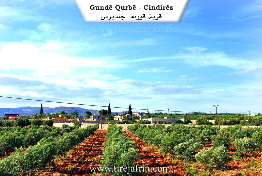
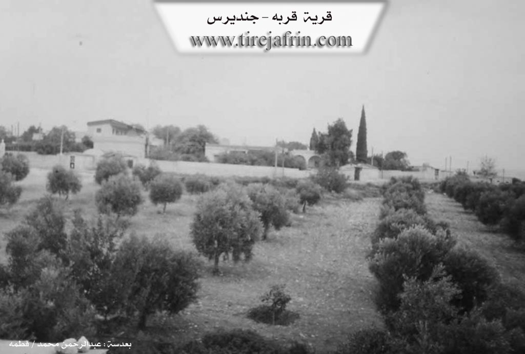
Qurbe is a village in Çiyayê Kurmênc following the Cindirês subdistrict, Efrîn area, Heleb governorate. It is a small village located on the northeastern edge of the Cindirês plain and atop a fertile plateau with alluvial soil. A stream cuts through it heading towards the south to feed the Efrîn river. The village has a small area situated on a hill and plateau surrounded by olive trees from all sides. On the western side, there is an archeological hill near the village.
It is bordered to the north by a fertile plain planted with olive trees and the village of Qoceman. To the south, it is bordered by a slight slope, the Riya Cindirês-Efrîn (Cindirês-Efrîn road), and the village of Remadiye. To the east, it is bordered by a fertile plain planted with olive trees and the village of Şêx Ebdulrehman. To the west, it is bordered by Geliyê Sîlê (Sîlê valley), an archeological hill 500 meters away, and the village of Qîlê.
The number of its houses amounts to about 20 houses, and its age is approximately 100 years. It was a farm for the village of Qoceman, and currently, it has become an independent village. An electricity network, a primary school, and a modern technical olive press belonging to the state Ministry of Agriculture and Agrarian Reform are available in it.
Most of its residents work in the cultivation of olives and grains, both rain fed and irrigated from artesian wells, as well as summer vegetables and fruit trees, alongside raising sheep and cattle. It is connected to the subdistrict center by a paved road.
Among its most important families is the family of Xelîl Sîdo Mêmî Axa. It previously consisted of houses for the aghas and the peasants belonging to them, and the village became independent since 1930 AD.
Among the holders of higher degrees in the village:
Welîd Şêxo / PhD in Information Technology Engineering / Russia
Village Mukhtar: Hesen Fehmî Mihemed
Sources:
- Book: جبل الكرد (عفرين) دراسة جغرافية Çiyayê Kurmênc (Efrîn): A Geographical Study by د. محمد عبدو علي Dr. Mihemed Ebdo Elî.
- Book: عفرين .... نهرها وروابيها الخضراء Efrîn... Her River and Her Green Hills by عبدالرحمن محمد Ebdulrehman Mihemed.
Preparation and Execution:
- Manager of Tirej Efrîn website: Ebdulrehman Hacî Osman
- 20/12/2013
Foundation/Origin Information of Qurbê
It was formerly a farm for Qujeh Man village and became independent around 1930. The Khalil Sido Mimi agha family are associated with the village.
Source: TirejAfrin Site
Possible Village Name Meaning of Qurbê
Qurbe means 'the bend' or 'the elbow' in Kurdish. The village took its name from its location in the inner bend corner of a valley and road.
Source: TirejAfrin Site