General Information
Nahiya (Subdistrict)
Cindires
Also Known As
Sindiyankê, Zinda, Zindkan, زندة, زندكان, سندياكي, سنديانكي, زنده كان
Families, Clans, etc.
Hoto, Xelîl Axa, Zên Elûş

Photos
Basic Information about Sindiyankê
Source: Tirej Afrin
Etymology: The village took its name from the oak tree (sindiyan). There is also a Kurdish tribe named Sindkan in the Mêrdîn region of northern Kurdistan.
Foundation Date/Period: 125-150 years (old site) / 65 years (current site)
Summaries
I. Summary from TirejAfrin Site (English) of Sindiyankê
Source: https://www.tirejafrin.com/site/kura%20afrin%20Cindires%20-%20sindiyanke.htm
Sindiyankê Zindkan Zinde
Based on the book جبل الكرد (عفرين) دراسة جغرافية Çiyayê Kurmênc (Efrîn): A Geographical Study by د. محمد عبدو علي Dr. Mihemed Ebdo Elî:
Sindiyank, Zindkan, Zinde / 571 inhabitants - 4km - 285m /
Etymology and Location
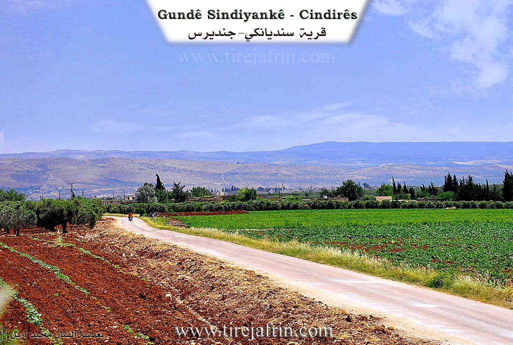
The village took its name from the oak tree (sindiyan). There is also a Kurdish tribe named Sindkan in the Mêrdîn region of northern Kurdistan. It is a small village located in the middle of a flat area surrounded by olive fields. Two archaeological hills (tells) exist north of the village, representing ancient habitation sites.
Geography and Boundaries
As stated in the book عفرين .... نهرها وروابيها الخضراء Efrîn... Her River and Her Green Hills by عبدالرحمن محمد Ebdulrehman Mihemed from the village of Qetme:
Zindkan - Sindiyankê is a village in Çiyayê Kurmênc belonging to the Cindirês district, Efrîn region, Heleb governorate. It is a small village at the end of the southeastern edge of the Cindirês plain, possessing fertile alluvial soil and abundant groundwater. It is located 5km north of the town of Cindirês.
It is bordered to the north by a fertile plain planted with olive trees and the villages of Miske Jorîn, Miske Jêrîn, and Koran. To the south, it is bordered by the fertile Cindirês plain, a watercourse passing by its western edge, the town of Cindirês, and the farm of Rif'atiye. To the west lies a fertile agricultural plain and the villages of Kefer Sefrê and Yalanqoz. To the east, there is a fertile agricultural plain and the villages of Kemoş Burc and Qîlê.
History, Demographics, and Infrastructure
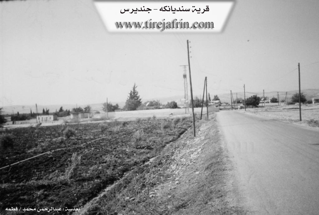
The number of houses in the village is approximately 25. The age of the old settlement is approximately 125-150 years, while the age of the current village location is 65 years. The old houses were made of stone and mud with flat wooden roofs, while the modern ones are made of cement. A primary school and a telephone center are available in the village. It connects with the town of Cindirês and neighboring villages via a road that passes through its center.
Economy and Agriculture
The village gets its drinking water from artesian wells or from cisterns that collect rainwater in winter. Most of its residents work in agriculture, growing rainfed grains and olives, as well as irrigated crops from artesian wells (summer vegetables and fruit trees such as pomegranates and tobacco). This is in addition to raising cows, sheep, and goats. The village is surrounded by olive trees on all sides.
Social Structure
This village formerly belonged to the family of Xelîl Axa and Zên Elûş (the first to inhabit the village). An electricity network has recently become available.
Village Administration
Village Mukhtar: Ednan Hoto
Sources
Book: جبل الكرد (عفرين) دراسة جغرافية Çiyayê Kurmênc (Efrîn): A Geographical Study by د. محمد عبدو علي Dr. Mihemed Ebdo Elî.
Book: عفرين .... نهرها وروابيها الخضراء Efrîn... Her River and Her Green Hills by عبدالرحمن محمد Ebdulrehman Mihemed from the village of Qetme.
Preparation and execution: Manager of Tirej Efrîn website: Ebdulrehman Hacî Osman.
20/12/2013
Foundation/Origin Information of Sindiyankê
This village was previously owned by Khalil Agha and Zin Alush families (the first to inhabit the village).
Source: TirejAfrin Site
Possible Village Name Meaning of Sindiyankê
The village took its name from the oak tree, and there is a Kurdish tribe named "Sindkan" in the Mardin areas in northern Kurdistan.
Source: TirejAfrin Site