General Information
Nahiya (Subdistrict)
Şera
Also Known As
Tilîlaqê, al-Sanubria Farm, تليلاق, مزرعة الصنوبرية
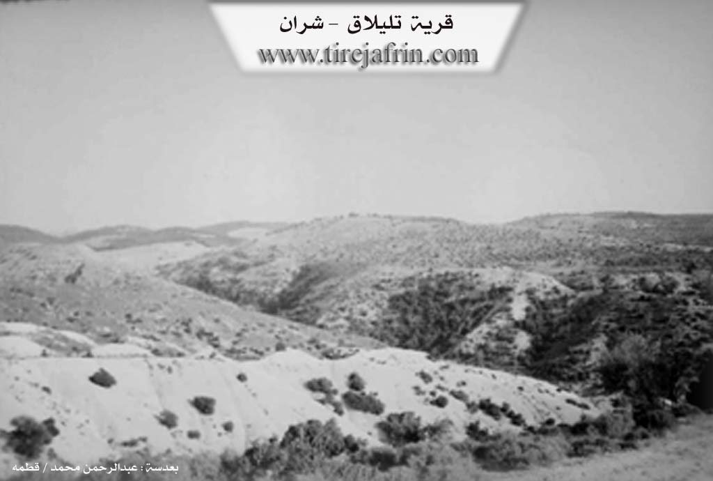
Photos
Basic Information about Tilîlaqê
Source: Tirej Afrin
Etymology: Name of the archaeological hill Tîlilaq
Foundation Date/Period: Approximately 35 years prior to the text (around 1978)
Hills: Tîlilaq
Ruins: Tîlilaq
Other Landmarks: Wadî Cehenem, Çemê Efrîn
Summaries
I. Summary from TirejAfrin Site (English) of Tilîlaqê
Source: https://www.tirejafrin.com/site/kura%20afrin%20%20sheran%20-%20%20telelaq.htm
It is stated in the book جبل الكرد (عفرين) دراسة جغرافية Çiyayê Kurmênc (Efrîn): A Geographical Study: Tillaq, the Sinoberiyê farm /132 inhabitants - 525m altitude/:
Tîlilaq: Name for the archaeological hill. It is currently an abandoned site.
It is stated in the book عفرين .... نهرها وروابيها الخضراء Efrîn... Her River and Her Green Hills:
Tîlilaq: A village in Çiyayê Kurmênc belonging to the Şera sub-district, Efrîn region, Heleb governorate, (132 inhabitants). It is located on a mountainous height and an archaeological hill, and it is surrounded by harsh slopes from all directions planted with forest trees.
It is bordered to the north by a slope, Wadî Cehenem, the course of Çemê Efrîn, and the village of Wêrakan.
It is bordered to the south by a valley, a mountain range of olive trees and forest trees, and the village of Emranlî.
It is bordered to the east by a slope, a valley planted with forest trees and olives, and Ereb Wêran.
It is bordered to the west by a slope, a mountain range, the course of Çemê Efrîn, and the village of Bellûrsenk (Bellûriye).
The road connecting to the village is mountainous and dirt. The number of its houses is about 5 houses, and its age is about 35 years.
Currently, due to the scarcity of houses in the village and the lack of resources, its people have migrated in search of livelihood. Its owners visit it during the seasons.
Sources of Information:
- Book: جبل الكرد (عفرين) دراسة جغرافية Çiyayê Kurmênc (Efrîn): A Geographical Study by د. محمد عبدو علي Dr. Mihemed Ebdo Elî.
- Book: عفرين .... نهرها وروابيها الخضراء Efrîn... Her River and Her Green Hills by عبدالرحمن محمد Ebdulrehman Mihemed from the village of Qetme.
- Studies of Navenda Tirej Soft / Ebdulrehman Hacî Osman.
- Some residents of the villages.
Preparation and Execution: Manager of the website Tirej Efrîn: Ebdulrehman Hacî Osman 20/12/2013
Foundation/Origin Information of Tilîlaqê
Currently, due to the small number of village houses and lack of resources, its people have migrated searching for livelihood, visited by its people during seasons.
Source: TirejAfrin Site
Possible Village Name Meaning of Tilîlaqê
Tililaق: Name of the archaeological mound. It is a currently abandoned site.
Source: TirejAfrin Site