General Information
Nahiya (Subdistrict)
Efrîn
Also Known As
Tal Tawil, Tirtewîlê, تل طويل, ترطويله

Photos
Basic Information about Tirtewîlê
Source: Tirej Afrin
Etymology: "Tir" means "hill or mountain" in the Syriac language, and "tawil" (long) is an Arabic word; the full name is a geographical attribute of the height of the town of Efrîn
Foundation Date/Period: Approximately 150 years ago
Hills: Xemrevn, Çiyayê Zêdiyê, Çiyayê Tir Tewl
Other Landmarks: Çemê Efrînê
Summaries
I. Summary from TirejAfrin Site (English) of Tirtewîlê
It is stated in the book جبل الكرد (عفرين) دراسة جغرافية Çiyayê Kurmênc (Efrîn): A Geographical Study by د. محمد عبدو علي Dr. Mihemed Ebdo Elî:
Tir Tewl /1160 inhabitants - 300m altitude/:
"Tir" means "hill or mountain" in the Syriac language, and "tawil" (long) is an Arabic word. The full name is a geographical attribute of the height of the town of Efrîn.
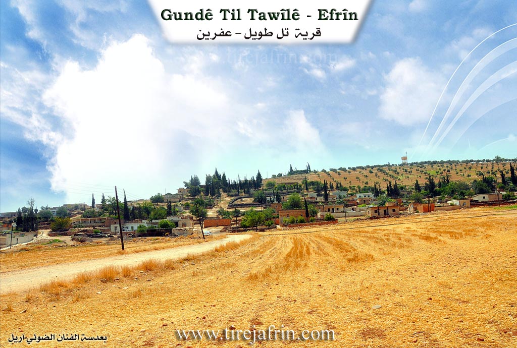
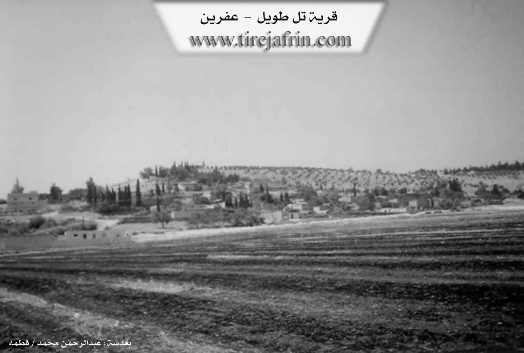
It is a small village whose few dwellings are graduated along the northern slope of the Efrîn height, Xemrevn. It is located approximately 1 km west of Çemê Efrînê (Afrin River).
In the book عفرين .... نهرها وروابيها الخضراء Efrîn... Her River and Her Green Hills by the writer عبدالرحمن محمد Ebdulrehman Mihemed from the village of Qetme, it is stated regarding Tir Tewl:
It is a village in Çiyayê Kurmênc that belongs to the sub-district of the villages of the Efrîn central district, Aleppo governorate. It is a small village situated on the slope and northern foothill of Çiyayê Zêdiyê and the city of Efrîn.
It is bordered to the north by a wide, agriculturally fertile plain with three watercourses where water flows, and the village of Estaro. To the south, it is bordered by the mountainous height of Çiyayê Zêdiyê, which is called Çiyayê Tir Tewl, and the city of Efrîn directly at a distance of 200 meters. To the east, at a distance of 200 meters, lie the course of Çemê Efrînê (Afrin River), a fertile agricultural plain, the village of Cumkê, Şêx Sîdî, and the village of Erşqîbar. To the west, there is a fertile plain planted with olive trees and grains, the Riya Reco-Efrîn (Reco-Efrîn road), soap and pomace factories, and the village of Cewîq.
Its old houses are made of mud with roofs of wood and tin, while the modern ones are of stone and concrete. The number of its houses reaches approximately 35, and its age is about 150 years. An electricity network and a paved road are available in the village. The village drinks water from collection ponds and currently from artesian wells found in the village. A primary school is available.
The residents of the village work in the cultivation of grains, olives, orchards, pomegranates, and summer vegetables, irrigated from Çemê Efrînê (Afrin River) or from artesian wells, alongside raising sheep, principally, and goats. Sheep owners settled there starting from the forties of this century.
Village Mukhtar: Xalid Xalid
Sources:
- Book: جبل الكرد (عفرين) دراسة جغرافية Çiyayê Kurmênc (Efrîn): A Geographical Study by د. محمد عبدو علي Dr. Mihemed Ebdo Elî.
- Book: عفرين .... نهرها وروابيها الخضراء Efrîn... Her River and Her Green Hills by عبدالرحمن محمد Ebdulrehman Mihemed from the village of Qetme.
Preparation and Execution:
- Manager of Navenda Tirej Efrîn: Ebdulrehman Hacî Osman
- 20/12/2013
Foundation/Origin Information of Tirtewîlê
Sheep owners settled there from the 1940s of this century.
Source: TirejAfrin Site
Possible Village Name Meaning of Tirtewîlê
Tir "تر" means "hill or mountain" in Syriac, and "طويل" is an Arabic word, and the complete name is a geographical description of the Afrin town elevation.
Source: TirejAfrin Site