General Information
Nahiya (Subdistrict)
Bilbilê
Also Known As
Uga, Ukanli, عوكان, عوكانلي, اوكانلي

Photos
Basic Information about Uga
Source: Tirej Afrin
Etymology: The name Ewga is believed to be derived from a local proper name.
Foundation Date/Period: Approximately 400 years ago
Summaries
I. Summary from TirejAfrin Site (English) of Uga
Source: https://www.tirejafrin.com/site/kura%20afrin%20%20%20bilbile%20-%20uga.htm
It is stated in the book Çiyayê Kurmênc / Efrîn / A Geographical Study: Ewga, Ewkanlî, Ewkan /2488 people - 465 hectares - 6km - 660m/:
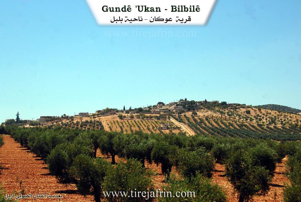
Ewga: It is believed that it is derived from a local proper name. It is a small village located on a mountain height.
It is stated in the book Efrîn... Her River and Her Green Hills: Ewkanlî: A village in Çiyayê Kurmênc following the Bilbile sub-district, Efrîn region, Heleb governorate. It is a small village located at the southern feet of a limestone mountain in the northern part of the Çiyayê Kurmênc massif. It is surrounded by watercourses from the south and west, and it overlooks its fertile agricultural lands to the southeast. It is 6km away from the town of Bilbile towards the southeast.
It is bordered to the north by a stream valley, a mountain height, the town of Bilbile, and Qurnê. To the south, it is bordered by a slope planted with olive trees and the villages of Qurt Uşaxî and Qaş Uşaxî. To the west, there is a very deep stream valley and the village of Şerqiyanlî at a distance of 2km. To the east, there is a slope, a stream valley, the Riya Bilbile-Meydankê (Bilbile-Meydankê road), and the village of Carcala.
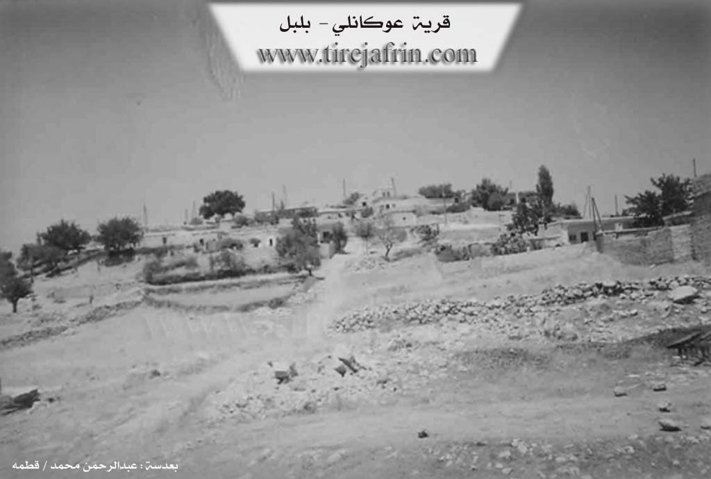
The number of its houses reaches 75, and its age is approximately 400 years. Its old houses are made of stone and mud with flat wooden ceilings, while the modern ones are of cement and stone. An electricity network and a primary school are available in the village. It draws drinking water from a water network connected to the artesian well west of the village and from cisterns where rainwater is collected.
Most of its inhabitants work in the cultivation of olives, grains, vines, and legumes via rain-fed agriculture on an area of 465 hectares, as well as in raising sheep and goats. The road from the village to the town of Bilbile is asphalted, while the branch road to the village is paved dirt. The farm of Carûra follows it administratively. The village is considered one of the oldest villages existing there, as there are olive trees on the southern side that are more than 150 years old, according to the account of the village residents.
Village Mukhtar: Şêx Neesan Miqdad
Sources of Information:
- Book: جبل الكرد (عفرين) دراسة جغرافية Çiyayê Kurmênc (Efrîn): A Geographical Study by د. محمد عبدو علي Dr. Mihemed Ebdo Elî.
- Book: عفرين .... نهرها وروابيها الخضراء Efrîn... Her River and Her Green Hills by عبدالرحمن محمد Ebdulrehman Mihemed from the village of Qetme.
- Studies of Navenda Tirej Soft / Ebdulrehman Hacî Osman.
- Some residents of the villages.
Preparation and execution: Manager of Tirej Efrîn site: Ebdulrehman Hacî Osman 20/12/2013
Possible Village Name Meaning of Uga
Uga (عوغا): It is believed to be derived from a local proper name.
Source: TirejAfrin Site