General Information
Nahiya (Subdistrict)
Bilbilê
Also Known As
'Ubila

Photos
Basic Information about Upila
Source: Tirej Afrin
Etymology: The name "Upil" or "Up" means "camel hump" in the local Kurdish dialect. It was perhaps a Kurdish corruption of the Arabic word "Ibil" (camel), as one of the early residents of the village owned some camels, so the village became known by it.
Foundation Date/Period: Approximately 250 years ago
Hills: Çiyayê Abel Uşaxî
Summaries
I. Summary from TirejAfrin Site (English) of Upila
Source: https://www.tirejafrin.com/site/kura%20afrin%20%20%20bilbile%20-%20%20ubila.htm
It was stated in the book جبل الكرد (عفرين) دراسة جغرافية Çiyayê Kurmênc (Efrîn): A Geographical Study: Upila, Obel Uşaxî, Abel / 900 inhabitants, 160 hectares, 12km, 600m /:
Upil or Up: Means "camel hump" in the local Kurdish dialect. It was perhaps a Kurdish corruption of the Arabic word "Ibil" meaning camel, as one of the early residents of the village owned some camels, so the village became known by it. The Arabized name has no meaning.
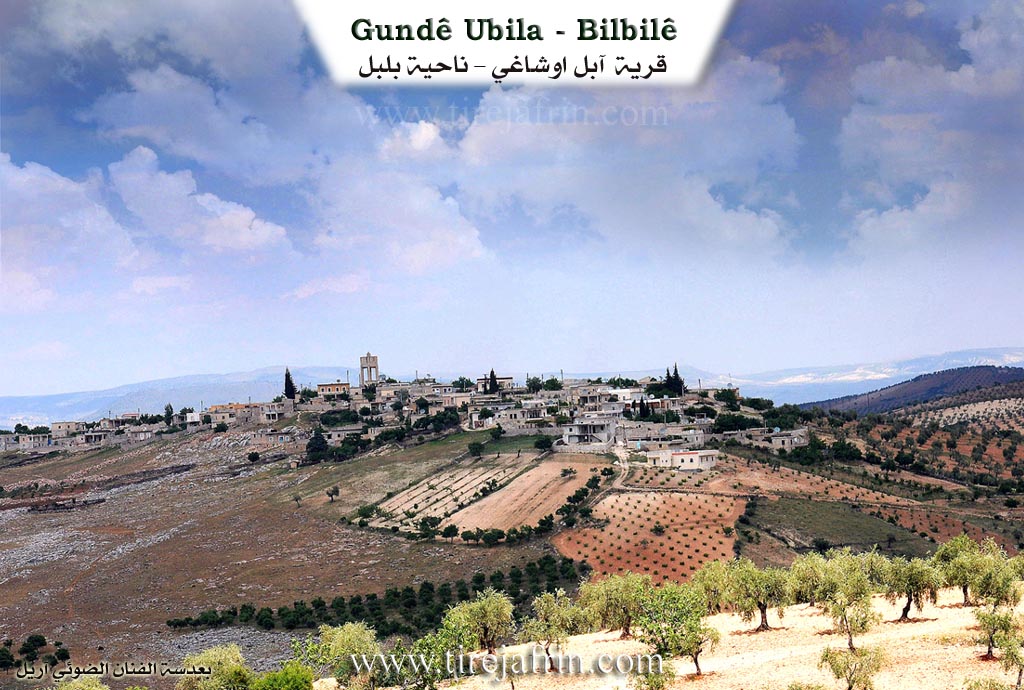
It is a medium sized and prosperous village located on the southern slope of Çiyayê Abel Uşaxî.
It was stated in the book عفرين .... نهرها وروابيها الخضراء Efrîn... Her River and Her Green Hills: Abel Uşaxî: A village in Çiyayê Kurmênc following the Bilbile district, Efrîn area, Heleb governorate. It is a small village located on the flattened, slightly sloping, and furrowed southern slope of the limestone Çiyayê Abel Uşaxî, which has clay soil suitable for grazing, and at the head of a watercourse heading southwest.
It is 12km southeast of the town of Bilbile. It is bordered to the north by a mountain range planted with olive trees and the village of Qaş Uşaxî; to the south by a slope and a torrential valley and the village of Qorê Gul; to the west by a slope planted with olive trees, a torrential valley, and the villages of Bêk Uşaxî and Xelîlak Uşaxî; and to the east by a slope planted with olive trees and the village of Kutanlî.
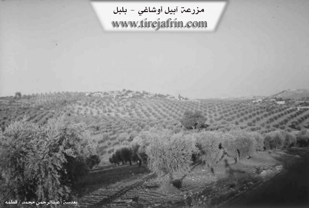
The number of its houses is about 45 houses and its age is about 250 years. Its houses are stone and mud, and the modern ones have expanded to the east and south. It has an electricity network, a primary school, and a modern olive press. Residents derive drinking water from a water network branching from the network of the village of Kutanlî to the east. Residents work in rain fed agriculture on an area of 160 hectares of olives, vines, and grains, alongside raising sheep and goats. It is connected to the district center by an asphalt road that passes through its center to several neighboring villages.
Village Mukhtar: Ebdulrehman Me'mo
Sources of Information:
- Book: جبل الكرد (عفرين) دراسة جغرافية Çiyayê Kurmênc (Efrîn): A Geographical Study by د. محمد عبدو علي Dr. Mihemed Ebdo Elî.
- Book: عفرين .... نهرها وروابيها الخضراء Efrîn... Her River and Her Green Hills by عبدالرحمن محمد Ebdulrehman Mihemed from the village of Qetme.
- Studies of Navenda Tirej Soft / Ebdulrehman Hacî Osman.
- Some residents of the villages.
Preparation and Execution: Manager of the Tirej Efrîn site: Ebdulrehman Hacî Osman 20/12/2013