General Information
Nahiya (Subdistrict)
Reco
Also Known As
Al-Wali, Bindarê, Walikli, Welîklî, الولي, واليكلي
Tribes
Meydan

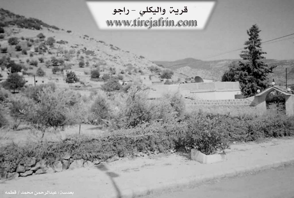
Photos
Basic Information about Welîklî
Source: Tirej Afrin
Etymology: Welîklî is derived from the local Kurdish proper name Welo; Bindarî means under the tree (bin + dar), referring to an ancient tree near the village
Foundation Date/Period: Approximately 200 years ago
Hills: Çiyayê Biêvê, Çiyayê Qere Bêl
Other Landmarks: Deşta Meydanlî
Summaries
I. Summary from TirejAfrin Site (English) of Welîklî
Source: https://www.tirejafrin.com/site/kura%20afrin%20%20%20Reco%20-%20welkle.htm
The following is stated in the book جبل الكرد (عفرين) دراسة جغرافية Çiyayê Kurmênc (Efrîn): A Geographical Study: Welkl, Bindar, Welîklî, El Welî 419 inhabitants, 14 km, 760 m.
Welîklî: A local Kurdish proper name derived from Welo. Bindarî: Meaning under the tree (bin + dar), which is another name by which the village is known, attributed to a perennial tree located beside the village. As for the Arabized name, it is a verbal distortion of its popular name Welîklî.
It is a small village on the southwestern slope of the highland Çiyayê Biêvê.
The following is stated in the book عفرين .... نهرها وروابيها الخضراء Efrîn... Her River and Her Green Hills: Welîklî: A farmstead in Çiyayê Kurmênc belonging to the Reco subdistrict, Efrîn region, Aleppo governorate.
It is a small farmstead located on the southwestern slope of a limestone height called Çiyayê Biêvê or the Almond Mountain in the northern section of the mentioned mountain. It overlooks to the west a watercourse that descends southward toward the alluvial Deşta Meydanlî. It is 15 km away from the town of Reco heading northeast.
It is bordered to the north by a mountain chain and the village of Têbe Kuy and Qestel; to the south by a fertile plain and a high mountain chain called Çiyayê Qere Bêl and the village of Cîlanlî; to the east by a mountain chain and, at a distance of 2 km, the village of Dodo and Kawende; and to the west by the Riya Şêx Mihemedlî (Şêx Mihemedlî highway) which is close to it and the mentioned village, separated by a highway.
The number of its houses is about 30 houses and its age is about 200 years. Its old dwellings are of stone and mud with flat wooden roofs, while the modern ones are cement and have expanded south and north. An electricity network and drinking water belonging to the state are available, as well as a joint school with the village of Şêx Mihemedlî, and it belongs to the municipality of Şêx Mihemedlî.
The residents work in rain fed agriculture on mountain slopes (olives, vines, pistachios) and raise sheep and goats. It is one of the seven Meydan villages.
Sources of Information:
- Book: جبل الكرد (عفرين) دراسة جغرافية Çiyayê Kurmênc (Efrîn): A Geographical Study by د. محمد عبدو علي Dr. Mihemed Ebdo Elî.
- Book: عفرين .... نهرها وروابيها الخضراء Efrîn... Her River and Her Green Hills by عبدالرحمن محمد Ebdulrehman Mihemed from the village of Qetme.
- Studies of Navenda Tirej Soft / Ebdulrehman Hacî Osman.
- Some residents of the villages.
Preparation and execution: Manager of the website Tirej Efrîn: Ebdulrehman Hacî Osman 20/12/2013