General Information
Nahiya (Subdistrict)
Cindires
Also Known As
Khaltan Eastern, Xalta ، خالتان, Xaltan Shrqe, Xeltê Şerqî, خالطان شرقي
Tribes
Xalta
Photos
Basic Information about Xeltê Şerqî
Source: Tirej Afrin
Etymology: Xalta is the name of a region and a known Kurdish tribe in Kurdistan, found in Behdînan in southern Kurdistan. It is also the name of the Xaltî or Xaldî people, one of the ancestors of the Kurdish people.
Foundation Date/Period: 250 years
Other Landmarks: Wadî Xeltan
Summaries
I. Summary from TirejAfrin Site (English) of Xeltê Şerqî
Source: https://www.tirejafrin.com/site/kura%20afrin%20Cindires%20-%20xaltan%20shrqe.htm
The following is stated in the book جبل الكرد (عفرين) دراسة جغرافية Çiyayê Kurmênc (Efrîn): A Geographical Study by د. محمد عبدو علي Dr. Mihemed Ebdo Elî: Xalta, Xaltan, Xeltan /550m altitude - 575 hectares? - 15km/:
Xalta: This is the name of a region and a known Kurdish tribe in Kurdistan. Members of it are found in Behdînan in southern Kurdistan (Layard, p. 52). It is also the name of the Xaltî or Xaldî people, one of the ancestors of the Kurdish people.
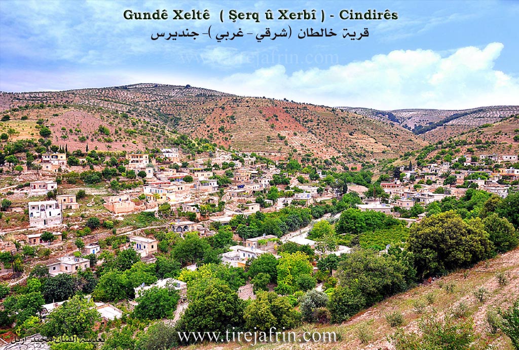
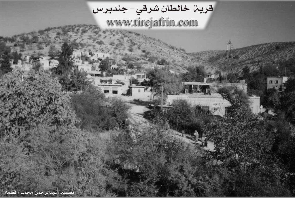
It is a medium sized village located at the beginning of the valley of Wadî Xeltan, which splits the village into two parts: a northeastern part /1206 inhabitants - 565m altitude/ and a southwestern part /977 inhabitants - 560m altitude/. Both are surrounded by mountainous heights covered in pine forests and olive fields. The site of the village is rich in ruins, indicated by huge building stones, numerous archaeological finds, and pieces of pottery. Its location is also rich in groundwater and surface springs.
The following is stated in the book عفرين .... نهرها وروابيها الخضراء Efrîn... Her River and Her Green Hills by the writer عبدالرحمن محمد Ebdulrehman Mihemed from the village of Qetme:
Xaltan Şerqî (East): A farm in Çiyayê Kurmênc following the Cindirês district of the Efrîn region, Heleb province. It is a small farm located on the southern slope of a rocky tongue with a medium slope, furrowed by water streams and covered by oak forests. Its soil is clay like. It is 1km away from Xeltan Xerbî (West) towards the northeast, and 14km from the district center.
It is bordered to the north by a stream and Xeltan Xerbî, to the south by Miske Tehtanî and Miske Foqanî, to the east by the village of Colqan, and to the west by Kûrdanlî. The number of its houses is 70 houses and the age of the village is 250 years. Its old houses are made of stone and mud with wooden ceilings, while the modern ones are made of cement and are spreading increasingly on the outskirts of the farm.
Its residents rely on the cultivation of grains and olive trees, alongside raising sheep and goats. Some of them work in making charcoal from oak wood. The village drinks from cisterns in which rainwater is collected. It is connected to Xeltan Xerbî and the district center by the paved Riya Xeltan-Cindirês (Xeltan Cindirês road).
Mukhtar of the village: Tahir Silêman Mihemed
Preparation and execution:
Manager of the Tirej Efrîn site: Ebdulrehman Hacî Osman
20/12/2013
Sources:
- Book: جبل الكرد (عفرين) دراسة جغرافية Çiyayê Kurmênc (Efrîn): A Geographical Study by د. محمد عبدو علي Dr. Mihemed Ebdo Elî.
- Book: عفرين .... نهرها وروابيها الخضراء Efrîn... Her River and Her Green Hills by عبدالرحمن محمد Ebdulrehman Mihemed from the village of Qetme.
Possible Village Name Meaning of Xeltê Şerqî
Name of a region and well-known Kurdish tribe in Kurdistan, found in Bahdinan from southern Kurdistan. It is also the name of the "khalty, khaldi" people, one of the grandsons of the Kurdish people.
Source: TirejAfrin Site