General Information
Nahiya (Subdistrict)
Cindires
Also Known As
Xerza, Xerzan, Xerze, خرزان, خارزا
Families, Clans, etc.
Bakîr, Mistefa, Osman

Photos
Basic Information about Xerza
Source: Tirej Afrin
Etymology: Name of a region and Kurdish tribal group in northern Kurdistan, province of Bedlîs
Foundation Date/Period: 300 years
Shrines: Şêx Ebdulrehman
Wells: Bîreke Romanî
Other Landmarks: Wadî Xerzan, Wadî Sîlê
Summaries
I. Summary from TirejAfrin Site (English) of Xerza
Source: https://www.tirejafrin.com/site/kura%20afrin%20Cindires%20-%20xerza.htm
It is stated in the book جبل الكرد (عفرين) دراسة جغرافية Çiyayê Kurmênc (Efrîn): A Geographical Study by د. محمد عبدو علي Dr. Mihemed Ebdo Elî: Xerza, Xerzan /744 inhabitants - 320 hectares - 520m altitude/:
Xerza: Name of a region and Kurdish tribal group in northern Kurdistan, province of Bedlîs.
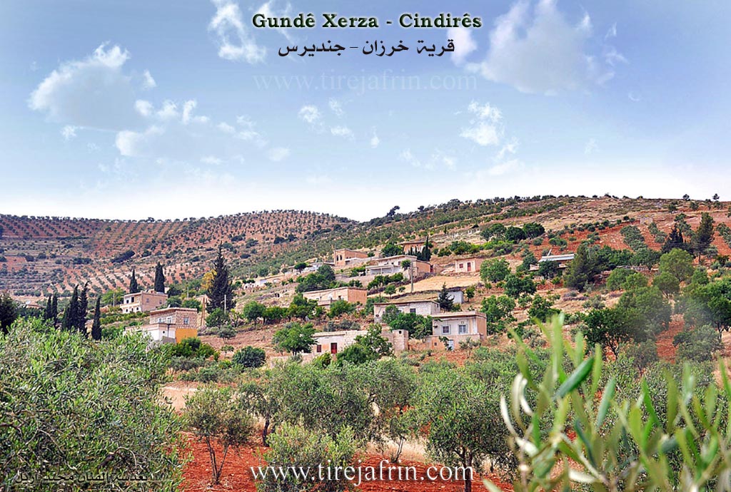
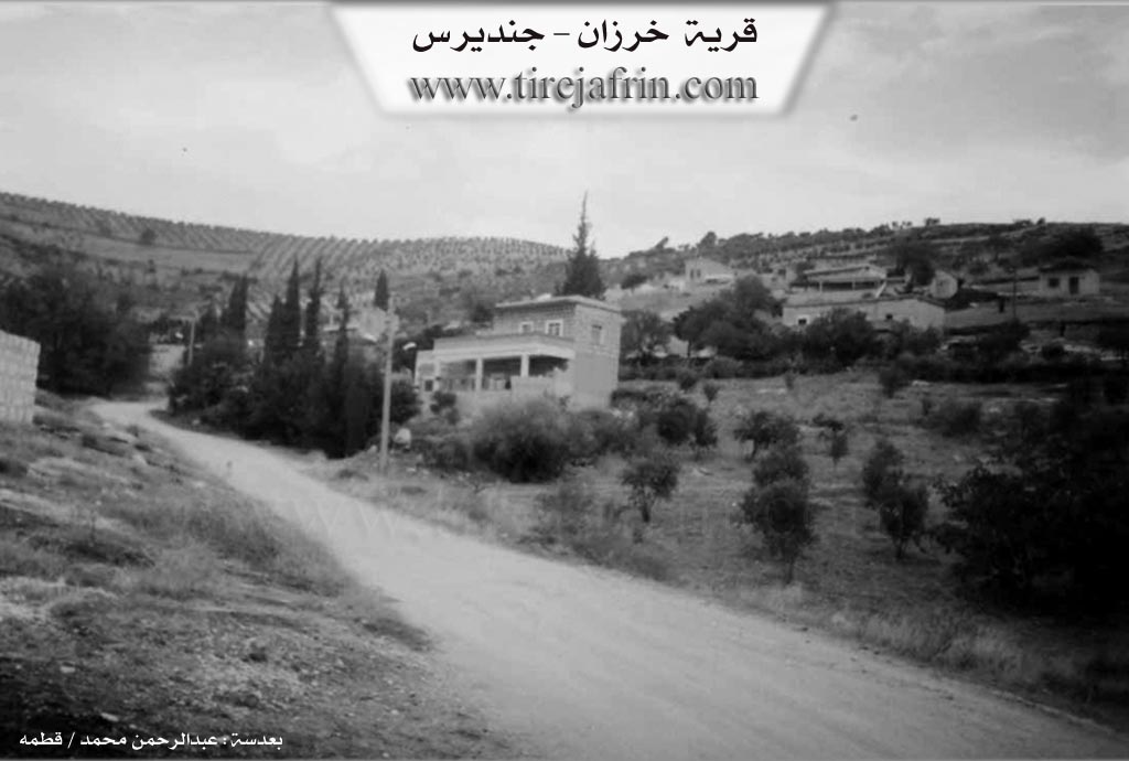
It is a small village located on both sides of the Xerzan valley, which slopes steeply towards the south, and is surrounded by steep mountain slopes.
It is stated in the book: عفرين .... نهرها وروابيها الخضراء Efrîn... Her River and Her Green Hills by the writer عبدالرحمن محمد Ebdulrehman Mihemed from the village of Qetme: Xerzan is a village in Çiyayê Kurmênc following the township of Cindirês, area of Efrîn, governorate of Heleb.
It is a small village located on both sides of the Xerzan valley, which slopes towards the southeast. It is surrounded by calcareous mountain slopes covered with clay soil. It is 12km away from Cindirês towards the northeast. It is bordered to the north by a high mountain range planted with forest trees and olives and the village of Îkî Axûr. To the south, a slope planted with olive trees, a wide and fertile plain, the shrine of Şêx Ebdulrehman, and the village of Şêx Ebdulrehman. To the west, a mountain range planted with olive trees and forest trees, and the village of Eşkan Şerqî and Çeqelê Cûm. To the east, the Sîlê valley, mountainous highlands, a fertile agricultural plain planted with olive trees, the village of Colqa, and the village of Qerebaş (Feqîran).
The number of its houses is about 20 houses, and its age is about 300 years. Its old houses are stone and mud with flat wooden roofs; the modern ones are cement, scattered on the adjacent slopes. An electricity network is available, as well as a paved road connecting the township to the neighboring villages.
The village drinks from cistern water where rainwater is collected in winter, or from an old Roman well in the valley. Currently, water is transported to it from the village of Colqa via a water network, and it belongs to the municipality of Kûrkan. The residents work in rain fed agriculture on an area of 320 hectares, producing olives, grains, and vines, alongside raising sheep and goats.
Among the holders of higher degrees in the village:
Celal Hesen Bakîr / PhD in Experimental Nuclear Physics / Russia
Cîhan Mistefa / PhD in Economics / Russia
Village Mukhtar: Mihemed Arif Osman
Sources
Book: جبل الكرد (عفرين) دراسة جغرافية Çiyayê Kurmênc (Efrîn): A Geographical Study by د. محمد عبدو علي Dr. Mihemed Ebdo Elî.
Book: عفرين .... نهرها وروابيها الخضراء Efrîn... Her River and Her Green Hills by عبدالرحمن محمد Ebdulrehman Mihemed from the village of Qetme.
Preparation and execution:
Manager of the Tirej Efrîn site: Ebdulrehman Hacî Osman
20/12/2013
Possible Village Name Meaning of Xerza
Name of a region and Kurdish tribal group in northern Kurdistan - Badlis Province.
Source: TirejAfrin Site